Asanpur is a village development committee in Siraha District in the Sagarmatha Zone of south-eastern Nepal. At the time of the 2011 Nepal census it had a population of 12926 people living in 2510 individual households.
Bhagawanpur is a Village Development Committee in Siraha District in the Sagarmatha Zone of south-eastern Nepal. At the time of the 1991 Nepal census it had a population of 2845 people residing in 455 individual households.
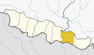
Bhokraha"भोक्राहा" is a Village Development Committee in Siraha District in the Sagarmatha Zone of south-eastern Nepal. At the time of the 2011 Nepal census it had a population of 1757 people residing in 341 individual households.
Govindapur Malahanama is a village development committee in Siraha District in the Sagarmatha Zone of south-eastern Nepal. At the time of the 1991 Nepal census it had a population of 6758.
Hanuman Nagar is a village development committee in Siraha District in the Sagarmatha Zone of south-eastern Nepal. At the time of the 1991 Nepal census it had a population of 4892 people living in 918 individual households.
Harakathi is a village development committee in Siraha District in the Sagarmatha Zone of south-eastern Nepal. At the time of the 1991 Nepal census it had a population of 2202 people living in 358 individual households.
Inarwa, Sagarmatha is a Village Development Committee in Siraha District in the Sagarmatha Zone of south-eastern Nepal. At the time of the 1991 Nepal census it had a population of 8045 people residing in 1451 individual households.
Jamadaha is a village development committee in Siraha District in the Sagarmatha Zone of south-eastern Nepal. At the time of the 1991 Nepal census it had a population of 3992 people living in 741 individual households.
Krishnapur Birta is a village development committee in Siraha District in the Sagarmatha Zone of south-eastern Nepal. At the time of the 1991 Nepal census it had a population of 3147 people living in 544 individual households.
Lagadigoth is a village development committee in Siraha District in the Sagarmatha Zone of south-eastern Nepal. At the time of the 1991 Nepal census it had a population of 2799 people living in 482 individual households.
Lalpur, Nepal is a Village Development Committee in Siraha District in the Sagarmatha Zone of south-eastern Nepal. At the time of the 1991 Nepal census it had a population of 3412 people residing in 621 individual households.
Lakshmipur is a village development committee in Siraha District in the Sagarmatha Zone of south-eastern Nepal. At the time of the 1991 Nepal census it had a population of 2651 people living in 474 individual households.
Malhaniyakhori is a town in Mirchaiya Municipality in Siraha District in the Sagarmatha Zone of south-eastern Nepal. The formerly village development committee was merged to form a new municipality on 18 May 2014 along with the existing Rampur Birta, Malhaniyakhori, Radhopur, Ramnagar Mirchaiya, Fulbariya, Sitapur PraDa and Maheshpur Gamharia Village Development Committees.
Pipra Pra. Dha. is a village development committee in Siraha District in the Sagarmatha Zone of south-eastern Nepal. At the time of the 1991 Nepal census it had a population of 3641.
Pipra Pra. Pi is a village development committee in Siraha District in the Sagarmatha Zone of south-eastern Nepal. At the time of the 1991 Nepal census it had a population of 5692.
Sitapur Pra. Da. is a town in Mirchaiya Municipality in Siraha District in the Sagarmatha Zone of south-eastern Nepal. The formerly village development committee was merged to form new municipality since 18 May 2014 along with existing Rampur Birta, Malhaniyakhori, Radhopur, Ramnagar Mirchaiya, Fulbariya, Sitapur PraDa and Maheshpur Gamharia Village Development Committees. At the time of the 1991 Nepal census it had a population of 4671 people living in 899 individual households.
Sitapur Pra. Dha. is a village development committee in Siraha District in the Sagarmatha Zone of south-eastern Nepal. At the time of the 1991 Nepal census it had a population of 3702 people living in 693 individual households.
Sothayan is a village development committee in Siraha District in the Sagarmatha Zone of south-eastern Nepal. At the time of the 1991 Nepal census it had a population of 3004 people living in 539 individual households.

Tenuwapati is in Bariyarpatti Gaupalikas or Rural municipalities of Siraha District in the Sagarmatha Zone of south-eastern Nepal. At the time of the 1991 Nepal census it had a population of 3365 people living in 601 individual households.
Hanumannagar is a village development committee in Saptari District in the Sagarmatha Zone of south-eastern Nepal. It is named after the Hanuman Temple situated here with the rare idol of Lord Hanuman in Black Stone as a Child. It was the former headquarter of Saptari District before the flood of Koshi stuck it badly. At the time of the 2011 Nepal census it had a population of 6275 people living in 957 individual households. The VDC consists of Health Post which have been set up by the Government and the facility of Electricity is provided to maximum of the household. It to also the trade center for neighboring 15 villages with the mix source if Income including Business and Agriculture. The VDC consists of two banks and. The education institution here have been providing Secondary level of education since 1951 A.D. through government school along with three other private schools which are yet to deliver their best. In concern of security the place has a well established police station and it is among those police stations which Maoist were not able to bomb during insurgency. It had a three level security of Nepal Police, Armes Police Force, and Royal Nepal Army serving the people and securing them during insurgency.
abbas rain sarshwar jayaul ijrail neta mobarak my friend lalu hasmi and saddam aksar kadir aslam anbarul tamanna etc