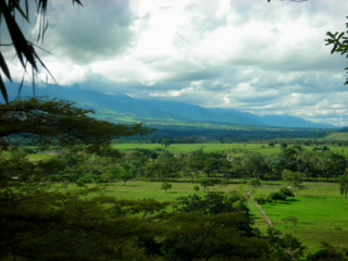
Boyacá is one of the thirty-two departments of Colombia, and the remnant of Boyacá State, one of the original nine states of the "United States of Colombia".

Arauca is a department of Eastern Colombia located in the extreme north of the Orinoco Basin of Colombia, bordering Venezuela. The southern boundary of Arauca is formed by the Casanare and Meta Rivers, separating Arauca from the departments of Casanare and Vichada. To the west, Arauca borders the department of Boyacá. The Caño Limón oil fields located within Arauca account for almost a third of the Colombian oil output. Its capital is the town of Arauca.

Arauca is a municipality and capital city of the Arauca Department of Colombia. Its full name is Villa de Santa Bárbara de Arauca, it is located at N 07° 05′ 25″ - W 70° 45′ 42″. The Municipality of Arauca has a total population of 85,585.

Vichada Department is a department of the Republic of Colombia in South America. Vichada is located in the eastern plains of Colombia, in the Orinoquía Region within the Orinoco river basin bordering the Bolivarian Republic of Venezuela to the north and east. To the north the department also borders with Arauca Department, to the northwest with Casanare Department, to the west with Meta Department, to the southwest narrowly bordering with Guaviare Department and to the south with Guainía Department. The department is the second largest in Colombia and scarcely populated in comparison to other departments.

The Llanos is a vast tropical grassland plain situated to the east of the Andes in Colombia and Venezuela, in northwestern South America. It is an ecoregion of the tropical and subtropical grasslands, savannas, and shrublands biome.
AeroTACA was an airline based in Bogotá, Colombia. It operated charter flights within Colombia and to neighboring countries. Its main base was El Dorado International Airport.

Inírida, formerly Puerto Inírida, is the capital city, and a municipality, of the department of Guainía in Colombia. It was established in 1963 on the site of the small village of Obando, at the time in the municipality of San Felipe. The municipality was renamed in 1974. The municipal population of 31,514 is mostly indigenous and accounts for about a third of the department's population.
Elorza is a town in the Apure State in Venezuela. Elorza is on the region of the Venezuelan Llanos and it had 26.800 inhabitants as of 2012. It is the capital of the Rómulo Gallegos Municipality. The current mayor is Solfreddy Solorzano.

Tame is a town and municipality in the Arauca Department, Colombia. The municipality has a total area of around 5,419 square kilometres or 2,090 square miles.
Santiago Pérez Quiroz Airport (Spanish: Aeropuerto Santiago Pérez Quiroz is an airport serving Arauca, the capital of the Arauca Department in Colombia. The runway is southeast of the city, and 2 kilometres south of Colombia's border with Venezuela.

Cuiba or Cuiva is a Guahiban language that is spoken by about 2,300 people in Colombia and additional 650 in Venezuela. More than half of Cuiba speakers are monolingual, and in Colombia there is a 45% literacy rate. Cuiva is also referred to as Cuiba, Cuiba-Wámonae, Kuiva, Chiricoa, Hiwi, and Maiben. In Colombia, Cuiva is spoken among those who live and who are born surrounding the Colombian rivers, Meta Casanare and Capanaparo. The Cuiba ethnic group is often found in the Casanare Department. In Venezuela the language is spoken in the state of Apure, one of the state border with Colombia, which is found alongside the Capanaparo river.

Fortul is one of the seven municipalities of the Colombian department of Arauca. It limits to the north with Saravena; to the south with Tame; to the east with Arauquita and to the west with Güicán. It was founded on January 7, 1920. According to the census conducted by the DANE in 2005, Fortul has a population of 25,379 inhabitants, of which 13,081 live in the municipal seat making it 49.5% women and 50.5% men.

Güicán de la Sierra, also known as Nuestra Señora de la Candelaria de Güicán, is a town and municipality in the Colombian Department of Boyacá. It is close to the national natural park El Cocuy National Park. As of the year 2020, it has a total population of 6,426.

Cumaribo is a town and municipality located in the Department of Vichada, Republic of Colombia. Cumaribo was founded by Jose Nicolino Mattar in 1959.

This is a timeline of events related to the Colombian armed conflict.
Los Colonizadores Airport is an airport serving Saravena in the Arauca Department of Colombia. The runway is just east of the town.
The Tamá National Natural Park is a national park located in the Tamá Massif of the Andean Region of Colombia, between the municipalities Toledo and Herrán, in the department of Norte de Santander, in the northeastern part of the Eastern Ranges of the Colombian Andes. One of the main attractions of the park is a 820-metre-high (2,690 ft) waterfall, one of the world's highest.

The Colombia–Venezuela border is an international border of 2219 kilometers (1378 mi) between Colombia and Venezuela, with a total of 603 milestones that demarcate the line. It is the longest border of both Colombia and Venezuela.

The Apure–Villavicencio dry forests (NT0201) is an ecoregion in Venezuela and Colombia to the east of the eastern cordillera of the Andes. The ecoregion covers the transition zone between montane forests in the Andes and the llanos, or lowland grasslands. It has been severely degraded by deforestation, farming and ranching. The remnants are poorly protected.

The 2021 Apure clashes started on 21 March 2021 in the south of the Páez Municipality, in the Apure state in Venezuela, specifically in La Victoria, a location bordering with Colombia, between guerrilla groups identified as Revolutionary Armed Forces of Colombia (FARC-EP) dissidents and the Venezuelan government led by Nicolás Maduro.


