Sardis, Ohio

Last updated

Sardis, Ohio
Sardis UMC from the east.jpg
Methodist church, Monroe and Fifth
OHMap-doton-Sardis.png
Location of Sardis, Ohio
Coordinates: 39°37′26″N80°54′20″W / 39.62389°N 80.90556°W / 39.62389; -80.90556
Country United States
State Ohio
County Monroe
Area
[1]
  Total
1.26 sq mi (3.27 km2)
  Land1.26 sq mi (3.27 km2)
  Water0.00 sq mi (0.00 km2)
Elevation
[2]
1,034 ft (315 m)
Population
 (2020)
  Total
522
  Density413.96/sq mi (159.86/km2)
Time zone UTC-5 (Eastern (EST))
  Summer (DST) UTC-4 (EDT)
ZIP code
43946
FIPS code 39-70548
GNIS feature ID2628967 [2]

Sardis is a census-designated place (CDP) in southeastern Lee Township, Monroe County, Ohio, United States. It is unincorporated, but has a post office with the ZIP code of 43946. [3] As of the 2020 census, it had a population of 522.

Contents

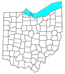
Sardis is at the intersection of Ohio State Routes 7 and 255, lying between Duffy and Fly.

Among the early settlers in this area was Major Earl Sproat, one of the 48 members of the Ohio Company. The Ohio Company founded Marietta, the first permanent settlement in the Northwest Territory in 1788. The village of Sardis was laid out by James Patton in 1843.[ citation needed ]

Students from Sardis attend River Elementary and River High School in nearby Hannibal, and are served by the Switzerland of Ohio Local School District. This school is shared with other nearby riverfront communities including: Antioch, Duffy, Fly, Hannibal, Laings, Powhatan Point (of neighboring Belmont County), and Clarington.[ citation needed ]

Geography

According to the United States Census Bureau, the CDP has a total area of 1.2 square miles (3.2 km2), all of it land. [4]

Demographics

Historical population
CensusPop.Note
2010 559
2020 522−6.6%
U.S. Decennial Census [5]

Related Research Articles

<span class="mw-page-title-main">Monroe County, Ohio</span> County in Ohio, United States

Monroe County is a county located on the eastern border of the U.S. state of Ohio, across the Ohio River from West Virginia. As of 2023, the population was 13,153, making it the second-least populous county in Ohio. Its county seat is Woodsfield. The county was created in 1813 and later organized in 1815.

Westwood is a census-designated place in Boyd County, Kentucky, United States. The population was 4,387 at the 2020 census. A suburb of Ashland, the two areas are closely affiliated, sharing a ZIP code and bus system. Westwood is located on a flat to hilly elevation just west of the Ohio River. The flat hilltop is unusual to eastern Kentucky and was created by the preglacial Teays River which existed in ancient times and flowed in the opposite direction of the Ohio River. Westwood is part of the Huntington–Ashland metropolitan area.

Okolona is a former census-designated place (CDP) in southern Louisville/Jefferson County, Kentucky, United States. It is centered on the intersection of Preston Highway and the Outer Loop. The population was 17,807 at the 2000 census. When the government of Jefferson County merged with the city of Louisville, Kentucky in 2003, residents of Okolona also became citizens of Louisville Metro. As a result, Okolona is said to be a neighborhood within the city limits of Louisville.

<span class="mw-page-title-main">Nakaibito, New Mexico</span> Census-designated place in New Mexico, United States

Nakaibito is an unincorporated community and census-designated place (CDP) in McKinley County, New Mexico, United States. The population was 355 at the 2020 census. The Mexican Springs post office serves the community.

<span class="mw-page-title-main">Pomona, New Jersey</span> Populated place in Atlantic County, New Jersey, US

Pomona is an unincorporated community and census-designated place (CDP) located within Galloway Township, in Atlantic County, in the U.S. state of New Jersey. As of the 2010 United States Census, the CDP's population was 7,124. The area is served as United States Postal Service ZIP Code 08240.

<span class="mw-page-title-main">East Liberty, Ohio</span> Census-designated place in Ohio, United States

East Liberty is an unincorporated community and census-designated place (CDP) located in Perry Township, Logan County, Ohio, United States. As of the 2020 census, it had a population of 371. It is located just off U.S. Route 33, 10 miles (16 km) east of Bellefontaine and 46 miles (74 km) northwest of Columbus. It has a post office with the ZIP code 43319.

<span class="mw-page-title-main">Lewistown, Ohio</span> Census-designated place in Ohio, United States

Lewistown is an unincorporated community and census-designated place (CDP) in central Washington Township, Logan County, Ohio, United States. As of the 2020 census, the population was 202.

Philadelphia is an unincorporated community and census-designated place in western Marion County, Missouri, United States. It is located 12 miles (19 km) west of Palmyra on Missouri Route 168. The community is part of the Hannibal Micropolitan Statistical Area.

<span class="mw-page-title-main">Ronks, Pennsylvania</span> Census-designated place in Pennsylvania, United States

Ronks is a small unincorporated farming community and census-designated place (CDP) in East Lampeter Township, Lancaster County, Pennsylvania, United States, just west of Paradise. As of the 2010 census the population was 362.

McConnellstown is a census-designated place in Walker Township, Huntingdon County, Pennsylvania, United States. Due to its long name, the village is often nicknamed "Mactown". The population of McConnellstown was 1,194 as of the 2010 census.

<span class="mw-page-title-main">Buford, Ohio</span> Census-designated place in Ohio, United States

Buford is an unincorporated community and census-designated place in central Clay Township, Highland County, Ohio, United States. The population was 306 at the 2020 census. It once had a post office, with the ZIP code 45110. The current ZIP code 45171 is for nearby Sardinia.

<span class="mw-page-title-main">Dola, Ohio</span> Census-designated place in Ohio, United States

Dola is a census-designated place in central Washington Township, Hardin County, Ohio, United States. As of the 2020 United States Census it had a population of 143. It has a post office with the ZIP code 45835.

<span class="mw-page-title-main">Stony Ridge, Ohio</span> CDP in Ohio, United States

Stony Ridge is a census-designated place (CDP) in northwestern Troy Township, Wood County, Ohio, United States. As of the 2020 census, it had a population of 434. It has a post office with the ZIP code 43463.

<span class="mw-page-title-main">Collins, Ohio</span> Census-designated place in Ohio, United States

Collins is a census-designated place (CDP) in central Townsend Township, Huron County, Ohio, United States. As of the 2020 census the population of the CDP was 628. The CDP includes the unincorporated communities of Collins and East Townsend. Collins has a post office, with the ZIP code of 44826.

<span class="mw-page-title-main">Miamitown, Ohio</span> Census-designated place in Ohio, United States

Miamitown is a census-designated place (CDP) in western Whitewater Township, Hamilton County, Ohio, United States. The population was 1,256 at the 2020 census. It has a post office with the ZIP code 45041.

<span class="mw-page-title-main">East Rochester, Ohio</span> Census-designated place in Ohio, United States

East Rochester is an unincorporated community and census-designated place in southern West Township, Columbiana County, Ohio, United States. The population was 224 as of the 2020 census. It lies along U.S. Route 30 about 20 miles (32 km) east of Canton, and has a post office with the ZIP code 44625.

<span class="mw-page-title-main">Hannibal, Ohio</span> Census-designated place in Ohio, United States

Hannibal is a census-designated place in eastern Ohio Township, Monroe County, Ohio, United States. It has a post office with the ZIP code 43931. In the 2020 Census, it had a population of 314.

Boody is an unincorporated community and census-designated place (CDP) in Macon County, Illinois, United States. As of the 2020 census, Boody had a population of 232, down from 276 in 2010. Boody has a post office with ZIP code 62514.

<span class="mw-page-title-main">Scenic, Arizona</span> CDP in Mohave County, Arizona

Scenic is an unincorporated community and census-designated place (CDP) in Mohave County in extreme northwestern Arizona, United States. As of the 2020 census, its population was 1,321, down from 1,643 in 2010.

Geronimo Estates is both a census-designated place (CDP) and a populated place in Gila County, Arizona, United States. The population of the CDP was 60 at the 2010 census.

References

  1. "ArcGIS REST Services Directory". United States Census Bureau. Retrieved September 20, 2022.
  2. 1 2 U.S. Geological Survey Geographic Names Information System: Sardis, Ohio
  3. Zip Code Lookup
  4. "Geographic Identifiers: 2010 Demographic Profile Data (G001): Sardis CDP, Ohio". United States Census Bureau . Retrieved June 4, 2012.
  5. "Census of Population and Housing". Census.gov. Retrieved June 4, 2016.