Graysville, Ohio | |
---|---|
Coordinates: 39°39′48″N81°10′29″W / 39.66333°N 81.17472°W | |
Country | United States |
State | Ohio |
County | Monroe |
Township | Washington |
Area | |
• Total | 1.01 sq mi (2.61 km2) |
• Land | 1.01 sq mi (2.61 km2) |
• Water | 0.00 sq mi (0.00 km2) |
Elevation | 1,053 ft (321 m) |
Population (2020) | |
• Total | 70 |
• Estimate (2023) [3] | 68 |
• Density | 69.51/sq mi (26.84/km2) |
Time zone | UTC-5 (Eastern (EST)) |
• Summer (DST) | UTC-4 (EDT) |
ZIP code | 45734 |
Area code | 740 |
FIPS code | 39-31542 [4] |
GNIS feature ID | 2398199 [2] |
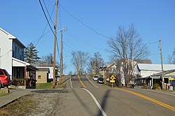
Graysville is a village in Monroe County, Ohio, United States. The population was 70 at the 2020 census.
According to the United States Census Bureau, the village has a total area of 1.01 square miles (2.62 km2), all of it land. [5]
Census | Pop. | Note | %± |
---|---|---|---|
1870 | 199 | — | |
1880 | 174 | −12.6% | |
1890 | 107 | −38.5% | |
1900 | 174 | 62.6% | |
1910 | 166 | −4.6% | |
1920 | 187 | 12.7% | |
1930 | 192 | 2.7% | |
1940 | 170 | −11.5% | |
1950 | 138 | −18.8% | |
1960 | 127 | −8.0% | |
1970 | 97 | −23.6% | |
1980 | 112 | 15.5% | |
1990 | 89 | −20.5% | |
2000 | 113 | 27.0% | |
2010 | 76 | −32.7% | |
2020 | 70 | −7.9% | |
2023 (est.) | 68 | [3] | −2.9% |
U.S. Decennial Census [6] [7] |
As of the census [8] of 2010, there were 76 people, 34 households, and 25 families living in the village. The population density was 75.2 inhabitants per square mile (29.0/km2). There were 38 housing units at an average density of 37.6 per square mile (14.5/km2). The racial makeup of the village was 89.5% White and 10.5% from two or more races.
There were 34 households, of which 23.5% had children under the age of 18 living with them, 58.8% were married couples living together, 8.8% had a female householder with no husband present, 5.9% had a male householder with no wife present, and 26.5% were non-families. 26.5% of all households were made up of individuals, and 11.8% had someone living alone who was 65 years of age or older. The average household size was 2.24 and the average family size was 2.64.
The median age in the village was 48 years. 18.4% of residents were under the age of 18; 3.8% were between the ages of 18 and 24; 22.4% were from 25 to 44; 39.4% were from 45 to 64; and 15.8% were 65 years of age or older. The gender makeup of the village was 50.0% male and 50.0% female.
As of the census [4] of 2000, there were 113 people, 41 households, and 33 families living in the village. The population density was 113.4 inhabitants per square mile (43.8/km2). There were 45 housing units at an average density of 45.2 per square mile (17.5/km2). The racial makeup of the village was 100.00% White. Hispanic or Latino of any race were 1.77% of the population.
There were 41 households, out of which 34.1% had children under the age of 18 living with them, 70.7% were married couples living together, 4.9% had a female householder with no husband present, and 19.5% were non-families. 14.6% of all households were made up of individuals, and 7.3% had someone living alone who was 65 years of age or older. The average household size was 2.76 and the average family size was 2.97.
In the village, the population was spread out, with 30.1% under the age of 18, 6.2% from 18 to 24, 26.5% from 25 to 44, 17.7% from 45 to 64, and 19.5% who were 65 years of age or older. The median age was 36 years. For every 100 females there were 109.3 males. For every 100 females age 18 and over, there were 97.5 males.
The median income for a household in the village was $24,286, and the median income for a family was $24,643. Males had a median income of $32,000 versus $20,000 for females. The per capita income for the village was $9,810. There were 13.9% of families and 28.8% of the population living below the poverty line, including 38.0% of under eighteens and 10.5% of those over 64.
Graysville is a city in northwestern Jefferson County, Alabama, United States, located north of Adamsville. At the 2020 census, the population was 1,950.
Gordon is a village in Darke County, Ohio, United States. The population was 245 at the 2020 census.
Ithaca is a village in Darke County, Ohio, United States. The population was 81 at the 2020 census.
Palestine is a village in Darke County, Ohio, United States. The population was 180 at the 2020 census.
Yorkshire is a village in Darke County, Ohio, United States. The population was 95 at the 2020 census.
Addyston is a village in Miami Township, Hamilton County, Ohio, United States. Located along the Ohio River, it is a western suburb of the neighboring city of Cincinnati. The population was 927 at the 2020 census.
Brinkhaven, once known as Mount Holly and Gann, is a village in Knox County, Ohio, United States. The population was 114 at the 2020 census.
Hanover is a village in Licking County, Ohio, United States. The population was 1,270 at the 2020 census. The village lies along Ohio State Route 16.
Hebron is a village in Licking County, Ohio, United States. The population was 2,326 at the 2020 census.
Rochester is a village in Lorain County, Ohio, United States, along the West Branch of the Black River. The population was 159 at the 2020 census.
Berkey is a village in Lucas County, Ohio, United States. The population was 275 at the 2020 census.
Miltonsburg is a village in Monroe County, Ohio, United States. The population was 42 at the 2020 census. Miltonsburg was named after Milton Pierson, son of Ohio pioneer David Pierson. David Pierson named Clarington, Ohio after his daughter Clarinda.
Adamsville is a village in Muskingum County, Ohio, United States. The population was 140 at the 2020 census. It is part of the Zanesville micropolitan area.
Darbyville is a village in Pickaway County, Ohio, United States. The population was 186 at the 2020 census.
Tarlton is a village in Fairfield and Pickaway counties in the U.S. state of Ohio. The population was 254 at the 2020 census.
Limaville is a census-designated place (CDP) and former village in Stark County, Ohio, United States. The population was 151 at the 2020 census. It is part of the Canton–Massillon Metropolitan Statistical Area.
Macksburg is a village in Washington County, Ohio, United States, along the West Fork of Duck Creek. The population was 120 at the 2020 census. The village is about 28 miles (45 km) south of Cambridge, Ohio.
Burkettsville is a village in Darke and Mercer counties in the U.S. state of Ohio. The population was 272 at the 2020 census.
Gratiot is a village in Licking and Muskingum counties in the U.S. state of Ohio. The population was 215 at the 2020 census.
Verona is a village in Montgomery and Preble counties in the U.S. state of Ohio. The population was 403 at the 2020 census. It is part of the Dayton Metropolitan Statistical Area.