Kempe Gowda I locally venerated as Nadaprabhu Kempe Gowda, or commonly known as Kempe Gowda, was a governor under the Vijayanagara Empire in early-modern India. He is famous for the development of Bengaluru Pete in the 16th century. Kempegowda erected many Kannada inscriptions across the region.

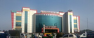
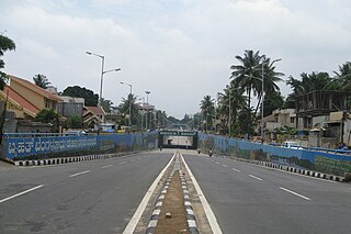
Yelahanka is a premium locality in north Bangalore and also a Taluk of Bangalore Urban district in the Indian state of Karnataka. One of the zones of BBMP. It is the oldest part of present Municipal Bengaluru (Bangalore) city and the northern end of the city. It is Nadaprabhu Kempegowda I, of the Yelahanka Prabhu clans, who laid the foundation of present-day Bengaluru through the creation of a "mud fort town" in 1537 CE
Chengam is an important market town and a taluk headquarter in the Foot hills of Eastern ghats in Tiruvannamalai district of Tamil Nadu, India. Chengam is the gateway to the Chengam pass in the Eastern ghats between Javvadhu hills to the north and Chennakesava hills to the south. The town is also the centre for various industrial activities which includes Sathanur dam hydro-electric project, Aavin milk processing plant and Periya Kolappadi SIDCO estate.

Kengeri is a western suburb of Bangalore city, located along Mysore Road.It is bordered by Nagarbhavi and Ullal to the north, Rajarajeshwari Nagar to the east, Kumbalgodu to the west and Uttarahalli to the south.
Puttenahalli WS Lake also spelled as Puttanahalli Lake is a 10-hectare water body near Yelahanka, 14 km north of Bangalore.
Muddenahalli is a village situated 7 km from Chikballapur in Chikballapur District of Karnataka State. It is the birthplace of M. Visvesvaraya, one of India's most accomplished engineers.

Puttenahalli is a suburban area in Bangalore, Karnataka State in India.

Bengaluru Suburban Railway is an under-construction suburban rail network for the city of Bangalore. A suburban rail system for the city was first proposed in 1983. Since then, several different route proposals were made but no suburban rail project took shape. It was finally approved in the 2019 Railway Budget.

Bangalore Fort began in 1537 as a mud fort. The builder was Kempe Gowda I, a vassal of the Vijaynagar Empire and the founder of Bangalore. King Hyder Ali in 1761 replaced the mud fort with a stone fort and it was further improved by his son King Tipu Sultan in the late 18th century. It was damaged during an Anglo-Mysore war in 1791. It still remains a good example of 18th-century military fortification. The army of the British East India Company, led by Lord Cornwallis on 21 March 1791 captured the fort in the siege of Bangalore during the Third Mysore War (1790–1792). At the time the fort was a stronghold for King Tipu Sultan. Today, the fort's Delhi gate, on Krishnarajendra Road, and two bastions are the primary remains of the fort. A marble plaque commemorates the spot where the British breached fort's wall, leading to its capture. The old fort area also includes King Tipu Sultan's Summer Palace, and his armoury. The fort has provided the setting for the treasure hunt in the book Riddle of the Seventh Stone.
Bommidi is a panchayat town which is located in Pappireddipatti taluka of Dharmapuri district in Tamil Nadu, India. It is also known as B. Mallapuram. Bommidi's name is used for the railway station, the police station situated at Nadur, the post office, and bus transportation, while the name "B. Mallapuram" is used for schools, hospitals, and government officials.
Kanivenarayanapura is a village located 6 km from Chikballapur, 3 km from Nandi Town and 2 km from Muddenahalli in Chikballapur District of Karnataka State.
Yelahanka Lake is a water body near Yelahanka, a suburb of Bangalore.
Sathanur is a village in Mandya district, Karnataka, India. Sathanur village is located in the SH-84, just 3 km from Bangalore-Mysore National highway -275.
Mudenahalli comes under Mudenahalli Panchayath. It is located 29 KM towards South from District headquarters Ramanagara. 39 KM from State capital Bangalore. Mudenahalli Pin code is 562112 and postal head office is Harohalli. Mudenahalli is surrounded by Ramanagara Taluk towards North, Thally Taluk towards East, Channapatna Taluk towards west, Maddur Taluk towards west. Ramanagaram, Maddur, Malavalli. Bangalore is the nearby Cities to Mudenahalli.
The Pink Line of Namma Metro is under construction and will form part of the metro rail network for the city of Bangalore, Karnataka, India. The 21.25 km (13.20 mi) line connects Kalena Agrahara station on Bannerghatta Road in the south with Nagawara station on Outer Ring Road in the north. The Pink Line is mostly underground but also has a 6.98 km (4.34 mi) elevated section and a 0.48 km (0.30 mi) at-grade (surface) section. There are 18 stations on the line, including 12 underground and 6 elevated ones. Pink Line will have an interchange with the Purple Line at MG Road station. It will also have interchanges with the Yellow line at Jayadeva Hospital station and with the Blue Line at Nagawara. Both these lines are under construction.

Jakkur is a suburb in the northern part of Bangalore, Karnataka, India. Located on the eastern side of the National Highway 44 between Yelahanka and Hebbal, the area is best known for the Jakkur Aerodrome and Jakkur Lake.
Dollars Colony is an upmarket residential locality in Bangalore, India. It is situated towards the north of Bangalore Central Business District. It is located 874 meters above mean sea level.

Whitefield railway station is an Indian Railways train station located in Whitefield, Bangalore, in the Indian state of Karnataka, which is about 8 km away from the Krishnarajapuram railway station and serves the Whitefield area.

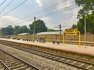
Yelahanka Junction railway station is an Indian Railways station in the outskirts of Bangalore in the Indian state of Karnataka, located in Yelahanka locality about 25 km away from the Bangalore City. This station is located on the Guntakal–Bangalore line.

Yelahanka Ward, officially known as Kempegowda Ward is one of the 225 Wards of Bruhat Bengaluru Mahanagara Palike, an administrative body responsible for civic amenities and some infrastructural assets of the Greater Bangalore metropolitan area in the Indian state of Karnataka.


