Coordinates: 13°03′26″N76°20′21″E / 13.057344°N 76.339075°E Sathenahalli is a small village in Hassan district of India.
Contents
Sathenahally | |
|---|---|
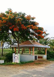
 Sathenahalli village |
Coordinates: 13°03′26″N76°20′21″E / 13.057344°N 76.339075°E Sathenahalli is a small village in Hassan district of India.
Sathenahally | |
|---|---|
| Sathenahalli village |
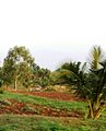
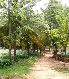
Sathenahalli lies on the Mysore - Arsikere highway. It comes under Channarayapatna taluk of Hassan district in Karnataka state, India.
The village is completely agrarian in nature. In 2015, the village recorded the highest rainfall in the region. [1]
There is a post office in the village and the PIN code is 573212.

Sanduru is a town in Bellary District in the Indian state of Karnataka. It is the administrative seat of Sanduru taluka. Sandur was ruled by the Ghorpade royal family of the Marathas.
Hassan is a district in Karnataka state, India. The district headquarter is Hassan.
The Shirani (Urdu: شيرانی)—also called Sherani —are a Pashtun tribe, from the Bettani tribal confederacy, who live in Afghanistan and Pakistan. The Sherani are mostly settled in the Frontier Region Dera Ismail Khan, in the Federally Administered Tribal Areas of Pakistan and in the adjoining Sherani District of Balochistan, Pakistan. Some clans have settled in other surrounding districts of Balochistan; and in the Zabul, Ghazni, and Kandahar provinces of Afghanistan. Diasporic communities can also be found in the Indian states of Rajasthan and Gujarat.

Baran district is a district in the Indian state of Rajasthan. The headquarters of the district are located at the city of Baran.
Arkalgud, also known as Arakalagudu is a panchayat town and is one among the eight taluks of Hassan district in the state of Karnataka, India. It is situated 30 km from Hassan, 181 km from Mangalore and 195 km from Bangalore. The river Hemavati forms the entire northern boundary of the Taluk; river Kaveri runs through a portion of the south. It is well connected by road to many towns and cities of Karnataka. Holenarasipura is the nearest railway station to Arakalgud taluk and the nearest airport is in Mangalore.

Murbad is a census town within the administrative division (Taluka) of Thane district in the Indian state of Maharashtra. Murbad city; its neighboring villages jointly form the Murbad Nagar Panchayat, which is near the cities of Thane, Karjat and Kalyan. Nearby cities include Badlapur, Ambernath, Ulhasnagar, and Dombivli. It is a largely industrial town with private and public enterprises (MIDC).
Pushpagiri, at 1,712 metres (5,617 ft), is the highest peak in Pushpagiri Wildlife Sanctuary in the Western Ghats of Karnataka. It is located in the Somwarpet Taluk, 20 kilometres (12 mi) from Somwarpet in the northern part of Kodagu district on the border between Dakshina Kannada and Kodagu district and hassan districts. It is 4th highest peak of Karnataka. The Sanskrit name of the mountain is Puṣpagiri while its Prakrit form is Puphagiri, which is mentioned in the Nagarjunakond Second Apsidal Temple inscription, although this may refer to a different mountain to the north of Cuddapah, in Andhra Pradesh.
Agalahalli is a village in the southern state of Karnataka, India, in the Hassan taluk of Hassan district.

Akkalavadi is a village in the southern state of Karnataka, India. It is located in the Arkalgud taluk of Hassan district in Karnataka.
Bendekere is a village in Hassan district in Karnataka state, India.
Kanakatte is a village located in Arasikere taluk, Hassan district, Karnataka, India.

Keralapura is a village in Hassan district of Karnataka state, India.
Gandasi is a "hobli" in Hassan district of India.
Mududi is a village in Arsikere taluk of Hassan district in India.
Bagur is a small village located at Channarayapatna taluka of Hassan district in Karnataka state of India.

Kantharajapura is a village in Hassan district of Karnataka state, India.

Dudda is a small village in Hassan district of Karnataka state in India.
| This article related to a location in Hassan district, Karnataka, India is a stub. You can help Wikipedia by expanding it. |