Sava, Apulia

Last updated
Sava
Comune di Sava
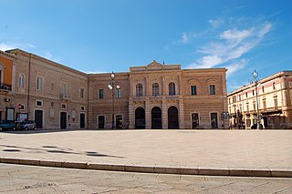
Piazza di sava completa.JPG
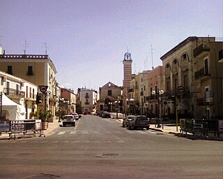
Town square at Sava
Sava (Italia)-Stemma.svg
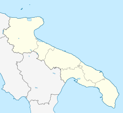
Location of Sava
Sava, Apulia
Italy provincial location map 2016.svg
Red pog.svg
Sava
Location of Sava in Italy
Italy Apulia location map.svg
Red pog.svg
Sava
Sava (Apulia)
Coordinates: 40°24′N17°34′E / 40.400°N 17.567°E / 40.400; 17.567
Country Italy
Region Apulia
Province Taranto (TA)
Frazioni Pasàno, Archignàno, Torre
Government
  MayorDario Iaia
Area
[1]
  Total44.57 km2 (17.21 sq mi)
Elevation
108 m (354 ft)
Population
 (31 December 2012) [2]
  Total16,490
  Density370/km2 (960/sq mi)
Demonym Savesi
Time zone UTC+1 (CET)
  Summer (DST) UTC+2 (CEST)
Postal code
74028
Dialing code 099
Patron saint San Giovanni Battista
Saint day23 and 24 June
Website Official website

Sava is a town and comune in the province of Taranto, Apulia, southeast Italy. With its 19000 [3] inhabitants, is one of the biggest town in the province.

It is a center of production of olive oil and of the wine Primitivo.

The nearby comuni are Maruggio, Torricella, Lizzano, Fragagnano, San Marzano di San Giuseppe, Francavilla Fontana and Manduria.

The main monuments of the city are the Mother Church, the Palazzo Baronale, the Mater Domini's Church, the Monastery's Church, the San Cosimo's Church and San Luigi's Church.

History

Some of the finds of the district of Agliano, dating from around 300 BC, attest to the Greek presence in the present territory of Sava. It was probably the last outpost towards the southern Salento, populated by Messapi. At the end of the 7th century AD, with the division of the Apulia region between Byzantines and Lombards, a wall built in dry limestone of modest size was built here. This limes ran from the Adriatic coast south of Brindisi up to the Ionian coast.

Although there are no documents proving the origins of the village of Sava, the majority of local historians agree that its foundation dates from the 15th century.

Sava, as the neighboring municipalities, has been characterized for most of the 20th century by emigration to northern Italy and, to a lesser extent, toward northern Europe.

On 19 August 1976 a powerful tornado struck the city of Sava and the surrounding countryside, until exhausting near Manduria; its passage led to intense rainfall and strong winds that caused extensive damage.

Related Research Articles

<span class="mw-page-title-main">Province of Foggia</span> Administrative unit of Apulia, Italy

The Province of Foggia is a province in the Apulia (Puglia) region of southern Italy.

<span class="mw-page-title-main">Manfredonia</span> Comune in Apulia, Italy

Manfredonia[maɱfreˈdɔːnja] is a town and commune of Apulia, Italy, in the province of Foggia, from which it is 35 kilometres northeast by rail. Manfredonia is situated on the coast, facing east, to the south of Monte Gargano, and gives its name to the gulf to the east of it. As of 2017 its population was 56,932.

<span class="mw-page-title-main">Manduria</span> Comune in Apulia, Italy

Manduria is a city and comune of Apulia, Italy, in the province of Taranto. With c. 32,000 inhabitants (2013), it is located 35 kilometres (22 mi) east of Taranto.

<span class="mw-page-title-main">Corato</span> Comune in Apulia, Italy

Corato is a town and comune in Italy. It is located in the Metropolitan City of Bari, Apulia, in southeastern Italy. Founded by the Normans, it became subject to Alfonso V, king of Aragon, at the end of the 15th century, and later to the Carafa family. The chief feature of the old town centre, which is surrounded by modern buildings, is the Romanesque church. It is a twin city of Grenoble, France, where many Coratini immigrated during the 20th century.

<span class="mw-page-title-main">Oria, Apulia</span> Comune in Apulia, Italy

Oria is a town and comune in the Apulia region, in the province of Brindisi, in southern Italy. It is the seat of the Roman Catholic Diocese of Oria.

<span class="mw-page-title-main">Francavilla Fontana</span> Comune in Apulia, Italy

Francavilla Fontana is a town and comune (municipality) in the province of Brindisi and region of Apulia, in southern Italy. It is also called the town of the "Imperiali", after the Imperiali, a family of feudal lords who ruled the town from the end of 16th century until the 18th century. With a population of 36,358, in 2017, it is the third municipality of its province after Brindisi and Fasano. Its one of the many towns in south Italy where the Greek dialect Griko is spoken.

<span class="mw-page-title-main">Fasano</span> Comune in Apulia, Italy

Fasano is a town and comune in the Province of Brindisi, Apulia, southern Italy. It is the second most populated town in the province after Brindisi, with a population in 2021 of 39,026.

<span class="mw-page-title-main">Modugno</span> Comune in Apulia, Italy

Modugno is a town and comune of the Metropolitan City of Bari, Apulia, southern Italy.

<span class="mw-page-title-main">Rutigliano</span> Comune in Apulia, Italy

Rutigliano is a town and commune in the Metropolitan City of Bari, Apulia, southern Italy.

<span class="mw-page-title-main">Nardò</span> Comune in Apulia, Italy

Nardò is a town and comune in the southern Italian region of Apulia, in the Province of Lecce.

<span class="mw-page-title-main">Ischitella</span> Comune in Apulia, Italy

Ischitella is a town and comune in the province of Foggia, Apulia, southeast Italy. It is a centre for agrumes production, on the northern slopes of the Gargano promontory.

<span class="mw-page-title-main">Vico del Gargano</span> Comune in Apulia, Italy

Vico del Gargano is a village and comune in the province of Foggia in the Apulia region of southeast Italy. Called the "Village of Love", it is part of the Gargano National Park and the Mountain Community of Gargano.

Carosino is a town and comune in the province of Taranto, in the northern Salento, part of the Apulia region of southeast Italy. Carosino was historically an Arbëreshë settlement.

<span class="mw-page-title-main">Maruggio</span> Comune in Apulia, Italy

Maruggio is a village and comune in the province of Taranto, Apulia, southeast Italy. The village is located in a natural depression 2 kilometres (1.2 mi) from the Gulf of Taranto, in the north-west part of Salento peninsula and it's one of the villages of South Italy where the Greek dialect Griko is spoken. The nearest villages are Torricella at 6 kilometres (4 mi), Sava at 10 kilometres (6 mi), Manduria at 12 kilometres (7 mi) and Avetrana at 16 kilometres (10 mi).
<span class="mw-page-title-main">San Giorgio Ionico</span> Comune in Apulia, Italy

San Giorgio Ionico is a town and comune in the province of Taranto, in the northern Salento, part of the Apulia region of southeast Italy. San Giorgio Ionico was historically an Arbëreshë settlement. After the inhabitants abandoned the Albanian Greek Orthodox faith they assimilated into the local population.

<span class="mw-page-title-main">Torricella, Apulia</span> Comune in Apulia, Italy

Torricella is a town and comune in the province of Taranto, in the Apulia region of southeast Italy. It is home to a large tuff castle from the 15th century, one of the best preserved in the region.
<span class="mw-page-title-main">Alessano</span> Comune in Apulia, Italy

Alessano is a town and comune in the province of Lecce, part of Apulia region of south-east Italy.

<span class="mw-page-title-main">Morciano di Leuca</span> Comune in Apulia, Italy

Morciano di Leuca is a town and comune of 3,121 inhabitants in the province of Lecce, in the Apulia region of south-east Italy.
<span class="mw-page-title-main">Patù</span> Comune in Apulia, Italy

Patù is a town and comune in the province of Lecce in the Apulia region of south-east Italy.

<span class="mw-page-title-main">Salve, Apulia</span> Comune in Apulia, Italy

Salve is a town and comune of 4,546 inhabitants of the province of Lecce, in the region of Apulia, south-east Italy.

References

  1. "Superficie di Comuni Province e Regioni italiane al 9 ottobre 2011". Italian National Institute of Statistics. Retrieved 16 March 2019.
  2. Population from ISTAT
  3. "Statistiche demografiche ISTAT".