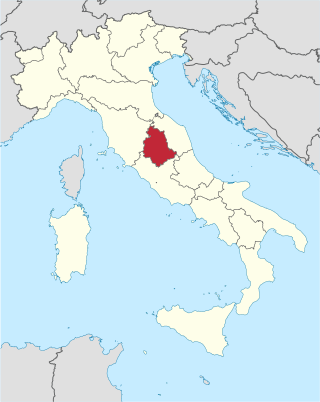
Umbria is a region of central Italy. It includes Lake Trasimeno and Marmore Falls, and is crossed by the river Tiber. It is the only landlocked region on the Apennine Peninsula. The regional capital is Perugia.

Umbrian is an extinct Italic language formerly spoken by the Umbri in the ancient Italian region of Umbria. Within the Italic languages it is closely related to the Oscan group and is therefore associated with it in the group of Osco-Umbrian languages, a term generally replaced by Sabellic in modern scholarship. Since that classification was first formulated, a number of other languages in ancient Italy were discovered to be more closely related to Umbrian. Therefore, a group, the Umbrian languages, was devised to contain them.

The Apennines or Apennine Mountains are a mountain range consisting of parallel smaller chains extending c. 1,200 km (750 mi) along the length of peninsular Italy. In the northwest they join with the Ligurian Alps at Altare. In the southwest they end at Reggio di Calabria, the coastal city at the tip of the peninsula. Since 2000 the Environment Ministry of Italy, following the recommendations of the Apennines Park of Europe Project, has been defining the Apennines System to include the mountains of north Sicily, for a total distance of 1,500 kilometres (930 mi). The system forms an arc enclosing the east side of the Ligurian and Tyrrhenian Seas.
The Via Flaminia or Flaminian Way was an ancient Roman road leading from Rome over the Apennine Mountains to Ariminum (Rimini) on the coast of the Adriatic Sea, and due to the ruggedness of the mountains was the major option the Romans had for travel between Etruria, Latium, Campania, and the Po Valley. The section running through northern Rome is where Constantine the Great, allegedly, had his famous vision of the Chi Rho, leading to his conversion to Christianity and the Christianization of the Roman Empire.

Marche, in English sometimes referred to as the Marches, is one of the twenty regions of Italy. The region is located in the central area of the country, and has a population of about 1.5 million people, being the thirteenth largest region in the country by number of inhabitants. The region's capital and largest city is Ancona.
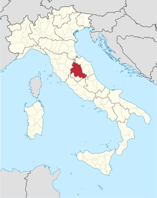
The province of Perugia is the larger of the two provinces in the Umbria region of Italy, comprising two-thirds of both the area and population of the region. Its capital is the city of Perugia. The province covered all of Umbria until 1927, when the province of Terni was carved out of its southern third. The province of Perugia has an area of 6,334 km2 covering two-thirds of Umbria, and a total population of about 660,000. There are 59 comunes in the province. The province has numerous tourist attractions, especially artistic and historical ones, and is home to the Lake Trasimeno, the largest lake of Central Italy. It is historically the ancestral origin of the Umbri, while later it was a Roman province and then part of the Papal States until the late 19th century.

Gubbio is an Italian town and comune in the far northeastern part of the Italian province of Perugia (Umbria). It is located on the lowest slope of Mt. Ingino, a small mountain of the Apennines.

Sassoferrato is a town and comune of the province of Ancona in the Marche region of central-eastern Italy. It is a member of the I Borghi più belli d'Italia association.

Regio VI Umbria is the name for one of the 11 administrative regions into which the emperor Augustus divided Italy. The main source for the regions is the Historia Naturalis of Pliny the Elder, who informs his readers he is basing the geography of Italy on the descriptio Italiae, "division of Italy," made by Augustus. The Regio Sexta is called Umbria complexa agrumque Gallicam citra Ariminium, "Umbria including the Gallic country this side of Rimini."
The Umbri were an Italic people of ancient Italy. A region called Umbria still exists and is now occupied by Italian speakers. It is somewhat smaller than the ancient Umbria.

Arcevia is a comune in the province of Ancona of the region of Marche, central-eastern Italy. It is a member of the I Borghi più belli d'Italia association.

Costacciaro is a comune (municipality) in the Province of Perugia in the Italian region Umbria, located about 40 km northeast of Perugia. It is a medieval burgh, which, after the rule of Perugia and Gubbio, became part of the Papal States in the 15th century.

Scheggia e Pascelupo is a comune (municipality) in the Province of Perugia in the Italian region Umbria, located about 40 km northeast of Perugia. The municipal seat is located in the main village of Scheggia, just below Scheggia Pass on Route SS/SR 3 Flaminia, following the ancient Via Flaminia.

The Italian geographic region, Italian physical region or Italian region is a geographical region of south-central Europe delimited to the north by the mountain chains of the Alps. This subregion is composed of a peninsular and continental part and an insular part. Located between the Balkan Peninsula and the Iberian Peninsula, it protrudes into the centre of the Mediterranean Sea and overlooks the Adriatic Sea, the Ionian Sea, the Ligurian Sea, the Sardinian Channel, the Sea of Corsica, the Sea of Sardinia, the Strait of Sicily, and the Tyrrhenian Sea.

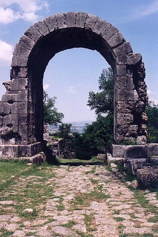
The Temple of Jupiter Apenninus or Temple of Jupiter Poeninus was an Umbrian-Roman temple that lay at the foot of Monte Catria, near the modern village of Scheggia, between today's Umbria and Marche regions, in Italy. The temple stood near the ancient Via Flaminia, 200 km from Rome, where the road crossed the Apennines. The structure, once one of the most important Umbrian shrines, has now completely disappeared.

The Sentino is a tributary of the Esino River, which springs at 750 m above sea level above the mountains of Gubbio, in Umbria. The Sentino flows from the north-eastern slope of Madonna della Cima.

La Festa della Venuta della Santa Casa, colloquially known as La Venuta is a traditional festival in the Marche region of Italy, also widespread in some parts of Umbria, which has been held for more than four hundred years on the night between the ninth and tenth of December, lighting large bonfires in cities, towns and the countryside.

The church of Saint Maria Assunta is a Catholic parish church in Nocera Umbra, in Umbria, and co-cathedral of the diocese of Assisi-Nocera Umbra-Gualdo Tadino.
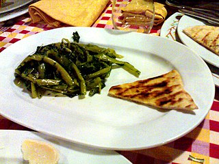
Crescia is a thin Italian flatbread typically prepared in Marche and Umbria. The crescia probably has a common ancestry to the piadina, to be found in the bread used by the Byzantine army, stationed for centuries in Romagna, in the north of the Marche (Pentapolis), and in the Umbrian Valley crossed by the Via Flaminia. The food is also known by the common name of "white pizza".

Mount Cucco is a mountain located in Umbria, along the Umbrian-Marche Apennines, in the area of Gubbio, included in the territory of the municipalities of Costacciaro, Scheggia e Pascelupo, Fossato di Vico and Sigillo. Since 1995 it has become a protected area under the name of Monte Cucco Park.


