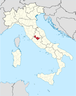
Province of Terni

Last updated
Province of Terni
Piazza Tacito.jpg
Palazzo Bazzani, the provincial seat
Flag of the province of Terni.svg
Provincia di Terni-Stemma.svg
Terni in Italy.svg
Location of the province of Terni in Italy
CountryFlag of Italy.svg  Italy
Region Umbria
Capital(s) Terni
Comuni 33
Government
  PresidentGianpiero Lattanzi
Area
  Total2,122 km2 (819 sq mi)
Population
 (28 February 2016)
  Total228,236
  Density110/km2 (280/sq mi)
GDP
[1]
  Total€5.030 billion (2015)
  Per capita€21,885 (2015)
Time zone UTC+1 (CET)
  Summer (DST) UTC+2 (CEST)
Postal code
05010-05018, 05020-05026,
05028-05032, 05034-05035,
05039, 05100
Telephone prefix075, 0744, 0763
Vehicle registration TR
ISTAT 055

The province of Terni (Italian : provincia di Terni) is the smaller of the two provinces in the Umbria region of Italy, comprising one-third of both the area and population of the region. Its capital is the city of Terni. The province came into being in 1927, when it was carved out of the original unitary province of Umbria.

Contents

The province of Terni has an area of 2,122 km2 and a population of 228,836 (2016). There are 33 comuni (sg.: comune ) in the province. [2]

In June 2006, the only comuni (municipalities) with a population over 10,000 were Terni, Orvieto, Narni and Amelia.

Geography

It is bordered to the north with the province of Perugia, to the east, south and west with the Lazio (province of Rieti and province of Viterbo) and to north-west with the Tuscany (province of Siena). The province extends into the south-west of the Umbria region, occupying the last section of the Nera Valley near the confluence with the River Velino, and the eastern part of the valley of the Tiber Valley  [ it ].

The province of Terni is characterized by its slopes encountered along the path of rivers, allowing the exploitation of hydro catchment areas, so as to have led to the creation of several artificial lakes:

History

In the 2nd millennium BC the province was occupied by a population called Umbri, who founded the cities of Amelia, Narnia Nahars, Otricolum and Interamna Nahars. With the development of the Etruscan civilization, their territory was reduced to the valleys of the Black and Velino. One of the most important and richest Etruscan cities in province of Terni was Orvieto and an unidentified place called Fanum Voltumnae. For centuries, Umbrian and Etruscan fought hard for the rule of the Tiber Valley, until, in 299 BC when Roman legions began the invasion of Umbria.

The provincial territory was part of the Roman Republic and then the Roman Empire until the latter's western part fell in the 5th century AD. In 571 the Lombards, after invading the Po Plain, went down the Apennines and, in 575, founded the Duchy of Spoleto in what is now Umbria and the neighbouring areas; this state remained formally independent until 1250. In 1527 Terni was used a camp of the Landsknecht army that would subsequently take part in the Sack of Rome and fought at Spoleto and Todi, where the League of Cognac troops were located.

Before the late-19th century industrial development, Terni was a small center with some 15,000 inhabitants in 1881. In 1921 it had grown to 40,000 inhabitants. In 1926 it became the seat of a separate province, detached from Perugia, including the countryside around the main centres of Terni and Orvieto.

Related Research Articles

<span class="mw-page-title-main">Umbria</span> Region of Italy

Umbria is a region of central Italy. It includes Lake Trasimeno and Marmore Falls, and is crossed by the Tiber. It is the only landlocked region on the Apennine Peninsula. The regional capital is Perugia.

<span class="mw-page-title-main">Terni</span> City in Umbria, Italy

Terni is a city in the southern portion of the region of Umbria, in Central Italy. It is near the border with Lazio. The city is the capital of the province of Terni, located in the plain of the River Nera. It is 104 kilometres northeast of Rome and 81 km south of the regional capital, Perugia.

Via Flaminia Ancient Roman road

The Via Flaminia was an ancient Roman road leading from Rome over the Apennine Mountains to Ariminum (Rimini) on the coast of the Adriatic Sea, and due to the ruggedness of the mountains was the major option the Romans had for travel between Etruria, Latium, Campania, and the Po Valley. The section running through northern Rome is where Constantine the Great, allegedly, had his famous vision of the Chi Rho, leading to his conversion to Christianity and the Christianization of the Roman Empire.

<span class="mw-page-title-main">Narni</span> Comune in Umbria, Italy

Narni is an ancient hilltown and comune (municipality) of Umbria, in central Italy, with 19,252 inhabitants (2017). At an altitude of 240 metres (790 ft), it overhangs a narrow gorge of the River Nera in the province of Terni. It is very close to the geographical centre of Italy. There is a stone on the exact spot with a sign in multiple languages.

<span class="mw-page-title-main">Province of Perugia</span> Province of Italy

The province of Perugia is the larger of the two provinces in the Umbria region of Italy, comprising two-thirds of both the area and population of the region. Its capital is the city of Perugia. The province covered all of Umbria until 1927, when the province of Terni was carved out of its southern third. The province of Perugia has an area of 6,334 km2 covering two-thirds of Umbria, and a total population of about 660,000. There are 59 comuni in the province. The province has numerous tourist attractions, especially artistic and historical ones, and is home to the Lake Trasimeno, the largest lake of Central Italy. It is historically the ancestral origin of the Umbri, while later it was a Roman province and then part of the Papal States until the late 19th century.

<span class="mw-page-title-main">Trasimène</span>

Trasimène was a department of the First French Empire from 1809 to 1814 in present-day Italy. It was named after Lake Trasimeno. It was formed on 15 July 1809, when the Papal States were annexed by France. Its capital was Spoleto.

<span class="mw-page-title-main">Regio VI Umbria</span> Subdivision of Roman Italy

Regio VI Umbria is the name for one of the 11 administrative regions into which the emperor Augustus divided Italy. The main source for the regions is the Historia Naturalis of Pliny the Elder, who informs his readers he is basing the geography of Italy on the descriptio Italiae, "division of Italy", made by Augustus. The Regio Sexta is called Umbria complexa agrumque Gallicam citra Ariminium.

<span class="mw-page-title-main">Umbri</span> Italic people of ancient Italy

The Umbri were an Italic people of ancient Italy. A region called Umbria still exists and is now occupied by Italian speakers. It is somewhat smaller than the ancient Umbria.

<span class="mw-page-title-main">Carsulae</span> Archeological site in Italy

Carsulae is an archaeological site in the region of Umbria in central Italy. It is located approximately 4 kilometres (2.5 mi) north of San Gemini, a small comune in the province of Terni.

<span class="mw-page-title-main">Amelia, Umbria</span> Comune in Umbria, Italy

Amelia is a town and comune located in central Italy which is part of the province of Terni. The city is located in Umbria not far from the border with Lazio. In Antiquity it was known as Ameria.

<span class="mw-page-title-main">Sabina (region)</span> Traditional region in Italy

Sabina, also called the Sabine Hills, is a region in central Italy. It is named after Sabina, the territory of the ancient Sabines, which was once bordered by Latium to the south, Picenum to the east, ancient Umbria to the north and Etruria to the west. It was separated from Umbria by the River Nar, today's Nera, and from Etruria by the River Tiber.

There are 70 community bands, 110 community choirs, and about 20 secondary music schools. The region is famous for its music festivals, including the Festival dei Due Mondi in Spoleto and the Umbria Jazz Festival.

<span class="mw-page-title-main">Nera (Tiber)</span> River in Italy

The Nera is a 116-kilometre (72 mi) long river that flows almost entirely in Umbria, Italy. It is the largest tributary to the Tiber. Its sources are in the Monti Sibillini, east of Foligno. It flows southward past Terni and Narni. It joins the Tiber near Orte. Its largest tributaries are the Velino and the Corno.

<span class="mw-page-title-main">Castel Giorgio</span> Comune in Umbria, Italy

Castel Giorgio is a comune (municipality) in the Province of Terni in the Italian region Umbria, located about 60 kilometres (37 mi) southwest of Perugia and about 60 km northwest of Terni on the Alfine Highland, facing the Lake Bolsena.

<span class="mw-page-title-main">Ferentillo</span> Comune in Umbria, Italy

Ferentillo is a comune (municipality) in the Province of Terni in the Italian region Umbria, located about 60 km southeast of Perugia and about 12 km northeast of Terni. The comune, located in the valley of the Nera, is divided by the river into the burghs of Matterella and Precetto.

<span class="mw-page-title-main">Montefranco</span> Comune in Umbria, Italy

Montefranco is a comune (municipality) in the Province of Terni in the Italian region Umbria, located about 70 km southeast of Perugia and about 10 km northeast of Terni. As of 31 December 2004, it had a population of 1,329 and an area of 10.1 km2.

Porano is a comune (municipality) in the Province of Terni in the Italian region Umbria, located about 50 km southwest of Perugia and about 45 km northwest of Terni. As of 31 December 2004, it had a population of 1,867 and an area of 13.5 km2.

<span class="mw-page-title-main">Stroncone</span> Comune in Umbria, Italy

Stroncone is a comune (municipality) in the Province of Terni in the Italian region Umbria, located about 70 km southeast of Perugia and about 8 km south of Terni. It is one of I Borghi più belli d'Italia.

<span class="mw-page-title-main">Roman Catholic Diocese of Terni-Narni-Amelia</span> Latin Catholic ecclesiastical jurisdiction in Italy

The Diocese of Terni-Narni-Amelia is a Latin Church ecclesiastical territory or diocese of the Catholic Church in Umbria, central Italy. It was created in 1983, when the Diocese of Amelia was united with the Diocese of Terni and Narni. The latter had been in turn created in 1907, when the Diocese of Narni was united to the historical Diocese of Terni. The diocese is immediately exempt to the Holy See, not part of any ecclesiastical province.

<span class="mw-page-title-main">Farnetta</span> Village in Umbria, Italy

Farnetta is a small village in the Terre Arnolfe countryside, 16 miles northwest of the Italian city of Terni, Umbria. It is included in the comune of Montecastrilli in the province of Terni. It has a population of 283.

References

42°34′N12°39′E / 42.567°N 12.650°E / 42.567; 12.650