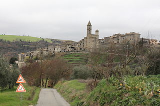
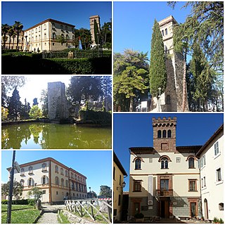
Fabro | ||
---|---|---|
Comune | ||
Comune di Fabro | ||
| ||
Coordinates: 42°52′N12°1′E / 42.867°N 12.017°E Coordinates: 42°52′N12°1′E / 42.867°N 12.017°E | ||
Country | Italy | |
Region | Umbria | |
Province | Terni (TR) | |
Frazioni | Fabro Scalo | |
Government | ||
• Mayor | Maurizio Terzino | |
Area | ||
• Total | 34.55 km2 (13.34 sq mi) | |
Elevation | 364 m (1,194 ft) | |
Population (31 ذJuly 2017) [1] | ||
• Total | 2,822 | |
• Density | 82/km2 (210/sq mi) | |
Demonym(s) | Fabresi | |
Time zone | CET (UTC+1) | |
• Summer (DST) | CEST (UTC+2) | |
Postal code | 05015 | |
Dialing code | 0763 | |
Patron saint | Saint Martin | |
Saint day | November 11 | |
Website | Official website |
Fabro is a comune (municipality) in the Province of Terni in the Italian region Umbria, located about 40 km southwest of Perugia and about 60 km northwest of Terni.
The comune is a basic administrative division in Italy, roughly equivalent to a township or municipality.
The Province of Terni is the smaller of the two provinces in the Umbria region of Italy, comprising one-third of both the area and population of the region. Its capital is the city of Terni. The province came into being in 1927, when it was carved out of the original unitary province of Umbria.
Italy, officially the Italian Republic, is a country in Southern Europe. Located in the middle of the Mediterranean Sea, Italy shares open land borders with France, Switzerland, Austria, Slovenia and the enclaved microstates San Marino and Vatican City. Italy covers an area of 301,340 km2 (116,350 sq mi) and has a largely temperate seasonal and Mediterranean climate. With around 61 million inhabitants, it is the fourth-most populous EU member state and the most populous country in Southern Europe.
Fabro borders the following municipalities: Allerona, Cetona, Città della Pieve, Ficulle, Montegabbione, Monteleone d'Orvieto, San Casciano dei Bagni.
Allerona is a comune (municipality) in the Province of Terni in the Italian region Umbria, located about 50 km southwest of Perugia and about 60 km northwest of Terni.
Cetona is a town and comune in the southern part province of Siena, Tuscany, in an area where Umbria and Lazio meet.
Città della Pieve is a comune (municipality) in the Province of Perugia in the Italian region Umbria, located about 50 km (31 mi) southwest of Perugia.
Galliavola is a comune (municipality) in the Province of Pavia in the Italian region Lombardy, located about 50 km southwest of Milan and about 30 km southwest of Pavia. As of 31 December 2004, it had a population of 230 and an area of 8.5 km².
Arrone is a comune (municipality) in the Province of Terni in the Italian region Umbria, located about 70 km southeast of Perugia and about 10 km east of Terni in the Valnerina.
Attigliano is a comune (municipality) in the Province of Terni in the Italian region Umbria, located about 70 km south of Perugia and about 30 km west of Terni. Attigliano has the lowest elevation of any municipality located in Umbria.
Baschi is a comune (municipality) in the Province of Terni in the Italian region Umbria, located about 50 km southwest of Perugia and about 35 km northwest of Terni.
Calvi dell'Umbria is a comune (municipality) in the Province of Terni in the Italian region Umbria, located about 80 km south of Perugia and about 20 km southwest of Terni.
Castel Giorgio is a comune (municipality) in the Province of Terni in the Italian region Umbria, located about 60 km southwest of Perugia and about 60 km northwest of Terni on the Alfine Highland, facing the Lake Bolsena.
Ferentillo is a comune (municipality) in the Province of Terni in the Italian region Umbria, located about 60 km southeast of Perugia and about 12 km northeast of Terni. The comune, located in the valley of the Nera, is divided by the river into the burghs of Matterella and Precetto.
Ficulle is a comune (municipality) in the Province of Terni in the Italian region Umbria, located about 40 km southwest of Perugia and about 60 km northwest of Terni.
Guardea is a comune (municipality) in the Province of Terni in the Italian region Umbria, located about 60 km south of Perugia and about 30 km west of Terni.
Montecastrilli is a comune (municipality) in the Province of Terni in the Italian region of Umbria, located about 50 km south of Perugia and about 15 km northwest of Terni.
Montecchio is a comune (municipality) in the Province of Terni in the Italian region Umbria, located about 50 km south of Perugia and about 30 km northwest of Terni.
Montefranco is a comune (municipality) in the Province of Terni in the Italian region Umbria, located about 70 km southeast of Perugia and about 10 km northeast of Terni. As of 31 December 2004, it had a population of 1,329 and an area of 10.1 km².
Montegabbione is a comune (municipality) in the Province of Terni in the Italian region Umbria, located about 35 km southwest of Perugia and about 60 km northwest of Terni.
Monteleone d'Orvieto is a comune (municipality) in the Province of Terni in the Italian region Umbria, located about 35 km southwest of Perugia and about 60 km northwest of Terni.
Parrano is a comune (municipality) in the Province of Terni in the Italian region Umbria, located about 35 km southwest of Perugia and about 50 km northwest of Terni.
Penna in Teverina is a comune (municipality) in the Province of Terni in the Italian region Umbria, located about 70 km south of Perugia and about 25 km southwest of Terni.
San Gemini is a comune (municipality) of c. 5,000 inhabitants in the province of Terni in the Italian region Umbria, located about 60 km south of Perugia and about 10 km northwest of Terni.
San Venanzo is a comune (municipality) in the Province of Terni in the Italian region Umbria, located about 30 km (19 mi) southwest of Perugia and about 45 km (28 mi) northwest of Terni.
Avigliano Umbro is a comune (municipality) in the Province of Terni in the Italian region Umbria, located about 50 km south of Perugia and about 20 km northwest of Terni. As of 2011 census its population was of 2,568.
This Umbria location article is a stub. You can help Wikipedia by expanding it. |