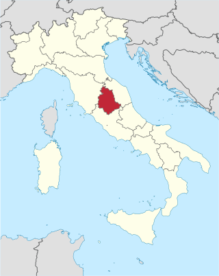
Umbria is a region of central Italy. It includes Lake Trasimeno and Marmore Falls, and is crossed by the Tiber. It is the only landlocked region on the Apennine Peninsula. The regional capital is Perugia.

The province of Terni is the smaller of the two provinces in the Umbria region of Italy, comprising one-third of both the area and population of the region. Its capital is the city of Terni. The province came into being in 1927, when it was carved out of the original unitary province of Umbria.

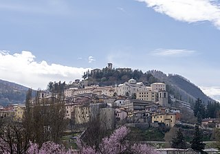
Cascia is a town and comune (municipality) of the Italian province of Perugia in a rather remote area of the mountainous southeastern corner of Umbria. It is about 21 km from Norcia on the road to Rieti in the Lazio (63 km). It is also very close to Terni.

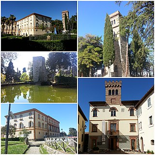
Acquapendente is a city and comune in the province of Viterbo, in Lazio (Italy). Acquapendente is a centre for the agricultural production of vegetables and wine, and has a tradition of pottery craftsmanship. Its frazione of Torre Alfina is one of I Borghi più belli d'Italia.

Castel San Lorenzo is a town and comune in the province of Salerno in the Campania region of south-western Italy.

Pigna is a comune (municipality) in the Province of Imperia in the Italian region of Liguria, located about 110 kilometres (68 mi) southwest of Genoa and about 30 kilometres (19 mi) west of Imperia, on the border with France. In 2024, it has an evaluated population of 741 and an area of 53.7 square kilometres (20.7 sq mi).

Capalbio is a comune (municipality) in the Province of Grosseto in Tuscany, Italy, located about 150 kilometres (93 mi) south of Florence and about 45 kilometres (28 mi) southeast of Grosseto. Capalbio borders the following municipalities: Manciano, Montalto di Castro (Lazio) and Orbetello. It is one of I Borghi più belli d'Italia.

Allerona is a comune (municipality) in the Province of Terni in the Italian region Umbria, located about 50 km southwest of Perugia and about 60 km northwest of Terni. It is one of I Borghi più belli d'Italia. The town consists of Allerona Alta, the hill town, and Allerona Scalo, the more populated town with a few bars, restaurants, grocers, and other services. The land is a mix of sand and clay soils, representing an ancient coastline where fossilized seashells can be found dating back a million years in the ancient sand dunes. Along the river that meanders on the valley west of the Autostrada, is an ancient Roman road. The fog settled in the valley quite often, leaving the hilltop village visible at a distance.

Arrone is a comune (municipality) in the Province of Terni in the Italian region Umbria, located about 70 km southeast of Perugia and about 10 km east of Terni in the Valnerina. It is one of I Borghi più belli d'Italia.

Castel Giorgio is a comune (municipality) in the Province of Terni in the Italian region Umbria, located about 60 kilometres (37 mi) southwest of Perugia and about 60 km northwest of Terni on the Alfine Highland, facing the Lake Bolsena.

Ficulle is a comune (municipality) in the Province of Terni in the Italian region Umbria, located about 40 km southwest of Perugia and about 60 km northwest of Terni.
Montecchio is a comune (municipality) in the Province of Terni in the Italian region Umbria, located about 50 km south of Perugia and about 30 km northwest of Terni.

Monteleone d'Orvieto is a comune (municipality) in the Province of Terni in the Italian region Umbria, located about 35 km southwest of Perugia and about 60 km northwest of Terni. It is one of I Borghi più belli d'Italia.
Porano is a comune (municipality) in the Province of Terni in the Italian region Umbria, located about 50 km southwest of Perugia and about 45 km northwest of Terni. As of 31 December 2004, it had a population of 1,867 and an area of 13.5 km2.

San Venanzo is a comune (municipality) in the Province of Terni in the Italian region Umbria, located about 30 km (19 mi) southwest of Perugia and about 45 km (28 mi) northwest of Terni.

Borgo Velino is a comune (municipality) in the Province of Rieti in the region of Latium, Italy. It is located about 70 kilometres (43 mi) northeast of Rome and about 15 kilometres (9 mi) east of the town Rieti. It has an area of 17.3 square kilometres (6.7 sq mi), and as of 31 December 2010 it had a population of 1,004. Until 1927 Borgo Velino was part of the province of L'Aquila in Abruzzo. It is located near the site of a pre- or early-Roman Sabine village named Viario. Rare ruins of this ancient village, now occupied by a cultivated field, were found near a standing medieval tower. Borgo Velino is the birthplace of Giulio Pezzola, a notorious outlaw of the 17th century.

Castel Sant'Angelo is a comune (municipality) in the Province of Rieti in the Italian region of Lazio, located about 70 kilometres (43 mi) northeast of Rome and about 12 kilometres (7 mi) east of Rieti.

Cittaducale is a comune (municipality) in the Province of Rieti in the Italian region Lazio, located about 70 kilometres (43 mi) northeast of Rome and about 7 kilometres (4 mi) southeast of Rieti. As of 31 December 2004, it had a population of 6,799 and an area of 71.0 square kilometres (27.4 sq mi). It was once part of the Abruzzi Region.

Poggio Mirteto is a comune (municipality) is situated in the Tiber Valley area of the region of Latium, Italy. Administratively Poggio Mirteto is in the province of Rieti and geographically this municipality is about 45 kilometres (28 mi) northeast of Rome and about 20 kilometres (12 mi) southwest of Rieti.

Orvieto is an Italian wine region located in Umbria and Lazio, centered on the comune of Orvieto. It is primarily known for its white wines made from a blend of mostly Grechetto and Trebbiano, which is sold under the Denominazione di origine controllata (DOC) Orvieto and Orvieto Classico. Blended red wine and eight varietal reds are sold under the Rosso Orvietano DOC. The region has been producing wine since the Middle Ages, when Orvieto wine was known as a sweet, golden-yellow wine. Today's white Orvieto is dry, but a semi-sweet style, known as Orvieto Abboccato, and dolce (sweet), are also produced in small quantities.


