Binnenmaas was a municipality in the western Netherlands, in the province of South Holland. The municipality had a population of in 2019, and covers an area of 75.57 km2 (29.18 sq mi) of which 6.31 km2 (2.44 sq mi) is water. It is named after the lake of the same name.

's-Gravendeel is a town and former municipality in the western Netherlands, in the province of South Holland. 's-Gravendeel is on the eastern side of Hoeksche Waard Island on the river Dordtsche Kil. It is connected to Dordrecht by means of the Kil Tunnel.

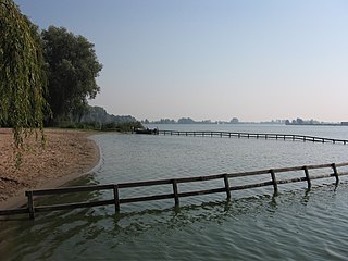
The Hoekse Waard is an island between the Oude Maas, Dordtsche Kil, Hollands Diep, Haringvliet and Spui rivers in the province of South Holland in the Netherlands. The island, part of the namesake municipality of Hoeksche Waard, is a mostly agricultural region, south of the outskirts of Rotterdam. The Hoeksche Waard consists of reclaimed land (polders): after the Saint Elisabeth flood of 1421 most of the area was flooded. The land has been reclaimed gradually in the following centuries.

Puttershoek is a village and former municipality in the western Netherlands. It is located on the banks of the Oude Maas, on the island Hoeksche Waard, in the province of South Holland. On 1 January 1984, the municipality of Puttershoek was merged with several others into Binnenmaas. With 6,293 inhabitants Puttershoek was the largest settlement in the municipality of Binnenmaas until 's-Gravendeel joined Binnenmaas in 2007. Since 1 January 2019, it is part of the new municipality Hoeksche Waard.

Nieuw-Beijerland is a village in the Dutch province of South Holland. It is a part of the municipality of Hoeksche Waard, and lies about 3 km south of Spijkenisse.
Schenkeldijk is a hamlet in the Dutch province of South Holland. It is a part of the municipality of Hoeksche Waard, and lies about 11 km south of Spijkenisse.

Heinenoord is a village in the Dutch province of South Holland on the island Hoekse Waard. It is located about 10 km south of Rotterdam, in the municipality of Hoeksche Waard.

Strijensas is a village in the Dutch province of South Holland. It is located about 12 km southwest of the city of Dordrecht, in the municipality of Hoeksche Waard.

Westmaas is a village in the Dutch province of South Holland. It is located about 14 km south of the city of Rotterdam, next to Mijnsheerenland in the municipality of Hoeksche Waard. In 2020, the population was 2065.
Greup is a hamlet on a dike in the Dutch province of South Holland. The village lies in the municipality of Hoeksche Waard.
De Wacht is a hamlet in the Dutch province of South Holland and is part of the municipality Hoeksche Waard. The village lies next to the Dordtse Kil.
Kuipersveer is a hamlet in the Dutch province of South Holland and is part of the municipality Hoeksche Waard. The village lies next to the Oude Maas between the villages of Puttershoek and Heinenoord.

Mookhoek is a village in the Dutch province of South Holland and is part of the municipality of Hoeksche Waard. Mookhoek lies 2.5 km from the town Strijen. Until 1984 Mookhoek belonged to the former municipality Maasdam. Mookhoek had 479 inhabitants on 1 January 2007.
De Klem is a hamlet in the Dutch province of South Holland and is part of the municipality of Hoeksche Waard. De Klem lies 3 km from the town of Strijen.
Oudendijk is a hamlet in the Dutch province of South Holland and is part of the municipality of Hoeksche Waard. Oudendijk lies 3 km south east from Westmaas.
Keizersdijk is a hamlet in the Dutch province of South Holland and is part of the municipality of Hoeksche Waard. It lies northwest of Strijen.
Reedijk is a hamlet in the Dutch province of South Holland and is part of the municipality Hoeksche Waard. Reedijk lies 1.5 km east of Oud-Beijerland.

Zwanegat is a hamlet in the Dutch province of South Holland and is part of the municipality Hoeksche Waard. Zwanegat lies between Westmaas and Sint Anthoniepolder.
Steenplaats is a hamlet in the Dutch province of South Holland and is part of the municipality of Hoeksche Waard. Steenplaats lies a few hundred metres southeast of Strijen.

Hoeksche Waard is a municipality in the western Netherlands, in the province of South Holland, consisting of the eponymous Hoeksche Waard and Tiengemeten islands.


