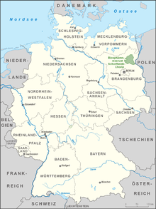
Brandenburg, officially the State of Brandenburg, is a state in northeastern Germany. Brandenburg borders Poland and the states of Berlin, Mecklenburg-Vorpommern, Lower Saxony, Saxony-Anhalt, and Saxony. It is the fifth-largest German state by area and the tenth-most populous, with 2.5 million residents. Potsdam is the state capital and largest city. Other major towns are Cottbus, Brandenburg an der Havel and Frankfurt (Oder).
Barnim is a district in Brandenburg, Germany. It is bounded by Poland, the district of Märkisch-Oderland, the city state of Berlin and the districts of Oberhavel and Uckermark.

The Thousand Islands – Frontenac Arch region or the Frontenac Axis is an exposed strip of Precambrian rock in Canada and the United States that links the Canadian Shield from Algonquin Park with the Adirondack Mountain region in New York, an extension of the Laurentian mountains of Québec. The Algonquin to Adirondacks region, which includes the Frontenac Axis or Arch, is a critical linkage for biodiversity and resilience, and one with important conservation potential. The axis separates the St. Lawrence Lowlands and the Great Lakes Lowlands. It has many distinctive plant and animal species. It is one of four ecoregions of the Mixedwood Plains.

Eberswalde is a major town and the administrative seat of the district Barnim in Brandenburg in north-eastern Germany, about 50 km (31 mi) northeast of Berlin. Population 42,144, geographical location 52°50′N13°50′E. The town is often called Waldstadt, because of the large forests around it, including the Schorfheide-Chorin Biosphere Reserve. Despite this fact, Eberswalde was an important industrial center until the German Reunification.

The Spree Forest or Spreewald is a large inland delta of the river Spree, and a historical cultural landscape located in the region of (Lower) Lusatia, in the state of Brandenburg, Germany, about 100 km southeast of Berlin and close to the city of Cottbus. The Spree Forest is located within the settlement area of the (Lower) Sorbs, and the region is officially bilingual, German and Lower Sorbian.

Templin is a small town in the Uckermark district of Brandenburg, Germany. Though it has a population of only 17,127 (2006), in terms of area it is, with 377.01 km2, the second largest town in Brandenburg and the seventh largest town in Germany. The town is located in the south of the rural Uckermark region and its capital Prenzlau, north of the Schorfheide-Chorin Biosphere Reserve. The municipality comprises the villages of Ahrensdorf, Bebersee, Beutel, Densow, Gandenitz, Gollin, Gross Dölln, Gross Väter, Grunewald, Hammelspring, Herzfelde, Hindenburg, Klosterwalde, Petznick, Röddelin, Storkow and Vietmannsdorf.

Bundesautobahn 11 is an autobahn in eastern Germany that was opened in 1936. As it is partly in a dilapidated state, it is currently undergoing modernisation works on various stretches. The road forms the main connection between Berlin and Szczecin, and it is connected to the Polish motorway A6 at Mecklenburg-Vorpommern.

Zehdenick is a town in the Oberhavel district, in Brandenburg, Germany. It is situated on the river Havel, 26 kilometres southeast of Fürstenberg/Havel, and 51 kilometres north of Berlin (centre). Since 31 July 2013, the city has the additional appellation "Havelstadt".

is a small town in the district of Barnim, in Brandenburg, Germany. It is situated within the Schorfheide-Chorin Biosphere Reserve on the isthmus between the lakes Grimnitzsee in the north and Werbellinsee in the south, about 17 km (11 mi) northwest of the district's capital Eberswalde and 55 km (34 mi) northeast of the Berlin city centre. The municipality is the administrative seat of the Amt Amt Joachimsthal.

Schorfheide is a municipality in the Barnim district of Brandenburg, Germany. It was established in 2003 by the merger of Finowfurt and Groß Schönebeck.

Chorin is a municipality in the district of Barnim in Brandenburg, Germany. It is most famous for its cloister and for being situated within the Schorfheide-Chorin Biosphere Reserve. It is famous for its medieval Brick Gothic Chorin Abbey and the Choriner Musiksommer music festival held there.

Flieth-Stegelitz is a municipality in the Uckermark district, in Brandenburg, Germany. It is part of the Amt Gerswalde. The municipality arose on 31 December 2001 by merging the former autonomous municipalities of Flieth and Stegelitz.
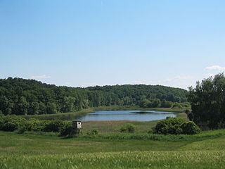
Uckermark Lakes Nature Park is a nature park and reserve in the state of Brandenburg, Germany. It covers an area of 895 km2. It was established on May 3, 1997, and is located on the northern edge of Brandenburg state. The nature park is bordered to the north by the Feldberg Lake District Nature Park, to the west by the Stechlin-Ruppiner Land Nature Park and to the southeast by the Schorfheide-Chorin Biosphere Reserve. The landscape was marked by the last ice age 15.000 years ago: pushed moraine with numerous lakes and ponds, extensive woodlands, mires, dry meadows and heaths. Many left behind blocks of stone, called erratics, are evidence of the glaciers from Scandinavia.

Lake Werbellin is a lake in the Barnim district of Brandenburg, Germany. It is located south of Joachimsthal in the Schorfheide-Chorin Biosphere Reserve. The southern shore belongs to the Schorfheide municipality. With a surface area of 7.82 square kilometers (3.02 sq mi) it is the fourth largest lake in Brandenburg and with 51 meters (167 ft) the second deepest.
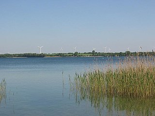
Parsteiner See is a lake in the Schorfheide-Chorin Biosphere Reserve in Brandenburg, Germany. At an elevation of 44 m, its surface area is 10.03 km2. It is located in the municipality of Parsteinsee, Barnim district.
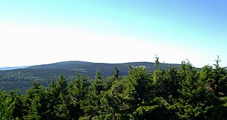
Thuringian Forest Nature Park is one of two nature parks in the state of Thuringia, Germany.
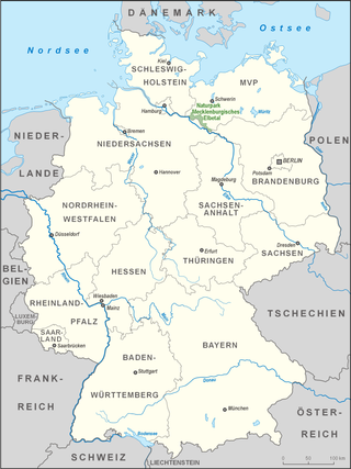
The Mecklenburg Elbe Valley Nature Park is part of the UNESCO biosphere reserve of Elbe River Landscape. At over 400 river kilometres long, the Elbe River Landscape Biosphere Reserve runs through the five German states of: Saxony-Anhalt, Brandenburg, Lower Saxony, Mecklenburg-Vorpommern and Schleswig-Holstein. It lies in the district of Ludwigslust-Parchim in Mecklenburg-Vorpommern. The nature park was created in 1990 and legally established by act of state in 1998. It has an area of 426 km2 (164 sq mi).

The Southeast Rügen Biosphere Reserve is a biosphere reserve in the German state of Mecklenburg-Vorpommern, which covers the southeastern part of the island of Rügen, the lagoon of Rügischer Bodden between Putbus and Thiessow, the outer coast between Thiessow and Binz and the island of Vilm.
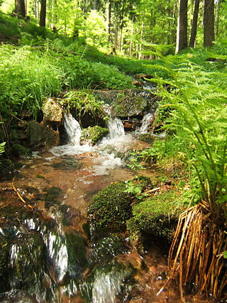
The Vessertal-Thüringen Forest forms a central part of the much larger Thuringian Forest.

The Parforceheide between the south of Berlin and the east of Potsdam is one of the last large contiguous forest areas in the Berlin-Brandenburg metropolitan region. Although located in Brandenburg, part of the forest is owned by the state of Berlin. The basis for this was created by the permanent forest contract or century contract of 1915. An area covering around 2350 hectares has been designated as the Parforceheide landscape conservation area since 1997. One of the aims of the conservation order is to preserve "the area's function as a climatic compensation area in the south of the Berlin conurbation". The name goes back to the par force hunts for which King Frederick William I of Prussia had the Stern hunting lodge built in the forest in 1730.
