The Scottsville and LeRoy Railroad was a horse-drawn short-line railroad running from Scottsville to Caledonia, in New York State, in the United States of America. It was chartered in 1836 and ran until 1840, when changes in the canal system reduced demand. The eight-mile long line used wooden rails, which were a continual source of derailments.
Scottsville is a village in southwestern Monroe County, New York, United States, and is in the northeastern part of the Town of Wheatland. The population was 1,980 at the 2010 census. The village is named after an early settler, Isaac Scott. Most Scottsvillians work in and around the city of Rochester, New York—the village of Scottsville is located about a ten-minute drive from the outer limits of the city.
Caledonia is a town in Livingston County, New York, United States. The population was 4,255 at the 2010 census.
The Scottsville and Leroy Railroad proved, as many short-lines do, short in life as well as in length. In one historian's words:
Horse cars were used upon this road for two seasons, principally to bring flour and plaster from the mills upon its line to Scottsville for shipment. Forty thousand dollars was expended and lost in this venture. This road was exclusively a Wheatland undertaking; its corporators and stockholders were residents of this town. In its inception the building of this road was no visionary scheme. It was intended by its projectors to push on to Batavia and the west, and to connect at Canandaigua with the road then in process of construction from Auburn to that village. Those engaged in this project were men of enterprise and broad views, and were eminently worthy of if they did not achieve success.[1]
A horsecar, horse-drawn tram, or (U.S.) horse-drawn streetcar, is an animal-powered tram or streetcar.
Flour is a powder made by grinding raw grains, roots, beans, nuts, or seeds. It is used to make many different foods. Cereal flour is the main ingredient of bread, which is a staple food for most cultures. Wheat flour is one of the most important ingredients in Oceanic, European, South American, North American, Middle Eastern, North Indian and North African cultures, and is the defining ingredient in their styles of breads and pastries.
Plaster is a building material used for the protective or decorative coating of walls and ceilings and for moulding and casting decorative elements. In English "plaster" usually means a material used for the interiors of buildings, while "render" commonly refers to external applications. Another imprecise term used for the material is stucco, which is also often used for plasterwork that is worked in some way to produce relief decoration, rather than flat surfaces.
The following text (uncorrected and with several notes) comes from History of the Town of Wheatland, by Carl F Schmidt, 1953.
The transportation fever struck the inhabitants of the Town of Wheatland, as it did nearly every community. The farmers were raising large crops, and more and more land was being cultivated. They wanted better means to get their products to the growing eastern markets. Hauling their products to the river warehouses or to Rochester by ox teams had taxed them almost to the limit of their endurance. A letter written by Donald McKenzie of Caledonia to the "Genesee Farmer" in 1832, suggested a railroad from LeRoy, through Caledonia, Mumford, and Scottsville to Rochester.
Rochester is a city on the southern shore of Lake Ontario in western New York and the seat of Monroe County. With a population of 208,046, Rochester is the third most populous city in New York state, after New York City and Buffalo. The metropolitan area has a population of just over one million people. It is about 73 miles (117 km) east of Buffalo and 87 miles (140 km) west of Syracuse.
Caledonia is a village in Livingston County, New York, USA. The population was 2,201 at the 2010 census. The name refers to Scotland.
The hamlet of Mumford lies on the west side of the Town of Wheatland, south of Oatka Creek on NY 36 and south of the terminus of NY 383.
"After a long and general acquaintance with the western part of this state, I am convinced that a railroad from LeRoy to Rochester, along the valley of Allen's Creek (Oatka) and the Genesee River, would be a public benefit, were it to serve no other purpose than to facilitate the forwarding of materials for the building of other railroads in the western district. The inexhaustible quarries of building stone of the first quality on the banks of Allen's Creek and adjacent region, the abundant supplies of gravel for horse paths, of water lime, of bog lime, plaster of paris, oak, pine, and cedar are found in various parts of Caledonia, LeRoy and Wheatland would then be easily conveyed to other sections of the State where other railroads were being built.
The consequences of which would be a great reduction in the price of these necessary materials for constructing railroads. It is worthy of remark that there are strong indications of coal and other minerals in this region, and that the oak timber is of superior quality. There are also an abundance of water privileges, where plaster, water, lime, etc., can be prepared.
D. McKENZIE."
This period in local history saw the Tonawanda Railroad built from Rochester to Batavia. Talk of routing it through Scottsville, Caledonia, and Le Roy on its way to Batavia came to nothing when the decision fell in favour of a more direct route. The local dissatisfaction with this outcome increased the support accorded the Scottsville and LeRoy Railroad proposal.
The Tonawanda Railroad was a railroad company established in Rochester, New York in 1832. It was eventually absorbed by the New York Central.
On December 3, 1835, an agreement was signed in which a number of people agreed to pay Powell Carpenter, Philip Garbutt, John McNaughton, and E. H. S. Mumford for the purpose of getting surveys and estimates for the route of a railroad along Oatka Creek from Scottsville to Mumford. The committee must have worked very quickly, because the next meeting by the people of Wheatland interested in such a railroad, was held in the home of Mr. Boughton December 24. Powell Carpenter was chairman and J. P. Sill was secretary of the meeting.
Oatka Creek is the third longest tributary of the Genesee River, located entirely in the Western New York region of the U.S. state of New York. From southern Wyoming County, it flows 58 miles (93 km) to the Genesee near Scottsville, draining an area of 215 square miles (560 km2) that includes all or part of 23 towns and villages in Wyoming, Genesee, Livingston and Monroe counties as well. Its name means "leaving the highlands" or "approaching an opening" in Seneca.
Mr. Alvin Savage, who made the survey of the contemplated route, reported that the building of the railroad was practicable. A new committee was elected, consisting of Powell Carpenter, Abraham Hanford, William Garbutt, E. H. S. Mumford, Philip Garbutt, and Clark Hall.
Shareholders of the Scottsville and LeRoy Railroad (click to enlarge)
Another meeting was held January 9, 1836, at the house of George Ensign in Scottsville. A motion was passed "that the memorial in circulation to be presented to our Legislature for an Act on Incorporation in behalf of the contemplated Scottsville and LeRoy Railroad Company be so altered that Caledonia village be inserted and mentioned as one of the places by which said railroad shall pass."
A contract was made with William Wallace on March 5, 1836, to act as engineer and to begin work as soon as the weather permitted. He was to receive $3.50 per day for his services.
Establishment of a corporation
A charter was obtained in May for the construction of a railroad from Scottsville to LeRoy. According to some sources (e.g., Early American Railroads, Franz Anton Ritter von Gerstner's "Die innern Communicationen," 1842-1843), the original intention had been to go as far as Batavia, a distance of twenty-six miles. Powell Carpenter, Abraham Hanford, Philip Garbutt, E. H. S. Mumford, Clark Hall, Ira Carpenter, Thomas Halsted, Nathaniel Clark, Donald McDonald and Thomas Brown were named as incorporators. The capital stock of the corporation was $200,000.00 which was divided into shares of fifty dollars each.
In April 1836, by Legislative enactment, a group of Wheatland men were authorized to form a company to construct a railroad from Scottsville to Canandaigua. It was proposed to connect this railroad at that point with the road, then in process of construction, from Auburn to Canandaigua. The section of the railroad from Canandaigua to Rochester had been completed as far as the Pittsford hills, and according to an old letter, "Rochester folks had partly given up the Geneva and Canandaigua Railroad because they could not get over the Pittsford hills. They dreaded the consequence of exploring the route by Mendon and the Honeoye valley for fear of its branching across the Genesee River to intersect the Caledonia and LeRoy Railroad to Batavia." Another letter written by Eliphalet Murdock dated January 29, 1837, said in part: "The ground for a railroad from Buffalo to Batavia is all bought in and building will commence next summer, and I learn that the road from Auburn to Geneva and Canandaigua and Rochester is to come down the valley of the Honeoye outlet and if so we shall only have to cross the Genesee River to open the communication from Buffalo to Albany if these improvements go into effect of which I think we have a fair prospect. The great thoroughfare of the state by railroad will pass through this place and if so here will be a chance for speculation."
A preliminary survey of the route was made by Wallace, but no further action toward any construction was even taken.
Completion
Financial difficulties, an ever-present risk in railroad-building, intervened, delaying completion of the Scottsville to Caledonia link until September 1838. The Scottsville and LeRoy Railroad was, most likely, completed as far as Mumford in 1837 and extended as far as Caledonia late in 1838. Steven's survey of the village of Scottsville indicates that the railroad started in front of E. T. Miller's warehouse and continued across the "millyard," in front of the mills, about one hundred and fifty feet south of Main Street. It then gently curved and ran southwest through Scott Crescent; crossed Caledonia Avenue and followed the embankment near the south line of the Catholic cemetery. It continued through farms and fields until it reached the highway just east of the McVean house. The railroad continued on the highway to the store of Philip Garbutt, where it passed in a depression under the platform in front of the store. The railroad tracks were on about the level of the basement floor, thus permitting the loading and unloading directly into the basement store room. The railroad curved southward across the fields, on an embankment, and rounded a hill almost parallel with the tracks of the Baltimore and Ohio Railroad. At Wheatland Center it met the highway and then ran on the south side and parallel to the highway to Mumford. At a point about due north of Smith Street it turned sharply south, crossed the creek on a bridge, and continued south in a straight line through Smith Street. It then followed the east bank of Spring Creek, passed Donald McKenzie's saw mill, to the grounds of the old Caledonia school.
Construction
Ties were laid with grooves cut into the top surfaces, to hold the oak timbers or stringers to keep them from spreading. On the stringers were spiked the narrow strips of oak, about one inch by three inches, which served for the tracks. No iron was used except at the highway crossings. It was the rails that eventually caused the most trouble and many accidents. The rails were never completely covered with iron and wore out rapidly, causing many derailments. Since the wood rails could not be securely spiked down, heavy loads forced the ends to spring up with such force as to penetrate the floors of the cars.[2]
Agreements were made with George Sheffer, Clark Hall, and William McKenzie, son of Donald McKenzie, to furnish the four by six green white oak timbers. (For estimate of the building of the railroad see Appendix No. 15.)
Ebenezer Beck was one of the principle contractors on the road. William Cook was one of the grading contractors, and Jefferson Edmunds was the contractor for building the bridge over Oatka Creek at Mumford.
The rail line from Scottsville to Caledonia ran approximately eight miles, with the tightest curve having a radius of 1,200 feet. Grades were mild, with the severest between Caledonia and Mumford at 36 feet per mile, or 1 in 147 (0.68%).
The roadbed for the line was fairly easy to build and had neither high embankments nor deep cuts through rock, an excellent fortuity, given the lack of blasting materials. The bed averaged twelve feet in width, with cross-ties set at what is by today's standards an extraordinary interval of four feet. The bridge across Oatka Creek was one hundred feet long and rested atop two masonry abutments and three piers.
By one accounting, the total cost, including land, labour, and rolling stock (eight freight cars), was around $4,000 a mile, for a total of eight miles and $32,000.
Horse cars were used on this railroad. The cars had no brakes and the wheels were made of pieces of planks bolted together. The axles were of iron similar to the axles used on wagons. Thomas Kane of Scottsville is said to have run the Scottsville and LeRoy Railroad, and he was the engineer, conductor, train-starter and brakeman.
The railroad had two passenger coaches, nearly square in shape, and painted a lead color. The passenger coaches were seldom used except by Clark Hall, of Halls Comers (now Wheatland Center) on Sundays, when he, his family, and friends would ride to Scottsville to attend church.
A story is told that during the William Henry Harrison campaign in 1840 the passenger coaches were used to carry a group of men from Caledonia, Mumford, and Wheatland Center to attend a Whig rally in Scottsville. Through some tinkering with the switch and rails, the cars and their occupants were thrown into the millrace, when the cars passed over the bridge of the raceway. Their Democratic friends were accused of this misdeed.
The people of LeRoy had several meetings to consider building the railroad from the town line to their village. A survey was made, but the people refused to act. Mr. Tomlinson tried to interest the people in extending the railroad from Caledonia to Tomlinson's Mills, south of LeRoy and thence to Batavia, but that also failed to materialize.
Operation
The railroad was a success for several years. It carried flour from the mills at Caledonia, Mumford, Wheatland Center, and Garbutt to Scottsville. Here the cargo was transferred to the boats in Oatka Creek, behind the mills. The boats then passed through the creek to the Scottsville-Genesee River Canal and then into the river.
James R. Clark of Caledonia was an enthusiastic supporter of the rail road. So confident was he that it would be continued to LeRoy that he named his tavern (now the home of Mrs. F. F. Keith) the Railroad House. A year after the railroad's completion, Clark approached William Garbutt, who was president at the time, with a proposition to take over the railroad. Garbutt laid the petition before the board at its next meeting in Mumford, and Clark was given a lease of the road and rolling stock for a term of years.
The building of the railroad, from Scottsville to Caledonia, would not alone have solved their transportation problem. The other half of the problem was to be able to load the boats at Scottsville and to navigate them to the river, and thence to Rochester and the Erie Canal.
The success of the Scottsville-LeRoy Railroad was of short duration. As long as it operated in conjunction with the Scottsville-Genesee River Canal it was a success; the railroad cars could then be unloaded in the "millyard," and the products transferred to the canal boats in the creek back of the mills. But with the completion of the Genesee Valley Canal in 1840, that section of Oatka Creek between the feeder gates and the flour mills, which was a part of the old Scottsville-Genesee River Canal, became obsolete and could no longer be used by canal boats. It became necessary to build new warehouses along the bank of the Genesee Valley Canal and on "the island." The island was that triangular shaped piece of land enclosed by the Genesee Valley Canal, the feeder, and Oatka Creek. The Scottsville-LeRoy Railroad could not be extended to the new warehouses on "the island" because the grade from Rochester Street down to the warehouses was too steep. The cost of trucking the goods from the end of the railroad line in the "millyard" to the boats or warehouses on the canal was too costly.
A letter written by James R. Clark states that it was expensive to purchase horses, equipment, and harness. After loading eighty barrels of flour on four freight cars, the load caused the sharp flanges on the wheels to cut the wooden rails and the cars would be derailed. It would then require half a day to get the cars back on the tracks. The various difficulties forced the Scottsville-LeRoy Railroad to cease operation soon after 1840.
AN ACT to provide for the construction of 3 railroad from Scottsville to LeRoy.
Passed May 21, 1836
Sec. 1. All persons who shall become stockholders pursuant to this act, shall be and they are hereby constituted a body politic and corporate for the term of fifty years by the name of "The Scottsville & LeRoy Rail-Road Company." for the purpose of constructing and maintaining a rail-road between the village of Scottsville in the County of Monroe and the town of LeRoy in the county of Genesee, commencing in or near the village of Scottsville, and running thence through Mumford and Caledonia to such point in the town of LeRoy, and on such roads as a majority of the directors of said company shall determine to be best adapted to the public accommodations, and may take, transport, carry and convey property and persons upon the same, by the power and force of steam, or animals, or any mechanical power, or of any combination of them.
Sec. 2. If the said corporation shall not, within two years from the passage of this act, commence the construction of the said road, and expend at least the sum of five thousand dollars thereon, and shall not, within four year from the passage of this act, finish the said road, and put the same in operation, then the said corporation shall henceforth forever cease, and this act shall be null and void.
Sec. 3. The capital stock of said corporation shall be two hundred thousand dollars, which shall be divided into shares of fifty dollars each, which shares shall be deemed personal property, and be transferred in such manner as the said corporation shall in its by-laws direct; and Powell Carpenter, Abraham Hanford, Philip Garbutt, Elihu H. S. Mumford, Clark Hall, Ira Carpenter, Thomas Halsted, Nathaniel Clark, Donald McDonald, and Thomas Brown, shall be commissioners or receive subscriptions and distribute the stock.
Sec. 4. The corporation hereby created, shall possess and enjoy all the privileges and provisions which are granted to, and made in favor of, the corporation created by the act "AN ACT to provide for the construction of a railroad from Attica to Buffalo." passed May 3, 1836, and shall be subject to all the conditions and restrictions which by the act aforesaid, are imposed upon the corporation therein referred to, except as herein provided.
Sec. 5. Any application to be made to a vice-chancellor under this act, shall be made to the vice-chancellor of the circuit in which the land proposed to be taken, shall be situated: All notices and meetings required in the act above referred to, shall be published and held in one of the counties through which the said rail-road hereby authorized, is to be made.
Sec. 6. The said corporation may receive a sum not exceeding five cents per mile for the transportation of any passenger and his ordinary baggage.
The commissioners to make estimates were Powell Carpenter, Philip Garbutt, William Garbutt, John McNaughion, and E. H. S. Mumford.
task/materials
cost
ties - 8,366 pieces
$1,300.00
rails - 133,848ft (40,797m)
1,400.00
laying timber - 6.34mi (10.20km)
1,300.00
bridge at Mumford
850.00
grading from Hanford's to Scottsville
1,044.00
two bridges across canal
100.00
grading from Hanford's to H. C. McVean's
200.00
grading and passways
200.00
grading Reed's ridge
240.00
timber and planking bridge at P. Garbutt's store
40.00
McKenzie and Laidlaw's job at grading
1,600.00
grading at McNaughton's
800.00
grading at McArthur's
400.00
grading at Blakeslee & Wells
1,450.00
grading John A. McVean's hill
654.00
grading from sawmill to plaster mill in Mumford
500.00
mason work and culverts west of Reed's
300.00
balance of engineering
500.00
amount paid by Philip Garbutt
4,132.00
subtotal
$19,870.00
monies advanced on contracts included in this estimate
1,363.00
one and one-quarter timber laid
453.00
digging plaster
230.00
subtotal
2,046.00
net total
$17,814.00
making 6.3 miles of road at $2,815.00 per mile
$17,818.33
Related Research Articles
Wheatland is a town in Monroe County, New York, United States. The population was 4,775 at the 2010 census. The town is home to Genesee Country Village and Museum.
Te Auburn and Rochester Railroad was a railroad company based in New York state in the 19th century.
The Genesee Valley Canal Railroad was a part of the Pennsylvania Railroad system in western New York. It was built on the former Genesee Valley Canal alignment.
New York State Route 36 (NY 36) is a north–south state highway in the western part of New York in the United States. The highway extends for 95 miles (153 km) from the Pennsylvania state line at Troupsburg, Steuben County northward to Ogden, Monroe County, where it ends at an intersection with NY 31. Along the way, NY 36 passes through the villages of Canisteo, Dansville, Mount Morris, Caledonia, and Churchville and the city of Hornell. The section of the route between Dansville and Mount Morris closely parallels Interstate 390 (I-390); however, from Dansville south and Mount Morris north, NY 36 serves as a regionally important highway, connecting to I-86, U.S. Route 20A (US 20A), US 20, and I-490 as it heads north. At its south end, NY 36 connects to Pennsylvania Route 249 (PA 249).
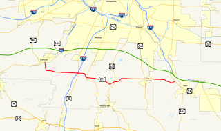
New York State Route 251 (NY 251) is an east–west state highway in western New York in the United States. It extends for 17.79 miles (28.63 km) from NY 383 in Scottsville, Monroe County, to NY 96 in the town of Victor, Ontario County. NY 251 connects to Interstate 390 (I-390) in Rush and serves the village of Honeoye Falls and the hamlet of Mendon within the town of the same name. The route, a two-lane, rural highway for much of its length, also intersects NY 15 and NY 64, two north–south highways leading to the Southern Tier and the Finger Lakes, respectively. Two sections of the route—from south of Scottsville to Rush and from Mendon to western Victor—follow linear east–west alignments. All but 3 miles (5 km) of the route are located in Monroe County.
New York State Route 33A (NY 33A) is an east–west state highway mostly located in Monroe County, New York, in the United States. The route is just over 17 miles (27 km) long and serves as an alternate route of NY 33 between the town of Bergen in Genesee County and the city of Rochester in Monroe County. While NY 33 heads to Rochester by way of Churchville and northern Gates, NY 33A dips south to pass through Chili and southern Gates. NY 33A was assigned as part of the 1930 renumbering of state highways in New York, but only from Riga to Rochester. It was extended westward to its current terminus in Bergen c. 1932.
New York State Route 383 (NY 383) is an 18.70-mile (30.09 km) north–south state highway in Monroe County, New York, in the United States. The southern terminus of the route is at an intersection with NY 36 in the hamlet of Mumford within the town of Wheatland. Its northern terminus is at a junction with NY 31 in the city of Rochester. The route follows the Genesee River and its tributaries for its entire length and passes through the village of Scottsville.
Garbutt, New York is a hamlet located between the village of Scottsville and the hamlet of Mumford. It sits at the intersection of Scottsville-Mumford Road and Union Street in the Town of Wheatland in Monroe County. Garbutt grew rapidly through the mid-nineteenth century, but starting in the late nineteenth and early twentieth centuries the collapse of the local economy caused the population to severely decline.
The Rochester and Genesee Valley Railroad Museum (RGVRRM) is an operating railroad museum located in Industry, New York. The museum started in 1971 with the purchase of a former Erie Railroad Depot from the Erie Lackawanna Railroad. Since then the museum has grown to include a one-mile demonstration railroad, connecting it with the New York Transportation Museum in Rush, making it one of the only operating railroad museums in New York State. The museum was formerly an operation of the Rochester Chapter National Railway Historical Society until 2011. The organization rosters more than 40 pieces of historic railroad equipment, including diesel and steam locomotives, electric trolley and multiple-unit cars, freight cars, cabooses, passenger cars, and work equipment. The museum campus includes a number of preserved railroad structures, including the 1909 Industry Depot built by the Erie Railroad, a waiting shelter from the Rochester, Lockport & Buffalo Railroad, and a crossing watchman's shanty from the New York Central. Train rides are operated and the museum is open to the public on select weekends from June through October, and is staffed entirely by volunteers.
The Western New York and Pennsylvania Railway was a railroad in the U.S. states of New York and Pennsylvania. Incorporated in 1887 as the Western New York and Pennsylvania Railroad from the reorganization of the Buffalo, New York, and Philadelphia, and reorganized in 1895 as the Western New York and Pennsylvania Railway, it was acquired and leased by the Pennsylvania Railroad in 1900 and merged into the Penndel Company in 1955.
The Scottsville Free Library, located at 28 Main Street in the village of Scottsville, New York, with a small branch at 883 George Street in Mumford, serves the people of the towns of Wheatland and Chili, as well as adjacent areas in Monroe County.
Oatka Creek Park, part of the Monroe County park system, lies near the center of the Town of Wheatland in New York. The park is bounded on the east by Union Street, the north by the tracks of the Rochester & Southern Railroad, and the west and south by Stewart Road. Immediately northeast of the park is the hamlet of Garbutt.
Wheatland Center is the rural area in the Town of Wheatland surrounding the intersection of Wheatland Center and Scottsville-Mumford Roads. Once known as Hall's Corners, it today shows little evidence of its past.
The Rochester and State Line Railroad was a 19th-century railroad company in New York state.
The Buffalo, Rochester and Pittsburgh Railway was one of the more than ten thousand railroad companies founded in North America. It lasted much longer than most, serving communities from the shore of Lake Ontario to the center of western Pennsylvania.
New York State Route 35 (NY 35) was a state highway in the Finger Lakes region of New York, in the United States. The western terminus of the route was at an intersection with NY 36 in the hamlet of Mumford within the town of Wheatland. Its eastern terminus was at a junction with U.S. Route 104 (US 104) in the hamlet of Ontario Center within the town of Ontario. NY 35 followed a mostly northeast–southwest routing across the counties of Monroe and Wayne and passed through downtown Rochester.
References
↑ Slocum, George Engs (1908). Wheatland, New York. p.40.
↑ Schmidt, Carl F. (1953). History of the Town of Wheatland. p.267.
↑ Schmidt, Carl F. (1953). History of the Town of Wheatland. p.269.
This page is based on this Wikipedia article Text is available under the CC BY-SA 4.0 license; additional terms may apply. Images, videos and audio are available under their respective licenses.