Seebenstein

Last updated
Seebenstein
Seebenstein - Kirche.JPG
AUT Seebenstein COA.png
Austria adm location map.svg
Red pog.svg
Seebenstein
Location within Austria
Coordinates: 47°42′N16°9′E / 47.700°N 16.150°E / 47.700; 16.150 Coordinates: 47°42′N16°9′E / 47.700°N 16.150°E / 47.700; 16.150
Country Austria
State Lower Austria
District Neunkirchen
Government
   Mayor Marion Wedl
Area
[1]
  Total9.09 km2 (3.51 sq mi)
Elevation
348 m (1,142 ft)
Population
 (2018-01-01) [2]
  Total1,401
  Density150/km2 (400/sq mi)
Time zone UTC+1 (CET)
  Summer (DST) UTC+2 (CEST)
Postal code
2824
Area code 02627
Website www.seebenstein.at

Seebenstein is a town in the district of Neunkirchen in the Austrian state of Lower Austria. It is often called the "Pearl of the Pitten valley" ("Perle des Pittentals") due to its preserved nature.

Contents

Geography

Seebenstein is in the industrial quarter of Lower Austria. The town covers 9.09 square kilometers and is 62.71 percent forested. The town includes the Seebenstein nature park and it borders the historic ruin of the Türkensturz. The town is overlooked by the medieval castle Burg Seebenstein.

History

In ancient times, Seebenstein was part of the Celtic kingdom of Noricum.

On April 16, 1972, Seebenstein was the center of a magnitude 5.3 earthquake [3]

Historical population

Historical population
YearPop.±%
1869587    
1880700+19.3%
1890768+9.7%
1900872+13.5%
1910979+12.3%
19231,049+7.2%
1934952−9.2%
1939967+1.6%
19511,075+11.2%
19611,033−3.9%
19711,088+5.3%
19811,040−4.4%
19911,139+9.5%
20011,196+5.0%
20111,326+10.9%
20211,470+10.9%
Building from carpark Seebenstein-Herminenhaus-(030411).jpg
Building from carpark

Demographics

In the 2001 census the population was described as 84.4% Roman Catholic, 3.8% evangelical, 0.5% Muslim, 0.3% Orthodox Christian, and 9.4% with no religion. Additional to the current population of 1470, around 500 people have a summer house in Seebenstein.

Related Research Articles

<span class="mw-page-title-main">Aggsbach</span> Place in Lower Austria, Austria

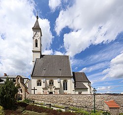
Aggsbach is a small wine-growing town in the Krems-Land district of Lower Austria, Austria. As of 2001, it has a population of 714 and an area of 13.72 km.² Aggsbach was first mentioned in an 1148 document calling it "Accusabah".

<span class="mw-page-title-main">Nenzing</span> Place in Vorarlberg, Austria

Nenzing is a market town in the district of Bludenz in the Austrian state of Vorarlberg with a population of 6.225 (2022).

<span class="mw-page-title-main">Ebenthal in Kärnten</span> Place in Carinthia, Austria

Ebenthal in Kärnten is a town in the district of Klagenfurt-Land in the Austrian state of Carinthia.

Ardagger is a town in the district of Amstetten in Lower Austria in Austria.

<span class="mw-page-title-main">Bad Deutsch-Altenburg</span> Place in Lower Austria, Austria

Bad Deutsch-Altenburg, until 1928 Deutsch-Altenburg is a market town and spa in the district of Bruck an der Leitha in Lower Austria in Austria.

<span class="mw-page-title-main">Trautmannsdorf an der Leitha</span> Place in Lower Austria, Austria

Trautmannsdorf an der Leitha is a town in the district of Bruck an der Leitha in Lower Austria in Austria.

<span class="mw-page-title-main">Prellenkirchen</span> Place in Lower Austria, Austria

Prellenkirchen is a town in the district of Bruck an der Leitha in Lower Austria in Austria.

<span class="mw-page-title-main">Großhofen</span> Place in Lower Austria, Austria

Großhofen is a town in the district of Gänserndorf in the Austrian state of Lower Austria.

Hohenau an der March is a town in the district of Gänserndorf in the Austrian state of Lower Austria, close to Vienna and the borders with the Czech Republic and Slovakia.

<span class="mw-page-title-main">Raasdorf</span> Place in Lower Austria, Austria

Raasdorf is a town in the district of Gänserndorf in the Austrian state of Lower Austria.

<span class="mw-page-title-main">Senftenberg, Austria</span> Place in Lower Austria, Austria

Senftenberg is a town in the district of Krems-Land in the Austrian state of Lower Austria.

<span class="mw-page-title-main">Bernhardsthal</span> Place in Lower Austria, Austria

Bernhardsthal is a town in the district of Mistelbach in the Austrian state of Lower Austria.

<span class="mw-page-title-main">Kreuttal</span> Place in Lower Austria, Austria

Kreuttal is a town in the district of Mistelbach in the Austrian state of Lower Austria.

<span class="mw-page-title-main">Achau</span> Place in Lower Austria, Austria

Achau is a town in the district of Mödling in the Austrian state of Lower Austria.

<span class="mw-page-title-main">Gießhübl</span> Place in Lower Austria, Austria

Gießhübl is a town in the district of Mödling in the Austrian state of Lower Austria. It is located in the south of Vienna, the Austrian capital, neighboring the nature protection area Föhrenberge. With an altitude of 416 m, Gießhübl is the highest-located wine-growing district in Lower Austria. Originally Gießhübl was an agrarian village. Today it is mainly a residential area because of its vicinity to Vienna and the direct connection to the highway A21.

<span class="mw-page-title-main">Kaltenleutgeben</span> Place in Lower Austria, Austria

Kaltenleutgeben is a town with a population of 3302 in the district of Mödling in the Austrian state of Lower Austria.

<span class="mw-page-title-main">Neunkirchen, Austria</span> Place in Lower Austria, Austria

Neunkirchen is the capital of the district of Neunkirchen in the Austrian state of Lower Austria. As of 2020 it has a population of 12,721.

<span class="mw-page-title-main">Scheiblingkirchen-Thernberg</span> Place in Lower Austria, Austria

Scheiblingkirchen-Thernberg is a town in the district of Neunkirchen in the Austrian state of Lower Austria.

<span class="mw-page-title-main">Loich</span> Place in Lower Austria, Austria

Loich is a town in the district of Sankt Pölten-Land in the Austrian state of Lower Austria.

<span class="mw-page-title-main">Statzendorf</span> Place in Lower Austria, Austria

Statzendorf is a municipality in the district of Sankt Pölten-Land in Lower Austria, Austria. It consists of the following towns:

References

  1. "Dauersiedlungsraum der Gemeinden Politischen Bezirke und Bundesländer - Gebietsstand 1.1.2018". Statistics Austria. Retrieved 10 March 2019.
  2. "Einwohnerzahl 1.1.2018 nach Gemeinden mit Status, Gebietsstand 1.1.2018". Statistics Austria. Retrieved 9 March 2019.
  3. "Stärkste Erdbeben — ZAMG". www.zamg.ac.at. Retrieved 2021-01-24.