Ternitz | |
|---|---|
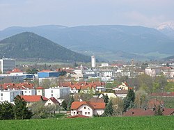 View of Ternitz | |
 Coat of arms | |
 Ternitz Location within Austria | |
| Coordinates: 47°43′N16°2′E / 47.717°N 16.033°E | |
| Country | Austria |
| State | Lower Austria |
| District | Neunkirchen |
| Government | |
| • Mayor | Rupert Dworak |
| Area | |
• Total | 65.35 km2 (25.23 sq mi) |
| Elevation | 396 m (1,299 ft) |
| Population (2018-01-01) [2] | |
• Total | 14,632 |
| • Density | 223.9/km2 (579.9/sq mi) |
| Time zone | UTC+1 (CET) |
| • Summer (DST) | UTC+2 (CEST) |
| Postal code | 2630, 2631 |
| Area code | 02630 |
| Website | http://www.ternitz.at/ |
Ternitz is a town and municipality (14,823 inhabitants end 2014) in the district of Neunkirchen in the Austrian state of Lower Austria, situated at the confluence of the Sierning stream and the River Schwarza, at the western end of the Steinfeld plain. It is divided in the following parts, called Katastralgemeinden: Dunkelstein, Flatz, Holzweg, Mahrersdorf, Pottschach, Putzmannsdorf, Raglitz, Rohrbach am Steinfelde, St. Johann am Steinfelde and Sieding.
