Seevur

Last updated
Seevur
suburb
India Tamil Nadu location map.svg
Red pog.svg
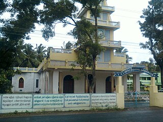
Seevur
Location in Tamil Nadu, India
Coordinates: 12°57′49″N78°51′18″E / 12.96361°N 78.85500°E / 12.96361; 78.85500 Coordinates: 12°57′49″N78°51′18″E / 12.96361°N 78.85500°E / 12.96361; 78.85500
CountryFlag of India.svg  India
State Tamil Nadu
District Vellore
Government
  mayor p.karthikeyan
Population (2001)
  Total 8,645
Languages
  Official Tamil
Time zone IST (UTC+5:30)

Seevur is a suburb of vellore city in the Indian state of Tamil Nadu.

India Country in South Asia

India, also known as the Republic of India, is a country in South Asia. It is the seventh largest country by area and with more than 1.3 billion people, it is the second most populous country and the most populous democracy in the world. Bounded by the Indian Ocean on the south, the Arabian Sea on the southwest, and the Bay of Bengal on the southeast, it shares land borders with Pakistan to the west; China, Nepal, and Bhutan to the northeast; and Bangladesh and Myanmar to the east. In the Indian Ocean, India is in the vicinity of Sri Lanka and the Maldives, while its Andaman and Nicobar Islands share a maritime border with Thailand and Indonesia.

Tamil Nadu State in Southern India

Tamil Nadu is one of the 29 states of India. Its capital and largest city is Chennai. Tamil Nadu lies in the southernmost part of the Indian subcontinent and is bordered by the union territory of Puducherry and the South Indian states of Kerala, Karnataka, and Andhra Pradesh. It is bounded by the Eastern Ghats on the north, by the Nilgiri Mountains, the Meghamalai Hills, and Kerala on the west, by the Bay of Bengal in the east, by the Gulf of Mannar and the Palk Strait on the southeast, and by the Indian Ocean on the south. The state shares a maritime border with the nation of Sri Lanka.

Demographics

As of 2001 India census, [1] Seevur had a population of 8645. Males constitute 50% of the population and females 50%. Seevur has an average literacy rate of 52%, lower than the national average of 59.5%: male literacy is 62%, and female literacy is 42%. In Seevur, 14% of the population is under 6 years of age.

Census Acquiring and recording information about the members of a given population

A census is the procedure of systematically acquiring and recording information about the members of a given population. The term is used mostly in connection with national population and housing censuses; other common censuses include agriculture, business, and traffic censuses. The United Nations defines the essential features of population and housing censuses as "individual enumeration, universality within a defined territory, simultaneity and defined periodicity", and recommends that population censuses be taken at least every 10 years. United Nations recommendations also cover census topics to be collected, official definitions, classifications and other useful information to co-ordinate international practice.

Related Research Articles

Puthunagaram village in Kerala, India

Puthunagaram is a village and gram panchayat in the Palakkad district, state of Kerala, India.

Bharveli town in Madhya Pradesh, India

Bharveli is a census town in Balaghat district in the state of Madhya Pradesh, India.

Dhamnod Town in Madhya Pradesh, India

Dhamnod is a town and a nagar parishad in Dhar district in the state of Madhya Pradesh, India.

Dhampur city in Uttar Pradesh, India

Dhampur is a city and a municipal board in Bijnor district in the state of Uttar Pradesh, India. It is located at 29.30°N 78.50°E, and lies in Northern India.

Ezhudesam city in Tamil Nadu, India

Ezhudesam is a town panchayat in Kanniyakumari district in the state of Tamil Nadu, India.

Kallukuttam town in Tamil Nadu, India

Kallukoottam is a panchayat town in Kanniyakumari district in the Indian state of Tamil Nadu.

Kappiyarai city in Tamil Nadu, India

Kappiyarai is a panchayat town in Kanniyakumari district in the Indian state of Tamil Nadu.

Kizh-Pennathur Town Panchayat in Tamil Nadu, India

Kilpennathur is a Panchayat Town in Tiruvanamalai district in the Indian state of Tamil Nadu. Kilpennathur is one of the taluks of Tiruvannamalai district and an assembly constituency of Tamil Nadu.The MLA of Kilpennathur assembly constituency is DMK party Mr. K. Pichandi.

Kothavalasa Census Town in Andhra Pradesh, India

Kothavalasa is a census town in Vizianagaram district of the Indian state of Andhra Pradesh. It is located in Kothavalasa mandal of Vizianagaram revenue division. It is located 30 km from City Visakhapatanam

Lohta city in Uttar Pradesh, India

Lohta is a census town in Varanasi district in the Indian state of Uttar Pradesh.

Nallur, Kanyakumari Town in Tamil Nadu, India

Nallur (Nalloor) is a panchayat town in Kanniyakumari district in the Indian state of Tamil Nadu.

Pappankurichi city in Tamil Nadu, India

Pappakurichi is a census town in Tiruchirappalli district in the Indian state of Tamil Nadu.

Paschim Punropara Census Town in West Bengal, India

Paschim Punropara is a census town in Suti II CD Block in Jangipur subdivision of Murshidabad district in the Indian state of West Bengal.

Peerkankaranai neighbourhood in Chennai, Tamil Nadu, India

Peerkankaranai is a town in Southern part of the metropolitan city of Chennai in the Indian state of Tamil Nadu.

Ramjibanpur Town in West Bengal, India

Ramjibanpur is a town and a municipality in Paschim Medinipur district in the Indian state of West Bengal.

Sriramapuram city in Tamil Nadu, India

Sriramapuram is a panchayat town in Dindigul district in the Indian state of Tamil Nadu.

Thevaram Town Panchayat in Tamil Nadu, India

Thevaram is a Town Panchayat in Theni district in the Indian state of Tamil Nadu. Thevaram is located in Tamil Nadu near on border of Kerala at the Eastern side foot-hill of Western Ghats. The State Highway SH-100 passes through this town.

Rambha, Odisha city in Odisha, India

Rambha is a town and a notified area council in Ganjam district in the Indian state of Odisha.

Khan Sahib, Jammu and Kashmir city in Jammu and Kashmir, India

Khan Sahib is a town and a notified area committee in Badgam district in the Indian state of Jammu and Kashmir.

Kerura City in Karnataka, India

Kerur is a City in Bagalkot district in Karnataka, which located on NH 218. It has an average elevation of 617 meters (2024 feet). Its a birthplace of Jagadish Shettar, a former Chief Minister of Karnataka. Kerur is a Town Panchayat city in district of Bagalkot, Karnataka. The Kerur city is divided into 16 wards for which elections are held every five years. The Kerur Town Panchayat has population of 19,731 of which 9,929 are males while 9,802 are females as per report released by Census India 2011.

References

  1. "Census of India 2001: Data from the 2001 Census, including cities, villages and towns (Provisional)". Census Commission of India. Archived from the original on 2004-06-16. Retrieved 2008-11-01.