Kancheepuram district is one of the 38 districts in the state of Tamil Nadu in India. The area comprising the present day Kancheepuram district was earlier a part of Chingleput district. The original Chingleput district was split in 1997 into form the present day Kancheepuram and Tiruvallur districts.

Porur is a neighbourhood of Chennai, India. It is situated in the Maduravoyal taluk of Chennai district in the southern part of the city. Since 2011, it has been a part of the Chennai Corporation and included in zone number 11.
Meenambakkam is a southern neighbourhood of Chennai in the Indian state of Tamil Nadu. It is home to Chennai International Airport, the Airports Authority of India regional office, and the DGQA Complex. It was under the reign of the Pallava kingdom. The name Meenambakkam signifies that it is a settlement near the coast. Pakkam means a settlement near to the coast. Meenambakkam was cherished with lakes, ponds and borderlines the Adyar river. This makes it a rich source of fishes. Hence the name Meenambakkam was coined.
Athipattu is a census town in Chennai in Thiruvallur district in the state of Tamil Nadu, India. The neighbourhood is served by Athipattu railway station of the Chennai Suburban Railway network. it is a suburb in northern part of Chennai.
Chinnasekkadu is a neighbourhood of Chennai in Chennai district in the state of Tamil Nadu, India. Chinnasekkadu used to be a town panchayat in Thiruvallur district. In 2011, Chinnasekkadu town panchayat was merged with Chennai Corporation. Chinnasekkadu comes under ward 29 in Zone 3(Madhavaram) of Chennai Corporation.

Gummidipoondi is an industrial town in Chennai Metropolitan Region of Thiruvallur district in the Indian state of Tamil Nadu. Notably, it is the northernmost assembly constituency and settlement in the state of Tamil Nadu.
Kaveripakkam is a town panchayat in Ranipet district in the Indian state of Tamil Nadu.
Neelangarai is a census town and is a locality in the south of Chennai. it is situated in Chennai district in the Indian state of Tamil Nadu about seven kilometers south of Adyar, Chennai. The former name of the city was Thiruneelakandapuram, named after the Thiruneelakandeshwarar temple. Neelankarai is located with Palavakkam in the north, Vettuvankeni in the south, Thoraipakkam in the west and the Bay of Bengal in the east. Over the years Neelankarai has developed tremendously and has made a significant name for itself in popularity for various reasons.
Palavakam is a locality in the south of Chennai and census town in Chennai district in the Indian state of Tamil Nadu. It is located on the East Coast Road about 6 km south of Adyar.
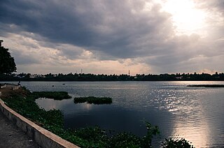
Puzhal is a Northwestern residential town in Chennai district in the Indian state of Tamil Nadu. Puzhal is located on the banks of Puzhal Lake. The town is known for Puzhal central prison.
Maraimalai Nagar is a satellite town of Chennai, Chengalpattu district, Tamil Nadu, India. It is a municipality town in Chengalpattu district. It lies in the southern part of the Chennai metropolitan area around 50 km from downtown Chennai Egmore and about 15 km from Vandalur. It is a satellite town developed by the CMDA in 1980. Many heavy industries are located in Maraimalai Nagar. The Ford India and BMW car factories are located within a mile from Maraimalai Nagar and the Indian software giant Infosys also has an office within eight kilometers of Maraimalai Nagar. SRM University has its main campus in the neighboring Potheri. As of 2011, Maraimalai Nagar had a population of 81,872.
Uthukottai is a town in Suburbs of Chennai, one of the taluk headquarters in Thiruvallur District Tamil Nadu, also one of the border towns of Tamilnadu - Andhra Pradesh, located on the banks of the Arani river. This town is the central hub for many nearby towns and villages for their needs of education, markets, shops, businesses, banks, travel, transport and entertainment(Movie Theatres, badminton courts, cricket grounds, Gyms). The town features a channel which helps to direct water from the Krishna river for local irrigation.
Arambakkam is a village in the Tiruvallur district of Tamil Nadu, India. It is located in the Gummidipoondi taluk.
Kattur also known as Kattoor is a suburb north of Chennai, a metropolitan city in Tamil Nadu, India.
Maaththoor formerly known as Mathur is a residential area located north of Chennai, a metropolitan city in Tamil Nadu, India. Maaththoor is administered by the Greater Chennai Corporation and belongs to Madhavaram taluk of Chennai district.

Kovilambakkam is a southern suburb of Chennai, India. It is located in Chengalpattu district in the state of Tamil Nadu, about 26 km from Chennai city center and 12 km from Tambaram. The neighbourhood spans the areas of Sunnambu Kolathur, Chinna Kovilambakkam and Periya Kovilambakkam.
Elavur is a village in the Tiruvallur district of Tamil Nadu, India. It is located in the Gummidipoondi taluk border between Tamil Nadu and Andhra pradesh. NH16 Chennai-Kolkata Highway. India's First modern Integrated Check post opened by Tamil Nadu chief minister and also located frontline medical village. ELR is and railway station code for Elavur.
Kadambathur, also spelt Kadambattur, is a town located in Tiruvallur district in the Indian state of Tamil Nadu. It is a census town in Tiruvallur taluk. According to the 2011 census, the town has a population of 11,235.
Pallavaram taluk is a taluk in Greater Chennai City formed from the bifurcation of Alandur taluk in 2015. It also included some areas from Sriperumbudur Taluk. Its headquarters are in the town of Pallavaram near Pallavaram–Thuraipakkam Radial Road. It comes under Chennai Metropolitan Development Authority (CMDA). It shares its boundaries with Alandur Taluk in Chennai District on the north, Kundrathur Taluk in Kanchipuram district on the west, Sholinganallur Taluk in Chennai District on the east.
Kolathur is a neighborhood located in the northwestern region of Chennai, India.

