Veppampattu is one of the fastest developing suburban areas in Chennai City. It is Western part of the suburbs of the Metropolitan city Chennai in the Indian state of Tamil Nadu between Chennai and Arakkonam on the Chennai - Arakkonam railway line. It is fast-growing with a number of schools and colleges. Electric trains and NH 205 road provide transportation to Chennai. Veppampatu can be approached by both train and bus. Bus stop is a very nearby railway station. Veppampattu comes under Chennai Metropolitan Area.

Tiruttani is a historic temple town situated in the Tiruvallur district and serves as a suburb of Chennai within the Chennai Metropolitan Area in the southern Indian state of Tamil Nadu. The town is famous for the Tiruttani Murugan Temple, an ancient Hindu temple dedicated to Kartikeya, also known as Murugan, the Hindu god of war. This temple is one of the Arupadaiveedu, a group of six significant abodes of Murugan. Tiruttani was officially incorporated into the Chennai Metropolitan Area in October 2022, signifying its growing importance and influence within the region..
Eruvadi is a town panchayath in Tirunelveli district in the state of Tamil Nadu, India.
Ilanji is a panchayat town in Tenkasi district, in the Indian state of Tamil Nadu. It is located between the towns Tenkasi and Shencottah.
Karumathampatti is a Municipality in the Coimbatore district in the state of Tamil Nadu, India. It is one of the prominent developing suburb in Coimbatore metropolitan area, about 25 km away from the city centre. It is situated in between NH544 which connects the city of Coimbatore with Salem – Erode – Tirupur and also in between the State Highway 165 connects Annur – Kamanaikenpalayam. Nearby places are Somanur-3 km, Avinashi-10 km, Tirupur-20 km, Sulur-15 km, Annur-16 km. Coimbatore -27,Mettupalayam-38,Palladam-19. Karumathampatti lies near the junction of two major roads, NH544(Coimbatore – Salem) and Karumathampatti – Annur road.
Kaveripakkam is a town panchayat in Ranipet district in the Indian state of Tamil Nadu.
Kunnathur is a panchayat town in Tirupur district in the Indian state of Tamil Nadu. It was previously under the jurisdiction of the Erode district. However kunnathur is in tiruppur district, legislative assembly consistency for kunnathur is Perundurai which is in Erode district.
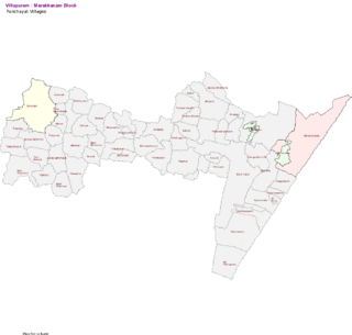
Marakkanam is a coastal panchayat town & Taluk in Viluppuram district in the Indian state of Tamil Nadu. It is well connected to the state capital Chennai and the nearby union territory of Puducherry by the East Coast Road. To the west, Marakkanam is connected to the town of Tindivanam by the SH-134. Marakkanam is situated on the declared National Waterways NW-4. On materialisation of National Waterways NW-4, Marakkanam will be connected to two states Andhra Pradesh (Kakinada) and Puducherry through north and south of Buckingham Canal.

Mukkudal is a panchayat town in Tirunelveli district in the Indian state of Tamil Nadu.

Muthur is a panchayat town in Vellakovil block which comes under Kangeyam taluk in Tirupur district, Tamil Nadu, India.

Tharamangalam is a Municipality in Salem district in the Indian state of Tamil Nadu.
Thisayanvilai is a special grade-town Panchayat. It is one of the taluks in Tirunelveli district in the Indian state of Tamil Nadu.
Vellakovil is a municipal town in Kangeyam taluk of Tirupur District, in the Indian state of Tamil Nadu. It is located on National Highway 81 between Trichy and Coimbatore. The town is spread in an area of 64.75 km2. As of 2011, the town had a population of 40,359. Kannapuram village located near to this town is famous for Kangeyam breed cattle market that happens on every year during Mariyamman temple festival in the month of April. It is an industrialized town with traditional agriculture being the occupation for most of the people. It holds lot of Power looms weaving bedsheets, floor mats and cotton materials being exported to foreign countries via exporters present in Karur.
Paramathi Velur, a town in Paramathi-Velur taluk, Namakkal District, Tamil Nadu, India is situated just off the Srinagar - Kanyakumari National Highway 44 (India). This town is also called as Paramathi Velur, with STD Code 04268 & Postal code 638182.
Vettavalam is a first grade panchayat town in Tiruvanamalai district in the Indian state of Tamil Nadu.

Ayyampettai is a panchayat town in Thanjavur district in the state of Tamil Nadu, India. It is located 15 km from Thanjavur and 24 km from Kumbakonam.
Sivagiri is a panchayat town in Erode district in the Indian state of Tamil Nadu.
Chetpet is a major town panchayat in Tiruvannamalai district in the state of Tamil Nadu, India. Chetpet's major economical activity is processing paddy and the town is home to one of the largest organised paddy exchange markets of the state. Chetpet is one of the very few places of German colonisation in Indian history. A village called Nedungunam nearby has one of the Famous temples of Lord Rama. The temple is very famous and called Sri Yoga Rama temple.
Tirupathur taluk is a taluk in Tirupathur district of the Indian state of Tamil Nadu. The headquarters of the taluk is the town of Tirupathur. It is known as the "Sandalwood Town" due to the abundant availability of sandalwood trees in the surrounding hills. On 15 August 2019, Chief Minister of Tamil Nadu, Edapaadi K. Palanisami announced Tirupathur district, as a new district of Tamil Nadu.

Kovilambakkam is a southern suburb of Chennai, India. It is a village panchayat located in Tambaram taluk, Chengalpattu district in the state of Tamil Nadu, about 26 km from Chennai city center and 12 km from Tambaram. The neighbourhood spans the areas of Sunnambu Kolathur, Chinna Kovilambakkam and Periya Kovilambakkam.
