Geography
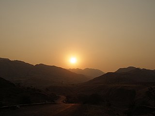
Sendhwa Tehsil is southwest of the district headquarters, Barwani. It is bounded by Warla Tehsil to the south, Niwali Tehsil to the east, and Rajpur Tehsil to the north, all of Barwani District, and by Bhagwanpura Tehsil of Khargone District (West Nimar District) to the west. [4]
Economy
The tehsil is primarily agricultural and forest lands. Mechanised farming has only been recently introduced. [6] Cotton is a big crop, [7] as are pulses, such as mung beans and moth beans. [8] Other crops include wheat, sorghum (jowar), maize, millet (kodo-kutki), especially pearl millet (bajra), rapeseed (canola), mustard, and urd and other pulses (gram). [9]
Regular markets are held in the town of Sendhawa and the villages of Chacria (Chachariya Pati), Dhanori, and Zopali (Jhopali, Jopali). [10] The village of Babdd Bhagoriya has a once-a-year market and festival. [10]
The only real industry is cotton processing. [11]

Jabalpur, formerly Jubbulpore, is a city situated on the banks of Narmada River in the state of Madhya Pradesh, India. According to the 2011 census, it is the third-largest urban agglomeration in Madhya Pradesh and the country's 38th-largest urban agglomeration. Jabalpur is an important administrative, industrial and business center of Madhya Pradesh. It is the judicial capital of Madhya Pradesh as The Madhya Pradesh High Court along with other important administrative headquarters of India and Madhya Pradesh are located in Jabalpur. It is generally accepted that the game of snooker originated in Jabalpur. Jabalpur is the administrative headquarters of Jabalpur district and the Jabalpur division. It also is a major education centre in India. The city is known for the marble rocks on the river Narmada at Bhedaghat.
Barwani or Badwani is a municipal town in Barwani district of Madhya Pradesh, India, that is situated near the left bank of the Narmada River. It is the administrative headquarters of Barwani district and has also served as the capital of the former princely state of Barwani. Barwani is only accessible by road.
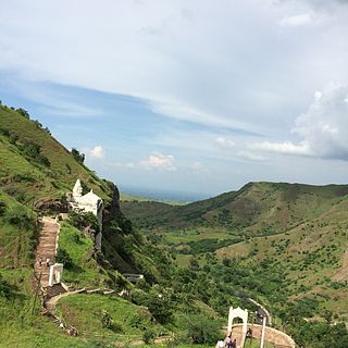
Bawangaja is a famous Jain pilgrim center in the Barwani district of southwestern Madhya Pradesh in India. Located about 6 kilometers south of River Narmada, its main attraction is the world's second largest megalithic statue of Lord Rishabhadeva, the first Jain Tirthankara. The statue is 84 feet (26 m) high. The center is located in the Satpura Range and is about 8 km from a Barwani town.

Khargone district, formerly known as West Nimar district, is a district of Madhya Pradesh state in central India. The district lies in the Nimar region and is part of the Indore Division. The district headquarters is the city of Khargone, which lies south of the Indore metropolis, the headquarters of Indore district.

Sagar district is a district of Madhya Pradesh state in central India. The town of Sagar serves as its administrative center.

Dhar district is a district of Madhya Pradesh state in central India. The historic town of Dhar is administrative headquarters of the district.

Tikamgarh district is one of the 52 districts of Madhya Pradesh state in central India. Tikamgarh town is the district headquarters. The district is part of Sagar Division.

Morena district is one of the 52 districts of the central Indian state of Madhya Pradesh, located in the Chambal division.
Sendhwa is a city with a municipal government in Barwani district in the Indian state of Madhya Pradesh. It is the headquarters for Sendhwa Tehsil.
Waraseoni is a tehsil and Nagar Palika Parishad (municipality) in Balaghat district in the Indian state of Madhya Pradesh. It is situated 16 km (10 mi) from the district headquarters. Waraseoni is second most populous town in Balaghat District after Balaghat.
Warla is a village in Barwani district in the Indian state of Madhya Pradesh. It is the headquarters of Warla tehsil.
Niwali, Madhya Pradesh is a village & Tehsil in Barwani district in the Indian state of Madhya Pradesh.
Anjad tehsil is a fourth-order administrative and revenue division, a subdivision of third-order administrative and revenue division of Barwani district of Madhya Pradesh.
Barwani tehsil is a fourth-order administrative and revenue division, a subdivision of third-order administrative and revenue division of Barwani district of Madhya Pradesh.
Niwali tehsil is a fourth-order administrative and revenue division, a subdivision of third-order administrative and revenue division of Barwani district of Madhya Pradesh.
Pati tehsil is a fourth-order administrative and revenue division, a subdivision of third-order administrative and revenue division of Barwani district of Madhya Pradesh.
Rajpur tehsil is a fourth-order administrative and revenue division, a subdivision of third-order administrative and revenue division of Barwani district of Madhya Pradesh.
Thikri tehsil is a fourth-order administrative and revenue division, a subdivision of third-order administrative and revenue division of Barwani district of Madhya Pradesh.
Warla or Varla tehsil is a fourth-order administrative and revenue division, a subdivision of third-order administrative and revenue division of Barwani district of Madhya Pradesh.
This page is based on this
Wikipedia article Text is available under the
CC BY-SA 4.0 license; additional terms may apply.
Images, videos and audio are available under their respective licenses.