Shah Jalal Mosque, Cardiff

Last updated

Shah Jalal Mosque
Mosque in Crwys Road - geograph.org.uk - 625292.jpg
Religion
Affiliation Islam
Location
Cardiff UK relief location map.jpg
Red pog.svg
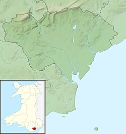
Shown within Cardiff
Geographic coordinates 51°29′35″N3°10′25″W / 51.4931°N 3.1736°W / 51.4931; -3.1736
Architecture
Architect(s) J. H. Phillips
Completed1899
Capacity600 worshipers

The Shah Jalal Mosque, officially the Shah Jalal Mosque & Islamic Cultural Centre is a listed place of worship in Cardiff, Wales. Originally built for Methodist Christians, it ceased as a church in the 1980s and is now a mosque. It is affiliated to Bangladeshi Sufi Fultoli movement. [1]

Contents

History

A Welsh Calvinistic Methodist presence in Cathays began in 1884, with the founding of Capel Horeb, a small building on May Street. It owed its birth to the widening of Cardiff's boundaries in 1875, which had taken in more Welsh-language speakers in the areas around the city. In 1900, this building was closed and the congregation moved to a newer, more prominent location on nearby Crwys Road. The building is constructed in Pennant stone and Bath stone with dressings in yellow brick, and on completion, was named Capel Heol y Crwys. The May Street building is now used by the Salvation Army. In its early years, it was a very popular Welsh-speaking chapel, with regular congregations of 500, but as with many of Cardiff's suburban churches, its attendance declined in the late 20th century, and maintenance costs became hard to meet. In 1988, the congregation moved into newer premises in Richmond Road, having acquired a building formerly used by Christian Scientists. It continues to operate at the location. In 1990, the old chapel underwent conversion into a mosque. [2]

The mosque became Grade II Listed on 21 August 1997. [3]

See also

Related Research Articles

<span class="mw-page-title-main">Llanelli</span> Town and community in Carmarthenshire, Wales

Llanelli is a market town and community in Carmarthenshire and the preserved county of Dyfed, Wales. It is located on the Loughor estuary and is the largest town in the county of Carmarthenshire. The town is 11 miles (18 km) north-west of Swansea and 12 miles (19 km) south-east of Carmarthen. The town had a population of 25,168 in 2011, estimated in 2019 at 26,225. The local authority was Llanelli Borough Council when the county of Dyfed existed, but it has been under Carmarthenshire County Council since 1996.

<span class="mw-page-title-main">Carmarthen</span> County town of Carmarthenshire, Wales

Carmarthen is the county town of Carmarthenshire and a community in Wales, lying on the River Towy 8 miles (13 km) north of its estuary in Carmarthen Bay. The population was 14,185 in 2011, down from 15,854 in 2001, but gauged at 16,285 in 2019. It has a claim to be the oldest town in Wales – Old Carmarthen and New Carmarthen became one borough in 1546. It was the most populous borough in Wales in the 16th–18th centuries, described by William Camden as "chief citie of the country". Growth stagnated by the mid-19th century as new settlements developed in the South Wales Coalfield.

<span class="mw-page-title-main">Llanbedr</span> Human settlement in Wales

Llanbedr is a village and community 2.8 miles (4.5 km) south of Harlech. Administratively, it lies in the Ardudwy area, formerly Meirionnydd, of the county of Gwynedd, Wales.

<span class="mw-page-title-main">South Wales</span> Region of Wales

South Wales is a loosely defined region of Wales bordered by England to the east and mid Wales to the north. Generally considered to include the historic counties of Glamorgan and Monmouthshire, south Wales extends westwards to include Carmarthenshire and Pembrokeshire. In the western extent, from Swansea westwards, local people would probably recognise that they lived in both south Wales and west Wales. The Brecon Beacons National Park covers about a third of south Wales, containing Pen y Fan, the highest British mountain south of Cadair Idris in Snowdonia.

<span class="mw-page-title-main">Roath</span> District and community in Cardiff, Wales

Roath is a district and community to the north-east of the city centre of Cardiff, capital of Wales. The area is mostly covered by the Plasnewydd electoral ward, and stretches from Adamsdown in the south to Roath Park in the north.

<span class="mw-page-title-main">Ann Griffiths</span> Welsh poet and hymnist

Ann Griffiths was a Welsh poet and writer of Methodist Christian hymns in the Welsh language. Her poetry reflects her fervent Christian faith and thorough scriptural knowledge.

<span class="mw-page-title-main">Taff's Well</span> Human settlement in Wales

Taff's Well is a semi-rural village, community and electoral ward located at the south easterly tip of Rhondda Cynon Taf, 6 miles (9.7 km) to the north of Cardiff, the capital city of Wales. Known locally as the 'Gates to the Valleys', it is separated from Gwaelod-y-Garth by the River Taff. Taff's Well is distinguished because it contains the only thermal spring in Wales. The tepid water is thought to rise along a fault-line from the Carboniferous Limestone, in somewhat similar manner to the warm springs at Bristol and Bath. Various religious groups regard it as a spiritual site.

<span class="mw-page-title-main">Trecynon</span> Human settlement in Wales

Trecynon is a village near Aberdare situated in the Cynon Valley, in Rhondda Cynon Taf, Wales. It dates from the early nineteenth century and developed as a result of the opening of the Aberdare Ironworks at Llwydcoed in 1800.

<span class="mw-page-title-main">Soar y mynydd</span> Chapel in Ceredigion, Wales

Soar-y-mynydd or Soar y mynydd is a Calvinist Methodist chapel near the eastern extremity of the large parish of Llanddewi Brefi, Ceredigion. It is claimed to be the remotest chapel in Wales. Its name is Welsh for ‘Zoar of the mountain’. Zoar or its Welsh equivalent Soar is a not uncommon chapel name in Wales which derives from the mention in Genesis 19:20–30 of the place which served as a sanctuary for Lot and his daughters and which was spared by God when the cities of Sodom and Gomorrah were destroyed.

<span class="mw-page-title-main">Pen-y-garn, Ceredigion</span> Human settlement in Wales

Pen-y-garn is a small village in the Tirymynach district of Ceredigion, Wales, approximately 4 miles (6 km) north-east of Aberystwyth. Along with the hamlet of Rhydypennau, Pen-y-garn is now often considered to be part of the neighbouring larger village of Bow Street. All three places stretch in a long narrow strip along the main Aberystwyth to Machynlleth road (A487). As well as the houses on the main road from Cross Street up to Ysgol Rhydypennau, Pen-y-garn also includes the housing estates of Maes Ceiro, Bryn Meillion, Maes y Garn and Cae'r Odyn.

<span class="mw-page-title-main">Borough Welsh Congregational Chapel</span> Welsh church in Southwark, London

The Borough Welsh Congregational Chapel is the mother chapel of the Welsh Congregational church in London, England. It is located at 90 Southwark Bridge Road in Southwark, a district also known as "The Borough".

<span class="mw-page-title-main">Capel Lligwy</span> Church in Wales

Capel Lligwy is a ruined chapel near Rhos Lligwy in Anglesey, north Wales, dating back to the first half of the 12th century. The chapel's original purpose is unknown, but it might have been used as a memorial chapel or in connection with a local royal court, or as a chapel of ease in a large parish with a growing population. It was used for a time until the early 18th century as a private place of worship for a nearby house, then later fell into disrepair. The walls still remain, with some traces of render on them internally, but there is no roof.

<span class="mw-page-title-main">Gwespyr</span> Village in Flintshire, Wales

Gwespyr is a village in Flintshire on the north coast of Wales in the community of Llanasa. Gwespyr had a population of 289 people in the United Kingdom 2001 census. It overlooks Point of Ayr on the west side of the River Dee estuary and its sandy beaches with dunes. The hills of the Clwydian Range behind the village form the eastern boundary of the Vale of Clwyd. Gwespyr also looks respectively Welsh but is an alien name. It represents Old English for 'West-bury' which came to be interpreted as the 'west fort' meaning the westernmost fort in Mercia. Originally, it is thought to have been a strategic Mercian lookout which was reduced in importance with the development of a fortified Rhuddlan.

<span class="mw-page-title-main">Places of worship in Burnley</span> List of places of worship

Burnley, in Lancashire, England, has a long history of religious worship, dating from at least before 1122 in the case of the Church of England. The chapel at Towneley Hall was the centre for Roman Catholic worship in Burnley until modern times. Well before the Industrial Revolution, the town saw the emergence of many non-conformist churches and chapels. In 1891 the town was the location of the meeting which saw the creation of the Baptist Union of Great Britain and Ireland. In the late 19th century a Jewish synagogue was established, and in recent times evangelical and free churches have appeared, as well as a large purpose-built mosque.

<span class="mw-page-title-main">Capel Heol Dŵr, Carmarthen</span> Church in Carmarthenshire, Wales

Capel Heol Dŵr was a Calvinistic Methodist chapel in the town of Carmarthen, Carmarthenshire, Wales. The building dates from 1831 and is located at Water St, Carmarthen. It was designated as a Grade II listed building on 19 May 1981.

<span class="mw-page-title-main">Gellionnen Chapel</span>

Gellionnen Chapel is a Unitarian place of worship near Pontardawe, South Wales, United Kingdom. The chapel was first built in 1692 by Protestant dissenters, becoming Unitarian in the late 18th century. It is a member of the General Assembly of Unitarian and Free Christian Churches, the umbrella body for British Unitarians. Gellionnen Chapel is the oldest Dissenting chapel in the Swansea Valley, is one of the oldest surviving chapels in the region and is a Grade II* listed building.

<span class="mw-page-title-main">Trinity Methodist Church, Cardiff</span> Former church in Cardiff, Wales

Trinity Methodist Church, now the Trinity Centre, is a Grade II listed former Methodist church in Adamsdown, Cardiff, Wales.

<span class="mw-page-title-main">Tabernacle Chapel, Roath</span> Church in Cardiff, Wales

Tabernacle is a listed place of worship in the suburb of Roath, Cardiff, Wales.

<span class="mw-page-title-main">Richard Owens (architect)</span> Welsh architect (1831–1891)

Richard Owens was a Welsh architect, working mostly on urban housing in Liverpool, England and on the construction of chapels in Wales.

References

  1. "Google Mosque Map - UK Mosques Directory". mosques.muslimsinbritain.org.
  2. Rose, Jean (2013). Cardiff Churches Through Time. Stroud: Amberley. p. 68. ISBN   9781445610924.
  3. "Listing" . Retrieved 12 August 2017.