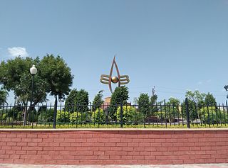
Nathdwara is a city in the Rajsamand district of the state of Rajasthan, India. It is located in the Aravalli hills, on the banks of the Banas River and is 48 kilometres north-east of Udaipur. Shrinathji, is a swarup of lord Krishna which resembles his 7-year-old "infant" incarnation of Krishna. The deity was originally worshiped at Jatpura, Mathura and was shifted in the year 1672 from Govardhan hill, near Mathura along holy river Yamuna after being retained at Agra for almost six months. Literally, Nathdwara means 'Gateway to Shrinathji (God)'.
Dholpur is a city in the Dholpur district in Rajasthan state of India. It is situated on the left bank of the famous Chambal river. The city is the administrative headquarters of Dholpur District.

Jhalawar ( ) is a city, municipal council and headquarter in Jhalawar district of the Indian state of Rajasthan. It is located in the southeastern part of the state. It was the capital of the former princely state of Jhalawar, and is the administrative Jhalawar district. Its district headquarters is Jhalawar. This district is the 22nd largest district of Rajasthan. This district is known by the nicknames of Cherrapunji of Rajasthan, Nagpur of Rajasthan, Brijnagar of Rajasthan etc. Cherrapunji of rajasthan because the highest rainfall in the whole of Rajasthan occurs in manoharthana town in this district. Gagron fort at the confluence of Kalisindh and Ahu river at some distance from Jhalawar It is situated which is one of the Jaldurg of Rajasthan and it is such a fort which is a standing fort without foundation. This fort was included in the UNESCO World Heritage List in 2013.
Gogunda is a town and tehsil headquarters of Gogunda Tehsil in Udaipur district, located about 35 km (22 mi) in north-west from Udaipur city in the Indian state of Rajasthan. It is situated on a high mountain in Aravalli hills and is reached by crossing a difficult mountain pass.

Pali district is a district in Rajasthan, India. The city of Pali is its administrative headquarters. Pali is also known as the Industrial/Textile City and has been a hub for merchant activities for centuries. It has a rich heritage and culture, including beautiful Jain temples and other elaborate monuments.
Amet is a town and a municipality located in Rajsamand district in the Indian state of Rajasthan.

Asind is a city and a municipality in Bhilwara district, Rajasthan, India. It is a Tehsil (sub-division) for many villages The city have a magistrate office, lower justice court and many administrative hub for many major villages.

Chomu is a town and municipality, near the city of Jaipur in Jaipur district in the state of Rajasthan, India.
Jahazpur is a historical town and a municipality in Bhilwara district in the Indian state of Rajasthan. It is also the tehsil headquarters of the Jahazpur tehsil. It is known for the Jain temple swastidham, built around the Jahazpur fort.

Kanore is a town in Udaipur district in the Indian state of Rajasthan.
Kapasan is a city and a municipality in Chittaurgarh district in the Indian state of Rajasthan.
Mandalgarh is a town with municipality in Bhilwara district in the Indian state of Rajasthan. Pincode of Mandalgarh is 311604. It is the tehsil headquarters of Mandalgarh tehsil.
Sadulshahar is a town and a municipality in Sri Ganganagar district in the Indian state of Rajasthan.

Shahpura is a town and a municipality, near city of Jaipur in Jaipur Rural district in the Indian state of Rajasthan.
Rikhabdeo ( Rishabhadeo) is a town in Udaipur district in the state of Rajasthan, in north-west India.

Ramdwara means "the doorway to the Ram". It is a place of worship for the people who believe in Ramsnehi Sampradaya, which advocates chanting of "Ram" (राम). Ramsnehi means "People who love God". Their way of worshipping God is simple. People of all faiths, castes, sections etc. visit at the Ramdwaras. This concept of Ram or Rama is distinct from the Hindu deity Rama.

Ram Charan (1720–1799)) is the Rajasthani Hindu guru, inspirator of a religious tradition called Ramsnehi Sampradaya or Ramdwara. He initiated and illustrated Nirguna (absolute) Bhakti, although he was not against Saguna Bhakti. He initiated and tried to eliminate "show", blind faith, hypocrisy and misled existing in the Hindu religion and preferred to worship the 'name of God', Rama, over God, to not get involved in false "show" activities.
Vijayvargiya is a merchant or (Vaishya-Baniya) community mainly from Rajasthan and Madhya Pradesh.
Bhinder or Bhindar is a town in Udaipur District, that is located 315 km (196 mi) from the state's main city Jaipur. Bhinder borders the Chittorgarh District in Rajasthan and is located 58 kilometres (36 mi) south-east of Udaipur. Notable tourist sites nearby include Sita Mata Wildlife Sanctuary, Jaisamand Sanctuary, and Jaisamand Lake. Bhinder is surrounded by four lakes.
Koshithal is a Gram Panchayat and Village Located in Sahara tehsil, nearby Gangapur town in Bhilwara District of Ajmer division in the Indian State of Rajasthan. It is located in Raipur Vidhan Sabha which governed by MLA Gayatri Kailash Trivedi Of Indian National Congress. Koshithal is largest and one of the most important Gram Panchayat in Bhilwara District. As of 2011, the population of Koshithal is 7153 having almost 1447 households. It is located 300 kms southwest of the state capital Jaipur and 60 kms away from District Headquarter Bhilwara. The village have historically rich history contemporary with Maharana Pratap. It is known for Koshithal Fort and for public cemetery where many War Martyr cremated. It is belief that Koshithal has large number of War Martyr Cremated in Local Cemetery after Chittaurgarh in Rajasthan.


