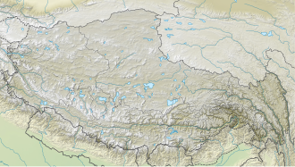
Shalbachum, also known as Phrul Rangien Ri, is a 6,918-metre (22,697-foot) glaciated summit in the Himalayas on the China–Nepal border.[5] It is situated 66 kilometres (41mi) north-northeast of Kathmandu on the boundary shared by Langtang National Park and Qomolangma National Nature Preserve. Precipitation runoff from the mountain's slopes drains into tributaries of the Trishuli River. Topographic relief is significant as the summit rises 2,000metres (6,560ft) above the Shalbachum Glacier in 1.5 kilometres (0.93mi), and 2,700metres (8,858ft) above the Langtang Valley in seven kilometres (4.3mi). The nearest higher peak is Langtang Lirung, 11.26 kilometres (7.00mi) to the west.[3]
Based on the Köppen climate classification, Shalbachum is located in a tundra climate zone with cold, snowy winters, and cool summers.[6] Weather systems coming off the Bay of Bengal are forced upwards by the Himalaya mountains (orographic lift), causing heavy precipitation in the form of rainfall and snowfall. Mid-June through early-August is the monsoon season. The months of April, May, September, and October offer the most favorable weather for viewing or climbing this peak.[7]
↑ Bed Upreti, The Beautiful Mountains of Nepal, Ghatal and Maateswori Publications, 1999, p. 53.
↑ Peel, M. C.; Finlayson, B. L.; McMahon, T. A. (2007). "Updated world map of the Köppen−Geiger climate classification". Hydrol. Earth Syst. Sci. 11. ISSN1027-5606.
This page is based on this Wikipedia article Text is available under the CC BY-SA 4.0 license; additional terms may apply. Images, videos and audio are available under their respective licenses.