
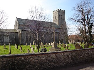
Sheringham is an English seaside town within the county of Norfolk, United Kingdom. The motto of the town, granted in 1953 to the Sheringham Urban District Council, is Mare Ditat Pinusque Decorat, Latin for "The sea enriches and the pine adorns".

Sheringham Park is a landscape park and gardens near the town of Sheringham, Norfolk, England. The park surrounds Sheringham Hall, lying mostly to its south. The hall is privately occupied, but Sheringham Park is in the care of the National Trust and open to visitors.

Holt is a market town, civil parish and electoral ward in the English county of Norfolk. The town is 22.8 miles (36.7 km) north of the city of Norwich, 9.5 miles (15.3 km) west of Cromer and 35 miles (56 km) east of King's Lynn. The town has a population of 3,550, rising and including the ward to 3,810 at the 2011 census. Holt is within the area covered by North Norfolk District Council. Holt has a heritage railway station; it is the south-western terminus of the preserved North Norfolk Railway, known as the Poppy Line.

Cromer is a coastal town and civil parish on the north coast of the English county of Norfolk. It is 23 miles north of Norwich, 116 miles north-northeast of London and four miles east of Sheringham on the North Sea coastline. The local government authorities are North Norfolk District Council, whose headquarters is on Holt Road in the town, and Norfolk County Council, based in Norwich. The civil parish has an area of 4.66 km2 and at the 2011 census had a population of 7,683.

Wells-next-the-Sea is a port town on the north coast of Norfolk, England.

Fakenham is a market town and civil parish in Norfolk, England. It is situated on the River Wensum, about 25 miles north west of Norwich. The town is the junction of several local roads, including the A148 from King's Lynn to Cromer, the A1067 to Norwich and the A1065 to Swaffham.

Gunthorpe is a village and a civil parish in the English county of Norfolk. The village is 8.6 miles east north east of the town of Fakenham, 14.9 miles west south west of Cromer and 122 miles north north east of London. The nearest railway station is at Sheringham for the Bittern Line which runs between Sheringham, Cromer and Norwich. The nearest airport is Norwich International Airport.

Matlaske is a village and a civil parish in the English county of Norfolk. The village is 21.6 miles (34.8 km) North-north-west of Norwich, 9.3 miles (15.0 km) south-west of Cromer and 136 miles (219 km) north-north-east of London. The nearest railway station is at Sheringham for the Bittern Line which runs between Sheringham, Cromer and Norwich. The nearest airport is Norwich International Airport. The parish of Matlask in the 2001 census, a population of 124, increasing to 139 at the 2011 Census. For the purposes of local government, the parish falls within the district of North Norfolk.
Upper Sheringham is a village and a civil parish in the English county of Norfolk. The village is 26.8 miles (43.1 km) north-north-west of Norwich, 6 miles (9.7 km) west of Cromer and 132 miles (212 km) north-north-east of London. The village is 1.2 miles (1.9 km) from the town of Sheringham. The nearest railway station is at Sheringham for the Bittern Line which runs between Sheringham, Cromer and Norwich. The nearest airport is Norwich International Airport. Nearby road connections are the A149 King's Lynn to Great Yarmouth road to the north of the village and the A148 King's Lynn to Cromer road just to the south. The parish of Upper Sheringham in the 2001 census, a population of 214, reducing slightly to 209 at the 2011 Census. For the purposes of local government, the parish falls within the district of North Norfolk.

Northrepps is a village and a civil parish in the English county of Norfolk. It is 3.4 miles (5.5 km) southeast of Cromer, 22.2 miles (35.7 km) north of Norwich and 137 miles (220 km) north of London. The village lies west of the A149 which runs between Kings Lynn and Great Yarmouth. The nearest railway station is at Cromer for the Bittern Line which runs between Sheringham, Cromer and Norwich. The nearest airport is Norwich International Airport. The village and parish of Northrepps had in the 2001 census a population of 839, increasing to 886 at the 2011 Census. For the purposes of local government, the village falls within the district of North Norfolk.

Ryburgh is a civil parish in the English county of Norfolk. The parish is 21.2 miles (34.1 km) south-west of Cromer, 23.1 miles (37.2 km) north-west of Norwich and 117 miles (188 km) north-east of London. The parish lies 4 miles (6.4 km) south-east of the nearby town of Fakenham. The nearest railway station is at Sheringham for the Bittern Line which runs between Sheringham, Cromer and Norwich. The nearest airport is Norwich International Airport. The parish includes the villages of Great Ryburgh and Little Ryburgh.

North Norfolk District Council Headquarters is located in Holt road in a prominent position south of the town of Cromer in the English county of Norfolk. It was built between 1988 and 1990. The nearest railway station is at Cromer for the Bittern Line which runs between Sheringham, Cromer and Norwich. The nearest airport is Norwich International Airport.
Herbert John Green was an English architect who was born near Ipswich in the English county of Suffolk.

Towcester Town Hall is a municipal building in Watling Street, Towcester, Northamptonshire, England. The town hall, which is the meeting place of Towcester Town Council, is a grade II listed building.
The Down Arts Centre, formerly Downpatrick Town Hall and also Downpatrick Assembly Rooms, is a municipal structure in Irish Street in Downpatrick, County Down, Northern Ireland. The structure, which was the meeting place of Down Urban District Council, is a Grade B1 listed building.

Tring Market House is a municipal building in the High Street, Tring, Hertfordshire, England. The structure, which is the meeting place of Tring Town Council, is a Grade II listed building.
Ballymoney Town Hall is a municipal structure in the High Street, Ballymoney, County Antrim, Northern Ireland. The structure, which incorporates a local history museum, is a Grade B1 listed building.

Wirksworth Town Hall is a municipal building in Coldwell Street, Wirksworth, Derbyshire, England. The town hall, which was the headquarters of Wirksworth Urban District Council, now accommodates the local public library.

The Old Town Hall is a former events venue in Prince of Wales Road, Cromer, Norfolk, England. The structure, which is currently used for retail purposes, is a grade II listed building.

Hunstanton Town Hall is a municipal building on The Green in Hunstanton, Norfolk, England. The structure, which is the meeting place of Hunstanton Town Council, is a grade II listed building.

