Shiriya

Last updated

Shiriya
Olayam Masjidh, Kasargod, Kerala, India. (4804983754).jpg
India Kerala location map.svg
Red pog.svg
Shiriya
Location in Kerala, India
India location map.svg
Red pog.svg
Shiriya
Shiriya (India)
Coordinates: 12°37′22″N74°55′42″E / 12.6228°N 74.9282°E / 12.6228; 74.9282
CountryFlag of India.svg  India
State Kerala
District Kasaragod
Area
  Total4.0 km2 (1.5 sq mi)
Population
 (2011)
  Total5,277
  Density1,300/km2 (3,400/sq mi)
Languages
  Official Malayalam, English
Time zone UTC+5:30 (IST)
PIN
671321
Vehicle registration KL-14
Nearest city Kasaragod
RAS since 2016

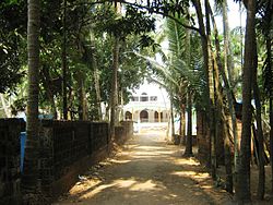
Shiriya is a village in the Kasaragod district of Kerala, India. Shiriya is composed of several smaller villages, those being Shiriya, Shiriya kunnil, Muttam-gate, and Olayam. [1]

Contents

Geography

Shiriya is in Manjeshwaram Taluk which is the northernmost taluk in both Kasaragod district and the state of Kerala. The town is situated on the coast of the Lakshadweep Sea, at the mouth of the Shiriya River. A rail line and National Highway 66 pass through the town.

Demographics

As per 2011 Census, Shiriya census town had a population of 5,277, where 2,403 are male and 2,874 are female. It covered an area of 400 hectares and had 974 households in that year. 818 people, roughly 15% of the town's population, were at or below the age of 6 in 2011. Although the two official languages of the region are Malayalam and English, people in Shiriya also speak Tulu, Beary, and Konkani. Migrant workers also speak Hindi language. [2]

Administration

Shiriya is within Manjeshwar State Assembly constituency, and Kasaragod Lok Sabha constituency.

Related Research Articles

<span class="mw-page-title-main">Kasaragod</span> Municipal city in Kerala, India

Kasaragod is a municipal town and administrative headquarters of Kasaragod district in the state of Kerala, India. Established in 1966, Kasaragod was the first municipal town in the district. It is the northernmost district of Kerala and is also known as Saptha Bhasha Sangama Bhoomi.

Bangramanjeshwar (Bangramanjeshwaram) is a census town in Kasaragod district in the state of Kerala, India.

<span class="mw-page-title-main">Udma</span> Census Town in Kerala, India

Udma is a census town in Kasaragod district in the Indian state of Kerala.

<span class="mw-page-title-main">Uppala</span> Town in Kerala, India

Uppala is a town and Headquarters of Manjeshwaram Taluk in Kasaragod district, Kerala, India. It is geographically located midway from Kasaragod to Mangalore. Easy geographical access and lack of major towns nearby are the key reasons for the town to develop exponentially, especially in the past decade. The population of Manjeshwaram Taluk alone was over 268,642 as of 2011. Uppala is 22 km north of Kasaragod and one of the fastest growing urban settlements in Kasaragod district. It is well known as an important trade hub in the northernmost part of Kerala state.

<span class="mw-page-title-main">Kasaragod district</span> District in Kerala, India

Kasaragod is one of the 14 districts in the southern Indian state of Kerala. Its northern border Thalappady is located just 10 km south to Ullal, which is the southernmost portion of the major port city Mangalore, on the southwestern Malabar coast of India.

<span class="mw-page-title-main">Badiyadka</span> Town in Kerala, India

Badiyadka officially known as "Badiadka" is a town and gram panchayat in the Kasaragod district, state of Kerala, India.

Karindalam is a village in Kasaragod district in the state of Kerala, India.

<span class="mw-page-title-main">Kunjathur</span> Census Town in Kerala, India

Kunjathur is a census town in Kasaragod district in the state of Kerala, India. It is 22 km (14 mi) south of Mangalore.

<span class="mw-page-title-main">Mangalpady</span> Panchayat in Kerala, India

Mangalpady is a Grama Panchayat in Kasaragod district, Kerala. Uppala is the major town in this panchayat.

Meenja is a grama Panchayat in Manjeshwaram Taluk of Kasaragod district in the state of Kerala, India. It consists of 7 revenue villages. Kaliyoor, Koliyoor, Talakala, Meenja, Kadambar, Moodambail and kuloor. & more beautiful village also kuloor

<span class="mw-page-title-main">Manjeshwaram Taluk</span> Taluk in Kerala, India

Manjeshwaram taluk is the northern most taluk of Kerala which borders Karnataka state. It is located in Kasaragod district, Kerala which was carved out from Kasaragod taluk on 2013.

<span class="mw-page-title-main">Perla, Kasaragod</span> Town in Kerala, India

Perla is an administrative capital of Enmakaje Panchayat, which is in Kasaragod district, Kerala, India.

<span class="mw-page-title-main">Mulleria, Kasaragod</span> Town in Kerala, India

Mulleria is a small town located in Karadka Panchayath, Kasaragod district in Kerala, India.

Padre is a village in Manjeshwaram Taluk of Kasaragod district in Kerala, India.

Edanad is a village in Manjeshwaram Taluk of Kasaragod district in Kerala, India.

Mugu is a village in Manjeshwaram Taluk of Kasaragod district in Kerala, India.

Adoor is a village in Kasaragod district in the Indian state of Kerala. Adoor is located 38 km east of Kasaragod town and 7 km away from State Highway 55 or Cherkala-Jalsoor road.

<span class="mw-page-title-main">Kallar (Kasaragod)</span> Village in Kerala, India

Kallar is a village in Kasaragod district in the Indian state of Kerala. Kallar is located on Kanhangad-Panathur road of 40 km south east of Kasaragod town and 27 km north east of Kanhangad.

Bela is a village in Kasaragod taluk of Kasaragod district in Indian state of Kerala.

Kolthur is a village in Kasaragod taluk of Kasaragod district in Indian state of Kerala.

References

  1. "Census of India : List of villages by Alphabetical : Kerala". Registrar General & Census Commissioner, India. Retrieved 10 December 2008.
  2. https://censusindia.gov.in/2011census/dchb/3201_PART_B_KASARAGOD.pdf [ bare URL PDF ]