Si Phang-nga National Park

Last updated
Si Phang Nga National Park
IUCN category II (national park)
Thailand location map Topographic.png
Red pog.svg
Map of Thailand
Location Phang Nga Province, Thailand
Nearest city Takua Pa
Coordinates 9°08′53″N98°28′19″E / 9.148°N 98.472°E / 9.148; 98.472 Coordinates: 9°08′53″N98°28′19″E / 9.148°N 98.472°E / 9.148; 98.472 [1]
Area 246.08 km2 (95.01 sq mi)
Established 16 Apr 1988
Governing body Department of National Parks, Wildlife and Plant Conservation
Department of National Parks

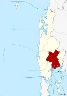
Si Phang Nga National Park (Thai : ศรีพังงา) is in Phang Nga Province in southern Thailand, covering the eastern parts of the districts Khura Buri and Takua Pa.

Thai language language spoken in Thailand

Thai, Central Thai or Ayutthaya or Siamese, is the sole official and national language of Thailand and the first language of the Central Thai people and vast majority of Thai of Chinese origin. It is a member of the Tai group of the Kra–Dai language family. Over half of Thai vocabulary is derived from or borrowed from Pali, Sanskrit, Mon and Old Khmer. It is a tonal and analytic language.

Phang Nga Province Province in Thailand

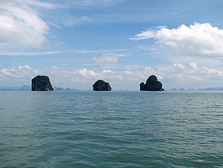
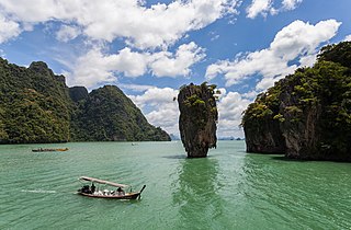
Phang Nga is one of the southern provinces (changwat) of Thailand, on the shore of the Andaman Sea to the west and Phang Nga Bay to the south. Neighboring provinces are Ranong, Surat Thani, and Krabi. To the south is the Phuket Province, connected by the Sarasin Bridge.

Thailand Constitutional monarchy in Southeast Asia

Thailand, officially the Kingdom of Thailand and formerly known as Siam, is a country at the center of the Southeast Asian Indochinese peninsula composed of 76 provinces. At 513,120 km2 (198,120 sq mi) and over 68 million people, Thailand is the world's 50th largest country by total area and the 21st-most-populous country. The capital and largest city is Bangkok, a special administrative area. Thailand is bordered to the north by Myanmar and Laos, to the east by Laos and Cambodia, to the south by the Gulf of Thailand and Malaysia, and to the west by the Andaman Sea and the southern extremity of Myanmar. Its maritime boundaries include Vietnam in the Gulf of Thailand to the southeast, and Indonesia and India on the Andaman Sea to the southwest. Although nominally a constitutional monarchy and parliamentary democracy, the most recent coup in 2014 established a de facto military dictatorship.

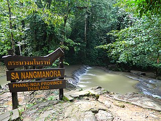
The landscape of the park is dominated by rugged mountains covered with dipterocarp forests, similar to the Khao Sok adjoining it to the east.

<i>Dipterocarpus</i> genus of plants

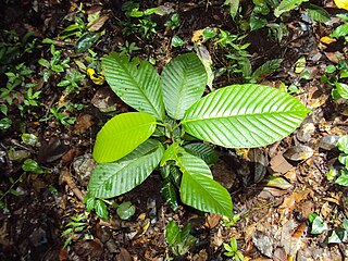
Dipterocarpus is a genus of flowering plants and the type genus of family Dipterocarpaceae.

The establishment of the park was announced in the Royal Gazette, Issue 105, Chapter 60 of 16 April 1988.

Related Research Articles

Takua Pa District Amphoe in Phang Nga, Thailand

Takua Pa is a district (amphoe) in Phang Nga Province in south Thailand.

Surin Islands archipelago in Andaman Sea, Thailand

The Surin Islands is an archipelago of five islands in the Andaman Sea, 60 km from the Thai mainland. Administratively, the islands are part of Tambon Ko Phra Thong, Khura Buri District, in Phang Nga Province, Thailand.

Phanom District Amphoe in Surat Thani, Thailand

Phanom is a district (amphoe) in the southwest of Surat Thani Province of southern Thailand.

Similan Islands

The Similan Islands is a group of islands in the Andaman Sea off the coast of, and part of, Phang Nga Province, southern Thailand. It is a national park, Mu Ko Similan, which was established in 1982 after a one-year assessment by the forestry department.

Phang Nga Bay large bay of Thailand

Phang Nga Bay is a 400 km2 bay in the Strait of Malacca between the island of Phuket and the mainland of the Malay peninsula of southern Thailand. Since 1981, an extensive section of the bay has been protected as the Ao Phang Nga National Park. The park is in Phang Nga Province, at 08°17'N 098°36'E.

Khura Buri District Amphoe in Phang Nga, Thailand

Khura Buri is a district (amphoe) in Phang Nga Province in the south of Thailand.

Kapong District Amphoe in Phang Nga, Thailand

Kapong is a district (amphoe) in Phang Nga Province in south Thailand.

Mueang Phang Nga District Amphoe in Phang Nga, Thailand

Mueang Phang Nga is the capital district of Phang Nga Province in southern Thailand.

Thailand Route 401 road in Thailand

Thailand Route 401 is a highway in southern Thailand. It starts from the west coast of the Thai-Malay Peninsula at an intersection with Route 4 near Amphoe Takua Pa, Phang Nga Province.

Takua Thung District District in Phang Nga, Thailand

Takua Thung is a district (amphoe) in the province Phang Nga in the south of Thailand.

Ton Pariwat Wildlife Sanctuary

The Ton Pariwat Wildlife Sanctuary is located in the north of Mueang Phang Nga district, Phang Nga Province, southern Thailand. It covers an area of 224 square kilometres of forested hills at the southern end of the Phuket mountain range. It is part of a system of protected areas known as the southern forest complex, continued to the northwest by the Khlong Phanom National Park.

Khao Phing Kan island in Thailand, in Phang Nga Bay

Khao Phing Kan or Ko Khao Phing Kan is an island in Thailand, in Phang Nga Bay northeast of Phuket. The islands are limestone tower karsts and are a part of Ao Phang Nga National Park.

Thai Mueang District Amphoe in Phang Nga, Thailand

Thai Mueang is a district (amphoe) in Phang Nga Province in the south of Thailand.

Ko Yao District District in Phang Nga, Thailand

Ko Yao is a district (amphoe) in Phang Nga Province in Thailand's south.

Sa Nang Manora Forest Park

Sa Nang Manora is a forest park in southern Thailand. It covers an area of 0.29 km2 of the Khao Thoi-Nang Hong Forest, Nop Pring Sub-district, Mueang District, Phang Nga Province, about four km north of Phang Nga town. It was established on 15 September 1980.

Ao Phang Nga National Park national park in southern Thailand

Ao Phang Nga National Park is in Phang Nga Province in southern Thailand. It includes coastal sections of Mueang Phang Nga District and Takua Thung District. Most of the park consists of an area of the Andaman Sea studded with numerous limestone tower karst islands. The best known of these islands is Khao Phing Kan, popularly called "James Bond Island" because it was used as a location for the James Bond movie The Man with the Golden Gun.

Phuket Range

The Phuket Range is a subrange of the Tenasserim Hills in the Kra Isthmus, Thailand.

References

  1. "Si Phangnga National Park". protectedplanet.net.