
A Village Development Committee (VDC) in Nepal was the lower administrative part of its Ministry of Federal Affairs and Local Development. Each district had several VDCs, similar to municipalities but with greater public-government interaction and administration. There were 3,157 village development committees in Nepal. Each VDC was further divided into several wards depending on the population of the district, the average being nine wards.
The 1991 Nepal census was a widespread national census conducted by the Nepal Central Bureau of Statistics.

Sarkuwa is a village development committee of the Baglung District of the Dhaulagiri Zone, situated in western Nepal. At the 1991 Nepal census it had a population of 2,516 and 495 houses.
Singana is a village development committee in Baglung District in the Dhaulagiri Zone of central Nepal. At the time of the 1991 Nepal census it had a population of 3,365 and had 624 houses in the village.
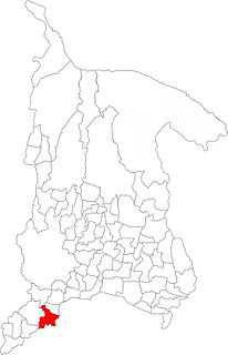
Barakot is a ward in Dasharathchanda municipality, in Baitadi District in Sudurpashchim Pradesh of western Nepal. Earlier it was a village development committee (VDC). At the time of the 1991 Nepal census it had a population of 2,389 and had 462 houses in the village.
Dilasaini is a former village development committee that is now a Rural Municipality in Baitadi District in Sudurpashchim Pradesh of western Nepal. At the time of the 1991 Nepal census it had a population of 4,828 and had 849 houses in the village. There is one plus two, two high schools and many primary schools in the VDC. This VDC is bordered by Mathairaj, Gokuleshwor, Rudreswor and Rim VDC and Darchula district in the northwest. Ths VDC is named after a local deity. The temple of this devi is located in Dhamigaun which is one of the wards of the VDC. This temple is famous in far-western Nepal for the sacrifice of huge number of bull buffaloes on occasion of Dashain.
Nagarain is a municipality in Dhanusha District in Province No. 2 of south-eastern Nepal. As of 2011 Nepal census, it has a population of 36,336 living in 6,478 individual households. It was formed by joining Fulgama, Devdiha, old Nagrain, Lagmagadhguthi and Ghodghans village development committees. The total area of Nagarain municipality is 38.71 km2.
Mukhiyapatti Musharniya is a village development committee in Dhanusa District in Province No. 2 of south-eastern Nepal. At the time of the 1991 Nepal census it had a population of 4,621 people living in 436 individual households.
Aslewa is a village development committee (VDC) in Gulmi District in the Lumbini Zone of central Nepal. At the time of the 1991 Nepal census it had a population of 8088 persons living in 992 individual households. The village has a temple called Rudra Beni Dhaam and a school for higher level study, the Shree Janata Higher Secondary School.
Rupakot is a Village Development Committee (VDC) in Gulmi District in the Lumbini Zone of central Nepal. Its headquarters is in Myal pokhara. It is located in about the center of Gulmi District. It is surrounded by hills. Its main religion is Hinduism. There are many temples like Chhatra Thaan, Shiddababa temple, Shiva Temple, Ram Temple, Debi deurali temple etc. The main sources of revenue for the village are agriculture and foreign employment. At the time of the 2001 Nepal census, it had a population of 3521 persons residing in 704 individual households. 76.48% of students attend school. The most populated parts of this VDC is Damuka, Sota & Ekle Pipal.
Wamitaksar (Nepali:वामीटक्सार) is a town and Village Development Committee in Gulmi District in the Lumbini Zone of central Nepal. At the time of the 1991 Nepal census it had a population of 6421. It is located 128.54 kilometers of the capital of Nepal Kathmandu.
Bidyapur is a village development committee in Surkhet District in Karnali Pradesh of mid-western Nepal. At the time of the 1991 Nepal census it had a population of 4053 people living in 707 individual households.
Bhangara, Nepal is a village development committee of the Parbat District of the Dhawalagiri Zone in central Nepal. It is located approximately 75 km from Pokhara City and 15 km from the district headquarters Kusma. At the time of the 1991 Nepal census, it had a population of 2242 people living in 421 households.
Thulipokhari is a village development committee in Parbat District in the Dhawalagiri Zone of central Nepal. At the time of the 1991 Nepal census it had a population of 2753 people living in 557 individual households. Thulipokhari is one of the academic center of Parbat District. Janata Sudarshan Secondary School and Janata Sudarshan multiple campus are the major education foundation of the region. Janata Sudarshan School situated at Thulipokhari served as a major educational institution for the people of Thulipokhari and surrounding villages for years. Alumni of this school are now around the globe working as Engineers, Doctors and are successful entrepreneurs.
Jijodamandau is a village development committee in Doti District in the Seti Zone of western Nepal. At the time of the 1991 Nepal census it had a population of 1906 living in 365 individual households.
Sunakhani is a village development committee in Dolakha District in the Janakpur Zone of north-eastern Nepal. Under the new geographical structure, Sunkhani is a village of Kalinchwok Gaun Palika.
Sanghutar is a village development committee in Ramechhap District in the Janakpur Zone of north-eastern Nepal. At the time of the 1991 Nepal census it had a population of 2,177 people living in 394 individual households. The VDC has a small market called Sanghutar Bazaar, situated in the bank of the Likhu River and bordering Okhaldhunga District. The bazaar is flat land near to the bridge ; therefore, its name is Sanghutar. It is a main commercial center of many neighboring villages of Ramechhap and Okhaldhunga District with a higher secondary school called Himaganga.
Tikhatar is a village development committee in Doti District in the Seti Zone of western Nepal. At the time of the 1991 Nepal census it had a population of 5222 people in 958 individual households.

Letang, "लेटाङ " is a Municipality in Morang District in the Province No. 1 of south-eastern Nepal. It was formed by merging the existing Village Development Committees of Letang, Jante, Warrangi and Bhogateni.
Edited by ABHASH
Urlabari is a city and municipality in Morang District in the Koshi Zone of south-eastern Nepal. It is considered to be the second largest city in Morang District after Biratnagar. At the time of the 1991 Nepal census it had a population of 18,224. At the time of the 2011 Nepal census it had a population of 35,166 and 8,165 households.

