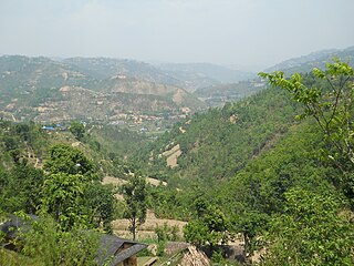
Arghakhanchi is one of the districts of Lumbini Province in Nepal. The district headquarter is Sandhikharka. The district covers an area of 1,193 km2 (461 sq mi) and has a population (2011) of 197,632. Its neighboring districts are Palpa in the east, Gulmi in the north, Kapilvastu District in the south and Pyuthan in the west.

Phungling Municipality is a municipality located in Taplejung District in the Province No. 1 of Nepal. The municipality was formed merging the then two Village Development Committees of Phungling and Dokhu in May 2014. At the time of the 2011 Nepal census it had a population of 19,085 people and 4,480 individual households.

Bara District lies in Province No. 2. It is one of the seventy-seven districts of Nepal. The district is third richest district in Nepal after Kathmandu and Morang with 3.3% share of total GDP of Nepal and per capita income is highest in province no.2. Kalaiya as its district headquarters, covers an area of 1,190 km2 (460 sq mi) and has a population (2011) of 687,708. Bakaiya, Jamuniya, Pasaha, Dudhaura and Bangari are the main rivers of Bara. The main languages spoken in Bara are Bhojpuri, Bajjika, Tharu and Nepali.

Dhading District, a part of Bagmati Province, is one of the seventy-seven districts of Nepal. The district, with Dhading Besi as its district headquarters, covers an area of 1,926 square kilometres (744 sq mi), had a population of 338,658 in 2001 and 336,067 in 2011.
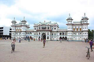
Dhanusha District,, a part of Province No. 2, is one of the seventy-seven districts of Nepal. It is situated in the Outer Terai. The district, with Janakpur as its district headquarter, covers an area of 1,180 km2 (460 sq mi) and has a population (2011) of 754,777.

Dolakha, often known as Dolkha or Dholkha, a part of Bagmati Province, is one of the seventy-seven districts of Nepal. The district, with Charikot as its district headquarters, covers an area of 2,191 km2 (846 sq mi) and has a population of 204,229 in 2001 and 186,557 in 2011. It is a district with a strong religious affiliation. It is popularly known amongst most Nepalese for the temple of Dolakha Bhimeshawor.
Gorkha District, a part of Gandaki Province, is one of the 77 districts of Nepal, which is the fourth largest district of Nepal and connected historically with the creation of the modern Nepal and the name of the legendary Gorkha soldiers. The district, with Gorkha Municipality as its district headquarters, covers an area of 3,610 km2 (1,390 sq mi) and has a population of 271,061 according to the 2011 Census of Nepal. Gorkha district is the site of the Manakamana Temple. The temples of Gorakh Nath and Gorakh Kali are found in the district. Several major rivers—the Chepe, Daraudi, Marsyangdi, Budi Gandaki, and Trishuli—run through the district.

Kavrepalanchok District, simply known as Kavre, is one of the 77 districts of Nepal, The district, with Dhulikhel as its district headquarters, covers an area of 1,396 km2 (539 sq mi). It is a part of Bagmati Province and has a population of 381,937.

Mahottari District, a part of Province No. 2, is one of the seventy-seven districts of Nepal. The district, with Jaleshwar as its district headquarters, covers an area of 1,002 km2 (387 sq mi) and had a population of 553,481 in 2001 and 627,580 in 2011. Its headquarters is located in Jaleshwar, a neighbouring town of the historical city of Janakpur. The name Jaleshwar means the 'God in Water'. One can find a famous temple of Lord Shiva in Water there. Jaleshwar lies at a few kilometres distance from the Nepal-India border and has a majority Maithili population. In Janakpur zone there are two districts ; mahottari and Dhanusha and both are in a distance of 1 hour.
Nuwakot District (Nepali: नुवाकोट जिल्लाListen , a part of Bagmati Province, is one of the seventy-seven districts of Nepal. The district, with Bidur as its district headquarters, covers an area of 1,121 km2 and had a population of 288,478 in 2001 and 277,471 in 2011. It is a historically important district in Nepal. Prithvi Narayan Shah died in Devighat of Nuwakot.

Palpa District (Nepali: पाल्पा जिल्लाListen , a part of Lumbini Province, is one of the seventy-seven districts of Nepal, a landlocked country of South Asia. The district, with Tansen as its headquarters, covers an area of 1,373 km2 and has a population of 261,180.

Parbat District (Nepali: पर्वत जिल्ला[pʌɾbʌt], is a hilly area of Nepal. It is a part of Gandaki Province and one of the seventy-seven districts of Nepal. The district, with Kusma as its district headquarters, covers an area of 494 km2 and has a population of 157,826. It is the fourth smallest district of Nepal with 47 VDCs currently. It is mainly known for the Gupteshwar Cave, which is visited by thousands of pilgrims during Shivaratri. Patheshwari Temple a notable temple in Kushma located at Katuwa Chaupari of Kushma-09. Patheshwori Mandir has many sub-temples inside like Ram Janaki Mandir, Bhagwati, Devi, Hanuman, and others. Alapeshwar cave is a cave in this district. It is also noted for the Dahere Deurali Temple, which is visited by thousands of pilgrims during Balachaturdanshai. Kamadhenu Mandir is another temple of Parbat district which is located in Khurkot development committee. Recently the Modi hydro project of 10 M.W. has been constructed in this district. Parbat's biggest playground lies in Phalewas village named Majhi Chour and Indra Chour.

Pyuthan District(Nepali: प्युठान जिल्ला[piu̯ʈʰan], is a "hill" district some 250 km west of Kathmandu in Lumbini Province in midwestern Nepal. Pyuthan covers an area of 1,309 km2 with population of 212,484 in 2001 and 226,796 in 2011. Pyuthan Khalanga is the district's administrative center.

RolpaListen (help·info), is a "hill" district in Lumbini Province of Nepal. Rolpa district covers an area of 1,879 km2 (725 sq mi) with population (2011) of 221,177. Rolpa town is the district's administrative center.

Rupandehi District, a part of Lumbini Province, is one of the seventy-seven districts of Nepal and covers an area of 1,360 km2 (530 sq mi). The district headquarter is Bhairahawa. As per the national census 2011, the population of Rupandehi was 880,196.

Saptari, a part of Province No. 2, is one of the seventy-seven districts of Nepal. Its district headquarter is Rajbiraj. Saptari is an Outer Terai district. This district covers an area of 1,363 km2 (526 sq mi) and has a population (2011) of 639,284 which makes it the 10th most populated district of Nepal. Saptari is renowned for its agricultural output, and is bordered on the east by the massive Sapta Koshi river.
Sarlahi, a part of Province No. 2, is one of the seventy-seven districts of Nepal. According to new laws, a combination of more than two or four villages makes a municipality, which covers an area of 1,259 km2 (486 sq mi) and had a population of 635,701 in 2001 and 769,729 in 2011.

Balara (Maithili/Nepali: बलरा) is a municipality in Sarlahi District, a part of Province No. 2 in Nepal. It was formed in 2016 occupying current 12 sections (wards) from previous 9 former VDCs. It occupies an area of 48.55 km2 with a total population of 45,194.

Letang, "लेटाङ " is a Municipality in Morang District in the Province No. 1 of south-eastern Nepal. It was formed by merging the existing Village Development Committees of Letang, Jante, Warrangi and Bhogateni.
Edited by ABHASH
Golbazar is a municipality in Siraha District in the Sagarmatha Zone of south-eastern Nepal. Golbazar Municipality was formed by merging former VDCs of Asanpur, Jamadaha, Ashokpur Balkawa, Betauna, Durgapur, Lalpur, Muksar, Chandraudyapur, Chandralalpur under new local administrative structure implemented by Government of Nepal. As per 2011 Nepal census it had a population of 47763 people living in 2500 individual households.

