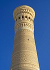
Silk Roads: Zarafshan-Karakum Corridor

Last updated
Silk Roads: Zarafshan-Karakum Corridor
UNESCO World Heritage Site
Location
Includes31 locations in 3 countries
Criteria Cultural: (ii)(iii)(v)
Reference 1675
Inscription2023 (45th Session)
Area669.679 ha (2.58565 sq mi)
Buffer zone1,750.042 ha (6.75695 sq mi)

Silk Roads: Zarafshan-Karakum Corridor is a UNESCO World Heritage Site which covers the Zarafshan-Karakum portion of the ancient Silk Road and historical sites along the route. On September 17, 2023, UNESCO designated a 886 km stretch of the Silk Road network in Central Asia as a World Heritage site. The corridor spans Tajikistan, Turkmenistan and Uzbekistan, includes 31 sites. [1] [2]

Contents

Location

The corridor is located in Central Asia. It crosses seven geographical zones: the highland zone, piedmont zone, plains zone, artificial irrigation zone, oases zone, wormwood-steppe zone and desert zone. [2]

Sites

The sites are located in three countries, which recognized for the World Heritage inscription: [2]

1. Tajikistan

2. Uzbekistan

3. Turkmenistan

Related Research Articles

<span class="mw-page-title-main">Qarshi</span> City in southern Uzbekistan

Qarshi is a city in southern Uzbekistan. It is the capital of Qashqadaryo Region. Administratively, Qarshi is a district-level city, that includes the urban-type settlement Qashqadaryo. It has a population of 278,300. It is about 520 km south-southwest of Tashkent, and about 335 km north of Uzbekistan's border with Afghanistan. It is located at latitude 38° 51' 48N; longitude 65° 47' 52E at an altitude of 374 meters. The city is important in natural gas production, but Qarshi is also famous for its production of woven flat carpets.

<span class="mw-page-title-main">Bukhara</span> City in southwestern Uzbekistan

Bukhara is the seventh-largest city in Uzbekistan by population, with 280,187 residents as of 1 January 2020. It is the capital of Bukhara Region. The mother tongue of the majority of people of Bukhara is the Tajik dialect of the Persian language, although Uzbek is spoken as a second language by most residents.

<span class="mw-page-title-main">Merv</span> Ancient major city in Central Asia

Merv, also known as the Merve Oasis, formerly known as Alexandria, Antiochia in Margiana and Marw al-Shāhijān, was a major Iranian city in Central Asia, on the historical Silk Road, near today's Mary, Turkmenistan. Human settlements on the site of Merv existed from the 3rd millennium BC until the 18th century AD. It changed hands repeatedly throughout history. Under the Achaemenid Empire, it was the center of the satrapy of Margiana. It was subsequently ruled by the ancient Macedonians, Seleucids, Parthians, Sasanians, Arabs, Ghaznavids, Seljuqs, Khwarazmians and Timurids, among others.

<span class="mw-page-title-main">Navoiy</span> City in Navoiy Region, Uzbekistan

Navoiy, also spelled Navoi, is a city and the capital of Navoiy Region in the southwestern part of Uzbekistan. Administratively, it is a district-level city, that includes the urban-type settlement Tinchlik. It is located at latitude 40° 5' 4N; longitude 65° 22' 45E, at an altitude of 382 meters. The city is named after Ali-Shir Nava'i. As of 2020, its population was 144,158 inhabitants.

<span class="mw-page-title-main">Konye-Urgench</span> City in north Turkmenistan on the site of the former capital of Khwarazm

Konye-Urgench, also known as Old Urgench or Urganj, is a city of about 30,000 inhabitants in north Turkmenistan, just south from its border with Uzbekistan. It is the site of the ancient town of Gurgānj, which contains the ruins of the capital of Khwarazm. Its inhabitants deserted the town in the early eighteenth century in order to develop a new settlement, and Konye-Urgench has remained undisturbed ever since. In 2005, the ruins of Old Urgench were inscribed on the UNESCO List of World Heritage Sites.

<span class="mw-page-title-main">Tourism in Uzbekistan</span>

Tourist activities in Uzbekistan range from outdoor activities, such as rock-climbing, to exploration of its archeological and religious history. The Statistical Internet Survey conducted between May 7 and August 27, 2008, found that the majority of those surveyed (39%) visit Uzbekistan due to interest in its architectural and historical sites. The next-largest group (24%) visited Uzbekistan to observe its culture, way of life, and customs.

<span class="mw-page-title-main">Architecture of Central Asia</span> Architectural styles of the societies that have occupied Central Asia throughout history

Architecture of Central Asia refers to the architectural styles of the numerous societies that have occupied Central Asia throughout history. These styles include a regional tradition of Islamic and Iranian architecture, including Timurid architecture of the 14th and 15th centuries, as well as 20th-century Soviet Modernism. Central Asia is an area that encompasses land from the Xinjiang Province of China in the East to the Caspian Sea in the West. The region is made up of the countries of Kazakhstan, Uzbekistan, Tajikistan, Kyrgyzstan, and Turkmenistan. The influence of Timurid architecture can be recognised in numerous sites in Kazakhstan and Uzbekistan, whilst the influence of Persian architecture is seen frequently in Uzbekistan and in some examples in Turkmenistan. Examples of Soviet architecture can be found in Uzbekistan, Kazakhstan, Tajikistan and Kyrgyzstan.

Sarahs is an oasis city in Ahal Province, Turkmenistan, and the administrative center of Sarahs district. It is located at latitude 36°31' North; longitude 61°12' East and an elevation of 285m above sea level. It is one of the oases of the ancient Silk Road lying between Merv to the east and Mashhad to the west. In 1989 the city had a population of 9,585.

<span class="mw-page-title-main">Rabati Malik</span> 12th-century ruin in Uzbekistan

Rabati Malik, also called Ribat-i Malik, is a caravanserai ruin located on the M37 road from Samarkand to Bukhara about a kilometer west of the edge of Malik, Navoiy Province, Uzbekistan. It was constructed along the Silk Road according to the orders of Karakhanid Shams al-Mulk Nasr, son of Tamgachkhan Ibragim, who ruled in Samarkand from 1068 until 1080.

<span class="mw-page-title-main">Paykend</span> Archaeological site in Uzbekistan

Paykend or Poykent, an ancient city in Uzbekistan, is located in the lower stream of Zarafshan River and was one of the largest cities of the Bukhara oasis. The city consisted of a citadel, two settlements, and a rabod (suburb). Paykend is currently under consideration for inscription as a UNESCO World Heritage site.

<span class="mw-page-title-main">Sarazm</span> Tajikistan district and Bronze Age site

Sarazm is an ancient town and also a jamoat in north-western Tajikistan. It dates back to the 4th millennium BC, with C14 dates ranging from 3900-2100 BC, and is today a UNESCO World Heritage Site. The jamoat is part of the city of Panjakent in Sughd Region, and has a total population of 27,877 (2015). It consists of 21 villages, including Chimqal'a, Abdusamad, Bostondeh, Kamar, Kamar-Tash and Sohibnazar.

<span class="mw-page-title-main">Tomb of Ahmad Sanjar</span> Mausoleum of the last Seljuk sultan

The Tomb of Ahmad Sanjar is a mausoleum commemorating Ahmad Sanjar, a Seljuk ruler of Khorasan. It was built in 1157 in the medieval city of Merv in the Karakum Desert in Turkmenistan. Throughout his reign, Sanjar fought off several invasions and uprisings until finally being defeated by the Oghuz. After being sacked by the Oghuz, Merv declined and in 1221, the Mongols attacked it and burned down the mausoleum. It would later be restored by Soviet, Turkmen, and Turkish architects during the 20th and 21st centuries. The tomb is part of The State Historical and Cultural Park "Ancient Merv", a UNESCO World Heritage Site.

Tourism is a small industry in Turkmenistan, serving just over 14,000 visitors in 2019. Tourist destinations include World Heritage Sites, museums, and natural sites. Many of its Central Asian cities were main points of trade on the Silk Road, linking Eastern and Western civilizations. Many neighboring countries promote their countries based on their location along the Great Silk Road. Tourists from abroad are deterred by the restrictive visa policy regime with all countries of the world. Tourism is regulated by the Tourism Committee of Turkmenistan.

<span class="mw-page-title-main">Dayahatyn</span> Medieval caravanserai in Lebap velayat, Turkmenistan

Dayahatyn is a medieval caravanserai, sitting on the left bank of the Amu Darya. It is around 170 km to the northwest of the modern city of Turkmenabat, Lebap welaýaty, near the border between Turkmenistan and Uzbekistan. It is a fortified square enclosure with sides 53 metres long. It is believed to have been originally a fortress built by Tahir ibn Husayn in the 9th century. In the 11th century, it was transformed into a caravanserai with fascinating brick-structures, providing shelter for not only caravans but also elites during their long journeys. The integrity of Dayahatyn is a typical example of the mastery of Seljuk architects in brickwork during the 11th and 12th centuries. Because of its artistic excellence, Dayahatyn is regarded as one of the most valuable examples, and perhaps the finest example, of a caravanserai extant in Central Asia, aside from that of Ribat of Sharaf.

<span class="mw-page-title-main">Silk Roads: the Routes Network of Chang'an-Tianshan Corridor</span> UNESCO World Heritage Site in Central Asia

Silk Roads: The Routes Network of Chang'an-Tian Shan Corridor is a UNESCO World Heritage Site which covers the Chang'an-Tianshan portion of the ancient Silk Road and historical sites along the route. On June 22, 2014, UNESCO designated a 5,000 km stretch of the Silk Road network from Central China to the Zhetysu region of Central Asia as a World Heritage site. The corridor spans China, Kazakhstan and Kyrgyzstan and includes 33 new sites and several previously designated heritage sites.

<span class="mw-page-title-main">Izad-Khast Castle</span> Castle in Izadkhast, Iran

The Izad Khast Castle is located in Izadkhast in the Fars Province, central Iran. The castle was built during the Sassanid Empire and functioned as fortified walled city on the ancient Silk Road that ran through central Iran. It is the second largest adobe building in the world after Arg-e Bam.

References

  1. "Silk Roads: Zarafshan-Karakum Corridor has been recommended for the inscription on the UNESCO World Heritage List". www.unesco-iicas.org. Retrieved 18 September 2023.
  2. 1 2 3 "Silk Roads: Zarafshan-Karakum Corridor": 7–9. Retrieved 18 September 2023.{{cite journal}}: Cite journal requires |journal= (help)