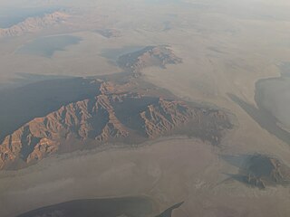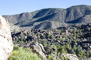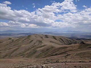
The Funeral Mountains is a short, arid mountain range in the United States along the California-Nevada border approximately 100 mi (160 km) west of Las Vegas. The mountains are considered a subrange of the Amargosa Range that form the eastern wall of Death Valley.

The Pah Rah Range is a mountain range located in western Nevada in Washoe County just to the northeast of Reno. It is a hook shaped range with the main eastern portion oriented northwest–southeast, approximately 20 miles (32 km) long. The northwest flowing Cottonwood Creek in Warm Springs Valley is bounded on three sides by the range. To the south and east the Truckee River forms the boundary and Pyramid Lake is at the northeast. Spanish Springs Valley north of Reno forms the southwest margin. To the north, the narrow Mullen Pass separates the Pah Rah Range from the Virginia Mountains.

The Shoshone Mountains, in west central Nevada, make up one of the longest mountain ranges in the state. The range runs in a general north-south direction in Nye and Lander counties. The range has a length of about 66 miles (106 km) and a width of about 6 mi (9.7 km) with an area of approximately 400 sq mi (1,000 km2).

The New York Mountains are a small mountain range found in northeastern San Bernardino County in California, USA. The range's northeastern area lies in southeastern Nevada. The range lies just south of the small community of Ivanpah, and north of the Lanfair Valley. The mountains are part of the mountain ranges, cones, mountains, and landforms in the Mojave National Preserve. The mountains reach an elevation of 7,533 feet (2,296 m), and run in a mostly southwest-northeasterly direction between the Providence Mountains and the McCullough Range approximately five miles into Nevada and border the northwest corner of the Piute Valley of Nevada-California.
The Clan Alpine Mountains are a mountain range located in west-central Nevada in the United States. The range lies in a southwest-northeasterly direction in Churchill County, and contains Mount Augusta, at 9,967 feet (3,038 m) above sea level. The mountains lie to the west of the Desatoya Mountains and southeast of the Stillwater Range. The Augusta Mountains lie to the northeast and the New Pass Range to the east. A large part of the range, 196,128 acres (793.70 km2), lies within the Clan Alpine Mountains Wilderness Study Area. The Clan Alpine Mountains lie to the north and northwest of Highway 50.

The Diamond Mountains are a mountain range along the border of Eureka and White Pine Counties, in northern Nevada, Western United States.

The Cortez Mountains are located in north central Nevada in the United States. The range lies in a southwest-northeasterly direction between Crescent Valley and Pine Valley. Mount Tenabo is the principal peak of the range, at 9,153 feet above sea level. Surrounding ranges include: the Shoshone Range to the northwest, the Pinon and Sulphur Springs ranges to the east, the Simpson Park Mountains to the south and the Toiyabe Range to the southwest across the narrow Cortez Canyon. The northeastern end of the range reaches the Humboldt River at Palisade about 9.5 miles (15.3 km) southwest of Carlin.

The Toquima Range is a mountain range, located primarily in Nye County with a small extension into Lander County, in Nevada, United States. Most of the range is included within the Humboldt-Toiyabe National Forest. The range reaches a maximum elevation of 11,949 feet (3,642 m) at the southern summit of Mount Jefferson. From Hickison Summit on U.S. Route 50, the range runs for approximately 71 miles (114 km) to the south-southwest. To its west are Big Smoky Valley, scenic State Route 376, and the large Toiyabe Range. To the east are remote Monitor Valley and the Monitor Range. Lying to the south of the range are U.S. Route 6 (Nevada) and the community of Tonopah, while to the north is U.S. Route 50, leading to the small community of Austin.
The Jackson Mountains are a north-northeast trending mountain range in southwestern Humboldt County, Nevada. The range is flanked on the west by the Black Rock Desert and the Black Rock Range beyond. To the north across the Quinn River and Nevada State Route 140 lie the Bilk Creek Mountains. To the northeast across Kings River Valley is the Double Mountains and to the east are the Sleeping Hills. To the southeast and south lie the Eugene and Kamma Mountains. The ghost town of Sulphur lies just southwest of the pass between the Jackson and Kamma ranges. Nevada State Route 49 and the Union Pacific railroad Feather River Route traverse this pass.
The Black Mountains, a mid-Miocene formation, in Nevada are a series of rugged, arid rocky volcanic mountains ranging in elevations to 3310 ft. The range lies on the north shore of Lake Mead, at the southwest corner of the Overton Arm, about 25 mi south of Overton, Nevada.

The Fish Lake Valley is a 25 miles (40 km) long endorheic valley in southwest Nevada, one of many contiguous inward-draining basins collectively called the Great Basin. The alluvial valley lies just northwest of Death Valley and borders the southeast, and central-northeast flank of the massif of the White Mountains of California. The southwestern portion of the valley lies in California, with the southern tip at the edge of Inyo County east of the Chocolate Mountains, and a significant portion of the south end of the valley floor including the ranching community of Oasis, in Mono County. The valley is sparsely populated, primarily with ranchers and indigenous Paiute. The valley's Post Office and commercial services are located in the town of Dyer.
The White Rock Mountains are a north-northwest trending mountain range located in eastern Lincoln County, Nevada with the eastern slopes of the range extending into Beaver and Iron counties of Utah. The north end of the range merges with the Wilson Creek Range on the west.

The Copper Mountains are a mountain range in Elko County, Nevada, United States.

The Silver Island Range, also called the Silver Island Mountains, is a mountain range in Utah, United States, situated the northwest corner of Tooele County and the southwest corner of Box Elder County, about 15 miles (24 km) northeast of Wendover.

The Mount Irish Range is a mountain range in Lincoln County, Nevada. The range is bounded by the Coal Valley to the north, the Pahranagat Valley to the east, the Tikaboo Valley to the southwest and the Wild Horse Valley to the northwest. Surrounding ranges include the Seaman Range and Hiko Range to the east, the Pahranagat Range and East Pahranagat Range to the south and south east, the Groom Range to the southwest, the Timpahute Range to the west and the Golden Gate Range across Murphy Gap to the northwest.

The New Pass Range is a mountain range in Lander and Churchill counties of Nevada. The range is a north-south trending range which straddles the Lander-Churchill county boundary for about 16 miles (26 km). The highest peak, New Pass Peak, has an elevation of 9,003 feet (2,744 m). US Route 50 crosses New Pass Summit on the south end of the range between Austin to the east and Fallon on to the west. The range was named from an early settler's belief that his route through the mountains was a "new pass" through the area.
The Sahwave Mountains are a mountain range in Pershing County, Nevada. The Sahwaves are a north – south trending range typical of the Basin and Range Province.

The Mountain states form one of the nine geographic divisions of the United States that are officially recognized by the United States Census Bureau. It is a subregion of the Western United States.

Carson Peak is a 10,908-foot-elevation (3,325-meter) mountain summit located in the Sierra Nevada mountain range, in Mono County of northern California, United States. It is situated in the Ansel Adams Wilderness, on land managed by Inyo National Forest. It is approximately 3.5 miles (5.6 km) southwest of the community of June Lake, 2.0 miles (3.2 km) south of Silver Lake, and 2.25 miles (3.62 km) northwest of San Joaquin Mountain, the nearest higher neighbor. The mountain is visible from various locations along the June Lake Loop, and from the nearby June Mountain ski area. The summit offers impressive views of Mount Ritter and Banner Peak. Topographic relief is significant as it rises 3,700 feet above the valley in 1.2 mile. The mountain consists of granite of Lee Vining Canyon. Carson Peak is considered an eastern Sierra classic by backcountry skiers drawn to routes called the "Devils Slide" and "Petes Dream".

Cirque Peak is a 12,900-foot-elevation (3,900-meter) mountain summit located on the crest of the Sierra Nevada mountain range in California. It is situated on the common border of Tulare County with Inyo County, as well as the shared boundary of Golden Trout Wilderness and John Muir Wilderness, on land managed by Inyo National Forest. It is 14 miles (23 km) southwest of the community of Lone Pine, 7.7 miles (12.4 km) south-southeast of Mount Whitney, and 3.2 miles (5.1 km) south of Mount Langley, the nearest higher neighbor. Cirque Peak is the highest point of the Golden Trout Wilderness, and ranks as the 175th highest peak in California. Topographic relief is significant as it rises 1,800 feet above Cirque Lake in approximately one mile. The Pacific Crest Trail traverses the southwest slope of this mountain, providing an approach option. The mountain was apparently named in 1890 by Joseph Nisbet LeConte and companions who noted the remarkable cirque on the north aspect.


