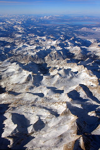
The Sierra Nevada is a mountain range in the Western United States, between the Central Valley of California and the Great Basin. The vast majority of the range lies in the state of California, although the Carson Range spur lies primarily in Nevada. The Sierra Nevada is part of the American Cordillera, an almost continuous chain of mountain ranges that forms the western "backbone" of the Americas.

Esmeralda County is a county in the southwestern portion of the U.S. state of Nevada. As of the 2020 census, the population was 729, making it the least populous county in Nevada, and the 20th least populous county in the United States. Esmeralda County does not have any incorporated communities. Its county seat is the town of Goldfield.
Sierra may refer to the following:

The Humboldt–Toiyabe National Forest (HTNF) is the principal U.S. National Forest in the U.S. state of Nevada, and has a smaller portion in Eastern California. With an area of 6,289,821 acres (25,454.00 km2), it is the largest U.S. National Forest outside of Alaska.
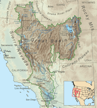
The Great Basin is the largest area of contiguous endorheic watersheds, those with no outlets to the ocean, in North America. It spans nearly all of Nevada, much of Utah, and portions of California, Idaho, Oregon, Wyoming, and Baja California. It is noted for both its arid climate and the basin and range topography that varies from the North American low point at Badwater Basin in Death Valley to the highest point of the contiguous United States, less than 100 miles (160 km) away at the summit of Mount Whitney. The region spans several physiographic divisions, biomes, ecoregions, and deserts.
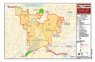
The Black Rock Desert is a semi-arid region of lava beds and playa, or alkali flats, situated in the Black Rock Desert–High Rock Canyon Emigrant Trails National Conservation Area, a silt playa 100 miles (160 km) north of Reno, Nevada, that encompasses more than 300,000 acres (120,000 ha) of land and contains more than 120 miles (200 km) of historic trails. It is in the northern Nevada section of the Great Basin with a lakebed that is a dry remnant of Pleistocene Lake Lahontan.

The Funeral Mountains is a short, arid mountain range in the United States along the California-Nevada border approximately 100 mi (160 km) west of Las Vegas. The mountains are considered a subrange of the Amargosa Range that form the eastern wall of Death Valley.

Lida, Nevada is a small ghost town in Esmeralda County, Nevada, near the border with California. The GNIS classifies it as a populated place. It is located on State Route 266, north of Magruder Mountain.

The Virgin Mountains are a mountain range of the northeastern Mojave Desert, located in Clark County, southeastern Nevada and Mohave County, northwestern Arizona.
The Sylvania Mountains are located in Inyo County, California and Esmeralda County, Nevada in the United States. The range trends in an east–west direction, north of the Last Chance Range at the northern end of Death Valley National Park.

State Route 266 is a 40.338-mile (64.918 km) state highway in Esmeralda County, Nevada, United States. It connects the routing of California State Route 266 east to U.S. Route 95 via the town of Lida. Lida Road previously carried the southern end of State Route 3.

Cottontail Ranch was a legal, licensed brothel in Nevada that opened in October 1967. Located near the intersection of U.S. Route 95 and State Route 266 known as Lida Junction, in Esmeralda County, Nevada. It was also known as the Cottontail Ranch Club.
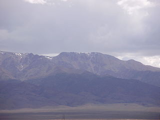
Mount Jefferson is the highest mountain in both the Toquima Range and Nye County in Nevada, United States. It is the sixth highest mountain in the state. As the high point of a range which is well separated from other ranges by low basins, Mount Jefferson has a high topographic prominence of 5,861 feet (1,786 m). This makes it the most prominent peak in Nye County and the third most prominent peak in Nevada. For similar reasons, it is also the highest mountain for over 90 miles in all directions. It is located about 50 miles (80 km) northeast of the county seat of Tonopah within the Alta Toquima Wilderness of the Humboldt-Toiyabe National Forest, near the smaller towns of Carvers and Round Mountain. Three distinct summits are located on a broad area of subalpine tundra: North Summit rises to 11,820 feet (3,603 m), Middle Summit to 11,692 feet (3,564 m), and South Summit to 11,949 feet (3,642 m). During the Pleistocene, alpine glaciers eroded several cirques east of the summit plateau.
Fish Lake Valley is a ghost town located in the geographic Fish Lake Valley, within Esmeralda County, Nevada and Inyo County, California.
The Silver Peak Range is a mountain range in southwest Esmeralda County, Nevada, United States.
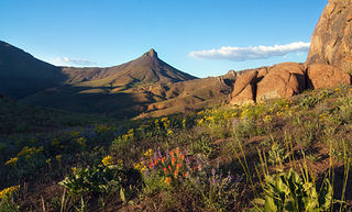
The Trout Creek Mountains are a remote, semi-arid Great Basin mountain range mostly in southeastern Oregon and partially in northern Nevada in the United States. The range's highest point is Orevada View Benchmark, 8,506 feet (2,593 m) above sea level, in Nevada. Disaster Peak, elevation 7,781 feet (2,372 m), is another prominent summit in the Nevada portion of the mountains.

The Mountain states form one of the nine geographic divisions of the United States that are officially recognized by the United States Census Bureau. It is a subregion of the Western United States.

Basin and Range National Monument is a national monument of the United States spanning approximately 704,000 acres of remote, undeveloped mountains and valleys in Lincoln and Nye counties in southeastern Nevada. It is described as "one of the emptiest spaces in a state famous for its emptiness."


