
The Pony Express was an American express mail service that used relays of horse-mounted riders between Missouri and California. It was operated by the Central Overland California and Pikes Peak Express Company.
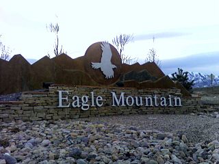
Eagle Mountain is a city in Utah County, Utah. It is part of the Provo–Orem metropolitan area. The city is located to the west as well as north of the Lake Mountains, which are west of Utah Lake. It was incorporated in December 1996 and is rapidly growing. The population was 43,623 at the 2020 census. Eagle Mountain was a town in 2000. It has since been classified as a third-class city in September 2001. In its short history, the city has become known for its rapid growth.

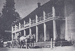
Camp Floyd State Park Museum is a state park in the Cedar Valley in Fairfield, Utah, United States. The park includes a small part of the former Camp Floyd site, the Stagecoach Inn, and the Fairfield District School.

The Central Overland California and Pike's Peak Express Company was a stagecoach line that operated in the American West in the early 1860s, but it is most well known as the parent company of the Pony Express. It was formed as a subsidiary of the freighting company Russell, Majors, and Waddell, after the latter two partners bought out Russell's stage line, the Leavenworth and Pikes Peak Express Company. The stage line had made its first journey from Westport, Missouri, to Denver on March 9, 1859.
Woodfords is an unincorporated community in Alpine County, California, near Markleeville. For census purposes, it is included in Alpine Village. It is located 6 miles (9.7 km) north-northwest of Markleeville, at 38°46′40″N119°49′19″W.

Rock Creek Station was a stagecoach and Pony Express station in southeastern Nebraska, three miles northeast of the present-day village of Endicott. The site is preserved as Rock Creek Station State Historical Park.
The Desatoya Mountains are located in central Nevada in the western United States, approximately 117 miles east of Reno by road. The range runs in a southwest-northeasterly direction along the border of Churchill and Lander counties, reaching a maximum elevation of 9,978 feet (3,041 m) at Desatoya Peak near Rock Creek Canyon.

U.S. Route 50 (US 50) is a transcontinental highway in the United States, stretching from West Sacramento, California, in the west to Ocean City, Maryland, on the east coast. The Nevada portion crosses the center of the state and was named "The Loneliest Road in America" by Life magazine in July 1986. The name was intended as a pejorative, but Nevada officials seized it as a marketing slogan. The name originates from large desolate areas traversed by the route, with few or no signs of civilization. The highway crosses several large desert valleys separated by numerous mountain ranges towering over the valley floors, in what is known as the Basin and Range province of the Great Basin.

Ruby Valley is a large basin located in south-central Elko and northern White Pine counties in the northeastern section of the state of Nevada in the western United States. From Secret Pass it runs south-southwest for approximately 60 miles (96 km) to Overland Pass. To the west is the steep escarpment of the Ruby Mountains, and to the north is the East Humboldt Range and Clover Valley. The east side of the valley is less well defined, but its maximum width is about 10 miles (16 km) near Franklin Lake. At its south end lies the Ruby Lake National Wildlife Refuge.
James Hervey Simpson (1813–1883) was an officer in the U.S. Army and a member of the United States Corps of Topographical Engineers.
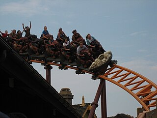
Pony Express is a steel motorbike roller coaster at Knott's Berry Farm in Buena Park, California. It is the first motocoaster built by Zamperla in the United States, opening on May 22, 2008. The ride features motorbike-style seating and a flywheel launch system.
Meyers is a small unincorporated community in El Dorado County, California, United States, along U.S. Route 50 in the northern Sierra Nevada. It is 6 miles (10 km) south of South Lake Tahoe in the Lake Tahoe area and lies at an elevation of 6,352 feet. Established in 1851, Meyers started out as a stagecoach stop, trading post and Pony Express station. The town is now registered as California Historical Landmark #708. It serves as a popular stop on the way into and out of the Tahoe Basin for travelers on Highway 50 and Highway 89.

The Hollenberg Pony Express Station, also known as Cottonwood Pony Express Station, is the most intact surviving station of the Pony Express in the United States. It was built by Gerat H. Hollenberg in 1858, to serve travelers on the Oregon and California Trails, and was used by the Pony Express when it was established in 1860. The station is owned by the state of Kansas and is operated by the Kansas Historical Society as Hollenberg Pony Express Station State Historic Site. It was designated a National Historic Landmark in 1961.
Simpson Springs is a spring, former Pony Express station, former Civilian Conservation Corps camp, and campground in southeast Tooele County, Utah, United States.

Middlegate is an unincorporated hamlet along "The Loneliest Road In America," U.S. Route 50, in Churchill County, Nevada, United States. The community consists of a commercial rest stop with food, fuel and lodging accommodations, and some ranches and other private properties in the nearby area. The last recorded population for the hamlet itself was 17 permanent residents.

The Ruby Valley Pony Express Station, located at 1515 Idaho St. in Elko, Nevada, was built in 1860 in Ruby Valley, Nevada. It was moved in 1960 approximately 60 miles (97 km) to Elko, during the centennial anniversary year for the Pony Express, and then restored, and is listed on the National Register of Historic Places. The building is significant as one of only two surviving Pony Express buildings in Nevada, out of 43 stations in Nevada.

The Mud Springs Station Archaeological District, which includes the Mud Springs Pony Express Station Site, near Dalton, Nebraska, has significance dating to the mid-19th century. The Pony Express station at Mud Springs, staffed by U.S. soldiers, was attacked by Lakota, Cheyenne, and Arapaho tribesmen during February 4–6, 1865, in what became known as the Battle of Mud Springs.
Friday's Station, on US 50 between Kingsbury Grade and Loop Road in Stateline, Nevada, is a two-story wood-frame white building built as a Pony Express station and inn in 1860. In 1986, it was known as Park Cattle Company Residence and was listed on the National Register of Historic Places. The two-story wood-frame white building is visible from U.S. Route 50 near the California-Nevada border at Stateline, Nevada.

Granger Station State Historic Site, also known as Granger Stage Station, South Bend Station and Ham's Fork Station, is a state park in Granger, Wyoming, United States, that is listed on the National Register of Historic Places (NRHP).
Jacobsville is a ghost town located in Lander County, Nevada, six miles west of Austin, on the east bank of Reese River, 0.7 mi N of US 50. Jacobsville was also known as Jacobs Spring, Jacobsville Station, Reese River and Reese River Station.

