
Ballari in the eponymous Ballari district, is a city in the state of Karnataka, India. Bellari houses many steel plants such as JSW Vijayanagar, one of the largest in Asia.
Kampli is a town in the Bellary district, Kampli taluk, in the Indian state of Karnataka. It is a headquarters of Kampli Taluk. The town is situated about 15 km away from Hampi.
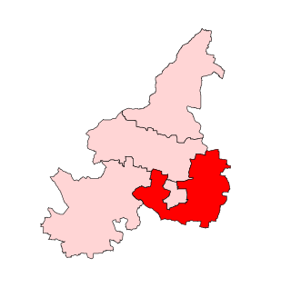
Siruguppa is a town and headquarters of the Siruguppa taluk and second largest city in Ballari district after Hospete carved out of Ballari district of Indian state of Karnataka.
Kolur is a village in the southern state of Karnataka, India. It is located in the Bellary taluk of Bellary district in Karnataka.
Arsikeri or Arasikere is a hobli and major village/town in the Harapanahalli Taluk of Vijayanagara District in the state of Karnataka, India. It is located in the 15km away from Harapanahalli city in Karnataka, and it was lied in state highway 47.
Amalpura is a village in the southern state of Karnataka, India.
Ammanakeri is a village in the southern state of Karnataka, India.
Andralu is a village in the southern state of Karnataka, India.
Kesarakoni is a village in the southern state of Karnataka, India.
Ramasgar is a village in Sandur Taluk, Ballari district of the southern state of Karnataka, India.
Haravanahalli is a village in the southern state of Karnataka, India.
Kenchamallanahalli is a village in the southern state of Karnataka, India.
Paramadevanahalli is a village in the southern state of Karnataka, India.
Gandabommanahalli is a village in the southern state of Karnataka, India.
Hanumagondanahalli is a village in the southern state of Karnataka, India.
Kakkabevinahalli is a village in the southern state of Karnataka, India.
Kodalu is a village in the southern state of Karnataka, India.
Kogali is a village in the southern state of Karnataka, India. This village is located in Hagaribommanahalli Tehsil of Bellary district in Karnataka, India. It is situated 22 km away from sub-district headquarter Hagari bommanahalli and 122 km away from district headquarter Bellary.
Bellary Rural Assembly seat is one of the 224 seats in the Karnataka State Assembly in India. It is part of Bellary Lok Sabha constituency. The constituency has been reserved for Scheduled Tribes since the 2008 delimitation. It is a stronghold of B. Sriramulu. It consists of 11 wards of Bellary City. The areas Cowl Bazar, TB Sanatorium, and Contonment belong to this constituency. It has both urban and rural voters.

Bellary City Assembly constituency is one of the seats in Karnataka State Assembly in India. It is part of Bellary Lok Sabha constituency. The constituency includes 28 wards of Ballari Mahanagara Palika. The constituency came into existence after the 2008 delimitation. It was a part of Bellary Rural Assembly constituency.
