Slaithwaite Town Hall

Last updated

Slaithwaite Town Hall
Town Hall, Lewisham Road, Slaithwaite - geograph.org.uk - 880404.jpg
Slaithwaite Town Hall
LocationLewisham Road, Slaithwaite
Coordinates 53°37′24″N1°52′51″W / 53.6232°N 1.8809°W / 53.6232; -1.8809
Built1892
ArchitectJames B. Eagland
Architectural style(s) Neoclassical style
West Yorkshire UK location map.svg
Red pog.svg
Shown in West Yorkshire

Slaithwaite Town Hall, also known as Empire House is a former municipal building in Lewisham Road in the town of Slaithwaite, West Yorkshire, England. The building, which served as the offices of Colne Valley Urban District Council, is now a business centre.

History

Following significant population growth, largely associated with the woollen industry, a local board of health was established in the Slaithwaite area in 1862. [1] In the late 1880s, the local board decided to commission purpose-built public offices for the area: the site they chose was open land at the junction of Station Road and Lewisham Road. [2] The foundation stone for the new building was laid by the proprietor of the Slaithwaite Spinning Company, [3] William Varley, on 19 May 1892. [4] It was designed by a local architect, James B. Eagland, in the neoclassical style, built in limestone brick and was completed later that year. [5]

The design involved a symmetrical main frontage with five bays facing onto the Lewisham Road; the second bay from the left, which projected forward, was fenestrated by a segmental window on the ground floor and a sash window on the first floor and was surmounted by a Dutch gable with a projecting flagpole. The other bays were fenestrated by segmental windows on the ground floor, and by casement windows with window cills and alternating triangular and segmental pediments on the first floor. Internally, the principal room was the board room for the local board. [4]

The local board was replaced by Slaithwaite Urban District Council, with its headquarters in the former public offices, in 1894. [6] [7] The building acted as the venue for parliamentary election results and it was there that the Reverend Charles Leach was duly elected member of parliament for Colne Valley at the January 1910 general election. [8] Leach went on to serve as a hospital visitor during the First World War and his seat was declared vacant under the Lunacy (Vacating of Seats) Act in August 1916, when he became the only member of parliament ever to be disqualified under that Act. [9]

A war memorial, in the form of a stone cross on a plinth, which was intended to commemorate the lives of local service personnel who died in the First World War, was erected to the immediate west of the town hall in the 1920s. [10] [11] An underground air raid shelter was established in the grounds during the Second World War. [12]

The building continued to serve as the headquarters of Colne Valley Urban District Council after it was formed in 1937, [13] but it ceased to be the local seat of government when the enlarged Kirklees Council was formed in 1974. [14] The building went on to become the offices of a fashion exhibition organiser and then, after a change of ownership in October 2019 and a programme of refurbishment works costing £450,000, it re-opened as a business centre known as Empire House in July 2021. [15] [16] [17]

Related Research Articles

<span class="mw-page-title-main">Holmfirth</span> Town in West Yorkshire, England

Holmfirth is a town in the Metropolitan Borough of Kirklees, West Yorkshire, England. It is located 6 miles (9.7 km) south of Huddersfield and 14 miles (23 km) west of Barnsley; the boundary of the Peak District National Park is 2 miles (3.2 km) to the south-west. The town is sited on the A635 and A6024 roads in the Holme Valley, at the confluence of the River Holme and Ribble. It mostly consists of stone-built cottages nestled on the eastern slopes of the Pennine hills.

<span class="mw-page-title-main">Marsden, West Yorkshire</span> Village in West Yorkshire, England

Marsden is a large village in the Colne Valley, in the metropolitan borough of Kirklees, West Yorkshire, England. It is in the South Pennines close to the Peak District which lies to the south. The village is 7 miles (11 km) west of Huddersfield at the confluence of the River Colne and Wessenden Brook. It was an important centre for the production of woollen cloth. In 2020, the village had an estimated population of 3,768.

<span class="mw-page-title-main">Slaithwaite</span> Town in West Yorkshire, England

Slaithwaite is a town and former civil parish in the Colne Valley area of the metropolitan borough of Kirklees, in West Yorkshire, England. Historically part of the West Riding of Yorkshire, it lies in the Colne Valley, lying across the River Colne and the Huddersfield Narrow Canal, approximately 5 miles (8 km) south-west of Huddersfield.

<span class="mw-page-title-main">Huddersfield</span> Town in West Yorkshire, England

Huddersfield is a market town in the Kirklees district in West Yorkshire, England. It is the administrative centre and largest settlement in the Kirklees district. The town is in the foothills of the Pennines. The River Holme's confluence into the similar-sized Colne is to the south of the town centre which then flows into the Calder in the north eastern outskirts of the town.

<span class="mw-page-title-main">Huddersfield Broad Canal</span> Navigation canal in West Yorkshire, England

<span class="mw-page-title-main">Colne Valley</span> Valley in West Yorkshire, England

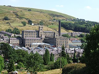
The Colne Valley is a steep sided valley on the east flank of the Pennine Hills in the English county of West Yorkshire. It takes its name from the River Colne which rises above the town of Marsden and flows eastward towards Huddersfield.

<span class="mw-page-title-main">Colne Valley (UK Parliament constituency)</span> Parliamentary constituency in the United Kingdom

Colne Valley is a constituency represented in the House of Commons of the UK Parliament since 2019 by Jason McCartney of the Conservative Party.

<span class="mw-page-title-main">Royds Hall Academy</span> Secondary school in West Yorkshire, England

Royds Hall Academy is a mixed secondary school for pupils aged 11 – 16. It is located in Huddersfield, West Yorkshire, England, and on the north side of the Colne Valley towards Milnsbridge.

<span class="mw-page-title-main">Nettleton Hill</span> Hamlet in West Yorkshire, England

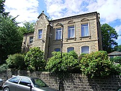
Nettleton Hill is a hamlet in the Kirklees district in the English county of West Yorkshire. It is situated west of the town of Huddersfield, north of Scapegoat Hill and south of Pighill Wood. Longwood reservoir is to the east of the settlement. Nettleton Hill is part of the Golcar ward and of the HD7 postcode district.

<span class="mw-page-title-main">Lewisham Town Hall</span> Municipal building in London, England

Lewisham Town Hall is a municipal building in Catford Road, Lewisham, London. The oldest part of the facility, the curved municipal offices, which is the headquarters of Lewisham London Borough Council, is a Grade II listed building.

<span class="mw-page-title-main">Elland Town Hall</span> Municipal building in Elland, West Yorkshire, England

Elland Town Hall is a municipal building in Southgate, Elland, West Yorkshire, England. The structure, which was primarily used as an events venue, is a Grade II listed building.

<span class="mw-page-title-main">Knottingley Town Hall</span> Municipal building in Knottingley, West Yorkshire, England

Knottingley Town Hall is a municipal building in Weeland Road, Knottingley, West Yorkshire, England. The structure, which served as the headquarters of Knottingley Urban District Council, now operates as a community centre.

<span class="mw-page-title-main">Horbury Town Hall</span> Municipal building in Horbury, West Yorkshire, England

Horbury Town Hall is a former municipal building in Westfield Road, Horbury, West Yorkshire, England. The structure, which is now used as business centre, is a locally listed building.

<span class="mw-page-title-main">Hanley Town Hall</span> Municipal building in Hanley, Staffordshire, England

Hanley Town Hall is a municipal building in Albion Square in Hanley, Staffordshire, England. The building, which is used as the local register office, is a Grade II listed building.

<span class="mw-page-title-main">Felixstowe Town Hall</span> Municipal building in Felixstowe, Suffolk, England

Felixstowe Town Hall is a municipal building in Undercliff Road West, Felixstowe, Suffolk, England. The building is the meeting place of Felixstowe Town Council.

<span class="mw-page-title-main">Meltham Town Hall</span> Municipal building in Cottingley, West Yorkshire, England

Meltham Town Hall is a municipal building in Carlile Street in Meltham, West Yorkshire, England. The building, which formerly operated as the offices of Meltham Urban District Council, is now The Crossroads Centre, which operates the local foodbank.

<span class="mw-page-title-main">Liversedge Town Hall</span> Municipal building in Liversedge, West Yorkshire, England

Liversedge Town Hall is a former municipal building and town hall on Knowler Hill in the town of Liversedge, West Yorkshire, England. The building, which formerly operated as the offices of Liversedge Urban District Council, is now used as private residential accommodation.

<span class="mw-page-title-main">Sowerby Bridge Town Hall</span> Municipal building in Sowerby Bridge, West Yorkshire, England

Sowerby Bridge Town Hall is a former municipal building in Town Hall Street in Sowerby Bridge, West Yorkshire, England. The building, which was initially used as the offices of the local board of health and as a public events venue, then as the home of the local Liberal Club and later as a bank branch, is a Grade II listed building.

<span class="mw-page-title-main">Denny Town House</span> Municipal building in Denny, Scotland

Denny Town House is a municipal building in Glasgow Road, Denny, Falkirk, Scotland. The structure is used by Falkirk Council for the provision of local services.

<span class="mw-page-title-main">Carlow Town Hall</span> Municipal building in Carlow, County Carlow, Ireland

Carlow Town Hall is a municipal building in Centaur Street, Carlow, County Carlow, Ireland. The building accommodated the offices of Carlow Town Council until 2014 but is now used as a community events venue.

References

  1. "Slaithwaite Local Board". Huddersfield Exposed. Retrieved 9 May 2022.
  2. "Ordnance Survey Map". 1888. Retrieved 8 May 2022.
  3. "Contracts Open". The British Architect and Northern Engineer. 9 March 1877. p. 156. Retrieved 9 May 2022.
  4. 1 2 "Public Offices, Slaithwaite, Yorkshire". The Builder. 28 May 1892. p. 424. Retrieved 9 May 2022.
  5. "Town Hall, Lewisham Road, Slaithwaite". Huddersfield Exposed. Retrieved 9 May 2022.
  6. "Slaithwaite UD". Vision of Britain. Retrieved 7 May 2022.
  7. "No. 28174". The London Gazette . 4 September 1908. p. 6452.
  8. Williams, J. B. (2009). Worsted to Westminster: The Extraordinary Life of the Rev Dr Charles Leach MP. Darcy Press. p. 211. ISBN   978-0956252302.
  9. "Causes of Byelections since the Reform Act". Archived from the original on 8 August 2011. Retrieved 27 January 2007.
  10. "War Memorial, Slaithwaite". Traces of War. Retrieved 9 May 2022.
  11. "Slaithwaite War Memorial". Memorials Online. Retrieved 9 May 2022.
  12. "Offices and Business Members' Club set top open in historic building". Insider Media. 28 February 2020. Retrieved 9 May 2022.
  13. "No. 45995". The London Gazette . 1 June 1973. p. 6959.
  14. Local Government Act 1972. 1972 c.70. The Stationery Office Ltd. 1997. ISBN   0-10-547072-4.
  15. "West Yorkshire 'luxury' business club to launch following £450k investment". B Daily News. 27 February 2020. Retrieved 9 May 2022.
  16. "Old Town Hall in Slaithwaite is set to be a luxurious business centre and will boast its own bar". Yorkshire Live. 11 November 2020. Retrieved 9 May 2022.
  17. "About us". Empire House. Retrieved 9 May 2022.