Smithers Creek

Last updated
Smithers Creek
Smithers Creek WV.jpg
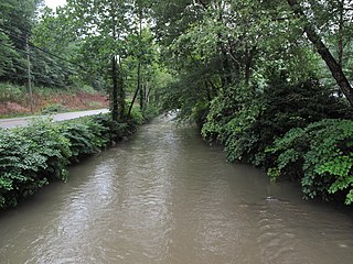
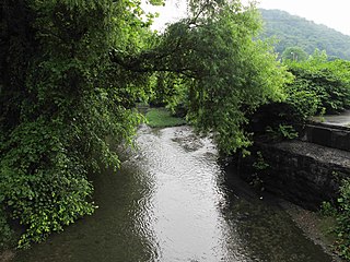
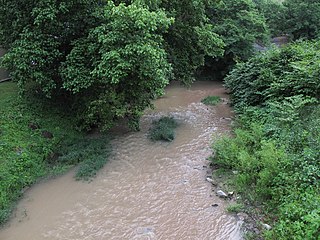
Smithers Creek in Smithers
Country United States
State West Virginia
County Fayette
Source
 - location Mount Olive
 - elevation 1,477 ft (450 m) [1]
 - coordinates 38°14′18″N81°14′09″W / 38.2384388°N 81.2359437°W / 38.2384388; -81.2359437   [2]
Mouth Kanawha River
 - location Smithers
 - elevation 640 ft (195 m) [2]
 - coordinates 38°10′51″N81°18′38″W / 38.1809390°N 81.3106669°W / 38.1809390; -81.3106669 Coordinates: 38°10′51″N81°18′38″W / 38.1809390°N 81.3106669°W / 38.1809390; -81.3106669   [2]
Length 7 mi (11 km)
Basin 18.1 sq mi (47 km2)
Hydrologic Unit Code 050500060303 (USGS)
Smithers Creek WV map.png
A map of Smithers Creek and its watershed

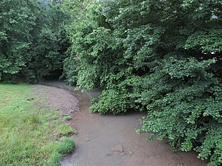
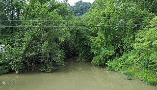
Smithers Creek is a tributary of the Kanawha River, 7 miles (11 km) long, [3] in southern West Virginia in the United States. Via the Kanawha and Ohio rivers, it is part of the watershed of the Mississippi River, draining an area of 18.1 square miles (47 km2) [4] on the unglaciated portion of the Allegheny Plateau. The creek flows for its entire length in western Fayette County; its tributaries additionally drain a portion of eastern Kanawha County.

Tributary stream or river that flows into a main stem river or lake

A tributary or affluent is a stream or river that flows into a larger stream or main stem river or a lake. A tributary does not flow directly into a sea or ocean. Tributaries and the main stem river drain the surrounding drainage basin of its surface water and groundwater, leading the water out into an ocean.

Kanawha River river in the United States of America

The Kanawha River is a tributary of the Ohio River, approximately 97 mi (156 km) long, in the U.S. state of West Virginia. The largest inland waterway in West Virginia, it has formed a significant industrial region of the state since early in the 19th century.

Southern West Virginia

Southern West Virginia is a culturally and geographically distinct region in the U.S. state of West Virginia. Generally considered the heart of Appalachia, Southern West Virginia is known for its coal mining heritage and Southern affinity. The region is also closely identified with southwestern Virginia and southeastern Kentucky, with close proximity to northwestern North Carolina and East Tennessee. Today, Southern West Virginia continues to grapple with poverty and continuing population loss. Almost the entire region is located in West Virginia's 3rd congressional district, which was represented by Evan Jenkins until he resigned on September 30, 2018 to take a seat as a Justice on the Supreme Court of Appeals of West Virginia.

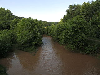
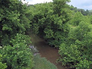
Smithers Creek rises in the unincorporated community of Mount Olive and flows generally southwestward through the unincorporated communities of Marting and Cannelton, to the city of Smithers, where it flows into the Kanawha River. The creek is paralleled by a county road for most of its course. [5] [6]

Mount Olive, Fayette County, West Virginia Unincorporated community in West Virginia, United States

Mount Olive is an unincorporated community in Fayette County, West Virginia, United States. Mount Olive is 5.5 miles (8.9 km) north-northwest of Gauley Bridge. The town itself has no ZIP code; however, Mount Olive Correctional Complex, West Virginia's maximum-security state prison, is located near the town and has a post office with ZIP code 25185.

Marting, West Virginia Unincorporated community in West Virginia, United States

Marting is an unincorporated community and coal town in Fayette County, West Virginia, along Smithers Creek.

Cannelton, West Virginia Unincorporated community in West Virginia, United States

Cannelton is an unincorporated community in Fayette County, West Virginia, United States. Cannelton is 1 mile (1.6 km) northeast of Smithers, along Smithers Creek. Cannelton has a post office with ZIP code 25036. The community was named for the deposits of cannel coal in the area.

The Geographic Names Information System lists "Smothers Creek," "Smuthers Creek," and "Smythers Creek" as historical variant names for the creek. [2]

Geographic Names Information System geographical database

The Geographic Names Information System (GNIS) is a database that contains name and locative information about more than two million physical and cultural features located throughout the United States of America and its territories. It is a type of gazetteer. GNIS was developed by the United States Geological Survey in cooperation with the United States Board on Geographic Names (BGN) to promote the standardization of feature names.

See also

Related Research Articles

Cedar Creek (West Virginia) tributary of the Little Kanawha River in central West Virginia in the United States

Cedar Creek is a tributary of the Little Kanawha River, 31.7 miles (51.0 km) long, in central West Virginia in the United States. Via the Little Kanawha and Ohio rivers, it is part of the watershed of the Mississippi River, draining an area of 81 square miles (210 km2) in a rural region on the unglaciated portion of the Allegheny Plateau.

Spring Creek (Little Kanawha River) tributary of the Little Kanawha River in western West Virginia

Spring Creek is a tributary of the Little Kanawha River in western West Virginia in the United States. Via the Little Kanawha and Ohio rivers, it is part of the watershed of the Mississippi River, draining an area of 89 square miles (230 km2) in a rural region on the unglaciated portion of the Allegheny Plateau. It is 25.3 miles (40.7 km) long, or 33.3 miles (53.6 km) long including its Left Fork.

Tygart Creek river in the United States of America

Tygart Creek is a tributary of the Little Kanawha River, 14.5 miles (23.3 km) long, in western West Virginia in the United States. Via the Little Kanawha and Ohio rivers, it is part of the watershed of the Mississippi River, draining an area of 51 square miles (130 km2) on the unglaciated portion of the Allegheny Plateau.

Steer Creek (West Virginia) river in the United States of America

Steer Creek is a tributary of the Little Kanawha River in central West Virginia in the United States. Via the Little Kanawha and Ohio rivers, it is part of the watershed of the Mississippi River, draining an area of 184 square miles (480 km2) in a rural region on the unglaciated portion of the Allegheny Plateau. It is 6.3 miles (10.1 km) long, or 31.7 miles (51.0 km) long including its Right Fork.

Reedy Creek (West Virginia) river in the United States of America

Reedy Creek is a tributary of the Little Kanawha River in western West Virginia in the United States. Via the Little Kanawha and Ohio rivers, it is part of the watershed of the Mississippi River, draining an area of 133 square miles (340 km2) in a rural region on the unglaciated portion of the Allegheny Plateau. It is 22.6 miles (36.4 km) long, or 38.5 miles (62.0 km) long including its Left Fork.

Leading Creek (Little Kanawha River tributary) river in the United States of America

Leading Creek is a tributary of the Little Kanawha River, 28.6 miles (46.0 km) long, in central West Virginia in the United States. Via the Little Kanawha and Ohio rivers, it is part of the watershed of the Mississippi River, draining an area of 147 square miles (380 km2) in a rural region on the unglaciated portion of the Allegheny Plateau.

Walker Creek (West Virginia) river in the United States of America

Walker Creek is a tributary of the Little Kanawha River, 15.6 miles (25.1 km) long, in western West Virginia in the United States. Via the Little Kanawha and Ohio rivers, it is part of the watershed of the Mississippi River, draining an area of 32 square miles (83 km2) on the unglaciated portion of the Allegheny Plateau.

Cabin Creek (West Virginia) river in the United States of America

Cabin Creek is a tributary of the Kanawha River, 22.7 miles (36.5 km) long, in West Virginia in the United States. Via the Kanawha and Ohio rivers, it is part of the watershed of the Mississippi River, draining an area of 72.6 square miles (188 km2) in a coal mining region on the unglaciated portion of the Allegheny Plateau.

Armstrong Creek (West Virginia) river in the United States of America

Armstrong Creek is a tributary of the Kanawha River, 8.6 miles (13.8 km) long, in southern West Virginia in the United States. Via the Kanawha and Ohio rivers, it is part of the watershed of the Mississippi River, draining an area of 22.8 square miles (59 km2) on the unglaciated portion of the Allegheny Plateau. The creek flows for its entire length in western Fayette County; its tributaries additionally drain a small portion of eastern Kanawha County.

Loop Creek (West Virginia) river in West Virginia, United States of America

Loop Creek, also known by the spelling Loup Creek, is a tributary of the Kanawha River, 20 miles (32 km) long, in southern West Virginia in the United States. Via the Kanawha and Ohio rivers, it is part of the watershed of the Mississippi River, draining an area of 49.6 square miles (128 km2) in a coal mining region on the unglaciated portion of the Allegheny Plateau.

Kellys Creek (West Virginia) river in the United States of America

Kellys Creek is a tributary of the Kanawha River, 6.5 miles (10.5 km) long, in West Virginia in the United States. Via the Kanawha and Ohio rivers, it is part of the watershed of the Mississippi River, draining an area of 24.7 square miles (64 km2) in a coal mining region on the unglaciated portion of the Allegheny Plateau.

Witcher Creek river in the United States of America

Witcher Creek is a tributary of the Kanawha River, 6.8 miles (10.9 km) long, in West Virginia in the United States. Via the Kanawha and Ohio rivers, it is part of the watershed of the Mississippi River, draining an area of 20.8 square miles (54 km2) on the unglaciated portion of the Allegheny Plateau.

Lens Creek river in the United States of America

Lens Creek is a tributary of the Kanawha River, 6.4 miles (10.3 km) long, in West Virginia in the United States. Via the Kanawha and Ohio rivers, it is part of the watershed of the Mississippi River, draining an area of 19.9 square miles (52 km2) on the unglaciated portion of the Allegheny Plateau, in the Charleston metropolitan area.

Campbells Creek (West Virginia) river in the United States of America

Campbells Creek is a tributary of the Kanawha River, 18.5 miles (29.8 km) long, in West Virginia in the United States. Via the Kanawha and Ohio rivers, it is part of the watershed of the Mississippi River, draining an area of 39.3 square miles (102 km2) on the unglaciated portion of the Allegheny Plateau, in the Charleston metropolitan area.

Twomile Creek (Kanawha River) river in the United States of America

Twomile Creek is a tributary of the Kanawha River, 4.7 miles (7.6 km) long, in West Virginia in the United States. Via the Kanawha and Ohio rivers, it is part of the watershed of the Mississippi River, draining an area of 24.4 square miles (63 km2) on the unglaciated portion of the Allegheny Plateau, in the city of Charleston and its vicinity.

Davis Creek (Kanawha River tributary) river in the United States of America

Davis Creek is a tributary of the Kanawha River, 9.4 miles (15.1 km) long, in West Virginia in the United States. Via the Kanawha and Ohio rivers, it is part of the watershed of the Mississippi River, draining an area of 47.1 square miles (122 km2) on the unglaciated portion of the Allegheny Plateau, in the Charleston metropolitan area.

McElroy Creek river in the United States of America

McElroy Creek is a tributary of Middle Island Creek, 22.1 miles (35.6 km) long, in northern West Virginia in the United States. Via Middle Island Creek and the Ohio River, it is part of the watershed of the Mississippi River, draining an area of 106.2 square miles (275 km2) in a rural region on the unglaciated portion of the Allegheny Plateau.

Flint Run (West Virginia) river in the United States of America

Flint Run is a tributary of McElroy Creek, 7.5 miles (12.1 km) long, in northern West Virginia in the United States. Via McElroy Creek, Middle Island Creek, and the Ohio River, it is part of the watershed of the Mississippi River, draining an area of 25.6 square miles (66 km2) in a rural region on the unglaciated portion of the Allegheny Plateau.

Sugar Creek (Middle Island Creek) river in the United States of America

Sugar Creek is a tributary of Middle Island Creek, 15 miles (24 km) long, in northwestern West Virginia in the United States. Via Middle Island Creek and the Ohio River, it is part of the watershed of the Mississippi River, draining an area of 22.1 square miles (57 km2) in a rural region on the unglaciated portion of the Allegheny Plateau.

McKim Creek (West Virginia) river in the United States of America

McKim Creek is a tributary of Middle Island Creek, 20.4 miles (32.8 km) long, in northwestern West Virginia in the United States. Via Middle Island Creek and the Ohio River, it is part of the watershed of the Mississippi River, draining an area of 37.3 square miles (97 km2) in a rural region on the unglaciated portion of the Allegheny Plateau.

References

  1. The National Map elevation for GNIS source coordinates. Retrieved 2013-11-22.
  2. 1 2 3 4 Geographic Names Information System. "Geographic Names Information System entry for Smithers Creek (Feature ID #1547008)" . Retrieved 2013-11-22.
  3. United States Environmental Protection Agency. "West Virginia, Upper Kanawha Watershed". Archived from the original on 2013-11-15. Retrieved 2013-11-22.
  4. U.S. Geological Survey. National Hydrography Dataset, area data for Smithers Creek watershed, 12-digit Hydrologic Unit Code 050500060303. The National Map, retrieved 2013-11-22
  5. The National Map, accessed 2013-11-22
  6. West Virginia Atlas & Gazetteer. Yarmouth, Me.: DeLorme. 1997. p. 53. ISBN   0-89933-246-3.