Smoke Rise is a residential community in DeKalb County, Georgia, United States, located northeast of Atlanta in the City of Tucker, incorporated in 2016. It is located north of the city of Stone Mountain on the eastern side of the city of Tucker.
Smoke Rise is a residential community in DeKalb County, Georgia, United States, located northeast of Atlanta in the City of Tucker, incorporated in 2016. It is located north of the city of Stone Mountain on the eastern side of the city of Tucker.
33°50′40″N84°09′55″W / 33.84444°N 84.16528°W
Municipalities and communities of DeKalb County, Georgia, United States | ||
|---|---|---|
| Cities | 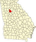 | |
| CDPs | ||
| Neighborhoods and unincorporated communities | ||
| Ghost town | ||
| Footnotes | ‡This populated place also has portions in an adjacent county or counties | |