
Burnie is a port city in Tasmania, Australia, located in Emu Bay on the north-west coast, 47 kilometres (29 mi) west from Devonport and 17 kilometres (11 mi) east from Wynyard. With an urban population of 19,550 in 2019, Burnie is the fourth largest city in Tasmania, serving as a major port for north-western agricultural and mining industries.
Waratah-Wynyard Council is a local government body in Tasmania, situated in the north-west of the state. Waratah-Wynyard is classified as a rural local government area and has a population of 13,800, the major towns and localities of the region include Savage River, Sisters Beach, Somerset, Waratah and the principal town of Wynyard.

Wynyard (/ˈwɪnjɚd/) wi-nyuhd) is a rural town located on the North West coast of Tasmania, Australia. Wynyard is situated 17 kilometres (11 mi) west of Burnie. As of the 2021 census, Wynyard has an estimated population of 6,296. The town is a regional hub servicing the surrounding rural areas. The main council offices for the Waratah-Wynyard local government area are located in Wynyard.
Hellyer College is a government comprehensive senior secondary school located in Burnie in north-western Tasmania, Australia. Established in 1976, the college caters for approximately 630 students in Years 11 and 12 and is administered by the Tasmanian Department of Education. Hellyer College is situated on the same campus as the TAFE Tasmania and 250 metres (820 ft) from the Cradle Coast campus of the University of Tasmania, on Mooreville Road.
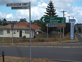
The Murchison Highway is a highway located in the West Coast region of Tasmania, Australia. The 147-kilometre (91 mi) highway runs generally north–south, with Somerset, near Burnie, as its northern terminus and Zeehan as its southern terminus. The highway was opened on 13 December 1963. Part of the highway from Waratah to Burnie was known as the Waratah Highway until 1973.

The electoral division of Murchison is one of the fifteen electorates in the Tasmanian Legislative Council, situated in the western/north-west region of the state. It is the largest electorate in size, covering an area of 19,391 km² and includes the municipalities of Circular Head, King Island, Waratah-Wynyard, West Coast and part of Burnie City.
Guildford is a rural locality in the local government area (LGA) of Waratah–Wynyard in the North-west and west LGA region of Tasmania. The locality is about 81 kilometres (50 mi) south of the town of Wynyard. The 2016 census has a population of nil for the state suburb of Guildford.

Burnie City Council is a local government body in Tasmania, located in the city and surrounds of Burnie in the north-west of the state. The Burnie local government area is classified as urban and has a population of 19,348, which also encompasses Cooee, Hampshire, Natone and Ridgley.

Cooee is a small town on the north-west coast of Tasmania immediately west of Burnie, to which it is in effect a dormitory suburb. At the 2011 census, Cooee had a population of 559.
Doctors Rocks is a rural locality in the local government area (LGA) of Waratah–Wynyard in the North-west and west LGA region of Tasmania. The locality is about 8 kilometres (5.0 mi) east of the town of Wynyard. The 2016 census has a population of 85 for the state suburb of Doctors Rocks.
Hampshire is a semi-rural locality in the local government areas (LGA) of Waratah Wynyard and Burnie in the North-west and west LGA region of Tasmania. The locality is about 30 kilometres (19 mi) south-west of the town of Burnie. The 2016 census has a population of 51 for the state suburb of Hampshire.
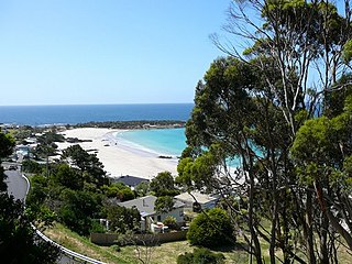
Boat Harbour Beach is a small seaside township located about 15 kilometres (9.3 mi) from Wynyard on the north-west coast of Tasmania. "Boat Harbour" is the name of the locality which surrounds the township. In the 2011 census, Boat Harbour Beach, Boat Harbour and the nearby districts had a population of 429.

North West Tasmania is one of the regions of Tasmania in Australia. The region comprises the whole of the north west, including the North West Coast and the northern reaches of the West Coast. It is usually accepted as extending as far south as the Pieman River and including the Savage River National Park within the Tarkine region.

The Cam River estuary is located in Somerset roughly halfway between the township of Wynyard and the city of Burnie on the North West Coast of Tasmania. The northern part of the Cam River forms part of the boundary between the City of Burnie and Waratah-Wynyard local government areas.
Camdale is a locality and small rural community in the local government area of Burnie, in the North West region of Tasmania. It is located about 7.5 kilometres (4.7 mi) west of the town of Burnie. The Cam River forms its western boundary, Bass Strait the northern boundary, and the Bass Highway follows the northern boundary. The 2016 census determined a population of 72 for the state suburb of Camdale.
Mount Hicks is a locality and small rural community in the local government area of Waratah-Wynyard in the North West region of Tasmania. It is located about 13 kilometres (8.1 mi) south of the town of Wynyard. The 2016 census determined a population of 351 people for the state suburb of Mount Hicks.
Oonah is a rural locality in the local government areas of Burnie and Waratah-Wynyard in the North West region of Tasmania. It is located about 38 kilometres (24 mi) south-west of the town of Burnie. The 2016 census determined a population of nil for the state suburb of Oonah.
Henrietta is a rural locality in the local government area of Waratah-Wynyard in the North West region of Tasmania. It is located about 25 kilometres (16 mi) south of the town of Wynyard. The 2016 census determined a population of 132 for the state suburb of Henrietta.
Elliott is a rural locality in the local government area of Waratah-Wynyard in the North West region of Tasmania. It is located about 21 kilometres (13 mi) south-east of the town of Wynyard. The 2016 census determined a population of 352 for the state suburb of Elliott.
Parrawe is a rural locality in the local government areas (LGA) of Burnie and Waratah–Wynyard in the North-west and west LGA region of Tasmania. The locality is about 58 kilometres (36 mi) south-west of the town of Burnie. The 2016 census recorded a population of nil for the state suburb of Parrawe.


