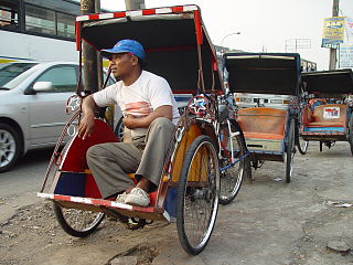
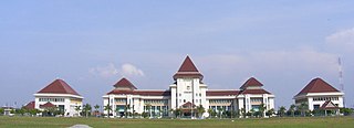
East Jakarta, abbreviated as Jaktim, is the largest of the five administrative cities which form the Special Capital Region of Jakarta, Indonesia, with a land area of 188.03 km2. It had a population of 2,693,896 at the 2010 Census and 3,037,139 at the 2020 Census; the official estimate as at mid 2023 was 3,315,114, making it the most populous of the five administrative cities within Jakarta. East Jakarta is not self-governed and does not have a city council, hence it is not classified as a proper municipality.

South Jakarta, abbreviated as Jaksel, is one of the five administrative cities which form the Special Capital Region of Jakarta, Indonesia. South Jakarta is not self-governed and does not have a city council, hence it is not classified as a proper municipality. It covers a land area of 141.27 km2, and had a population of 2,062,232 at the 2010 census and 2,226,812 at the 2020 census, and 2,409,380 as at mid 2022 according to the official estimates. It is the third most populous among the five administrative cities of Jakarta, after East Jakarta and West Jakarta. The administrative centre is at Kebayoran Baru.

South Solok Regency is a landlocked regency (kabupaten) of West Sumatra province, Indonesia. It covers an area of 3,282.14 km2, and had a population of 144,281 at the 2010 Census and 182,027 at the 2020 Census; the official estimate as at mid 2023 was 191,540 - comprising 97,420 males and 94,120 females. The seat of the administration is the town of Padang Aro.

Ciputat is a town and an administrative district (kecamatan) in the city of South Tangerang, in Banten Province on Java, Indonesia and is inside the Greater Jakarta metropolitan area. It covers an area of 21.11 km2 and had a population of 192,205 at the 2010 Census and 202,722 at the 2020 Census; the official estimate as at mid 2023 was 222,186.

Dogiyai Regency is one of the regencies (kabupaten) in the Indonesian province of Central Papua. The Regency was created on 4 January 2008 from what had previously been the southern districts of Nabire Regency. It covers an area of 7,052.92 km2, and had a population of 84,230 at the 2010 Census and 116,206 at the 2020 Census; the official estimate as at mid 2023 was 122,993, comprising 63,955 males and 59,038 females. The regency seat is the town of Kigamani.

Cikarang is a large industrial, commercial and residential town which includes the administrative headquarters of Bekasi Regency, West Java, Indonesia. The biggest industrial estate in Southeast Asia, Kota Jababeka is located there.
South Halmahera Regency is a regency of North Maluku Province, Indonesia. It lies partly on Halmahera Island and partly on smaller islands to the west and south of Halmahera. It covers a land area of 8,779.32 km2, and at the 2010 Census it had a population of 198,911 people, while the 2020 Census showed that this had risen to 248,395 and the official estimate in mid 2023 was 255,384 The capital lies at the town of Labuha on Bacan Island.
Setu is a town and an administrative district (kecamatan) within the city of South Tangerang, in Banten Province on Java, Indonesia. The district covers an area of 16.76 km2 and had a population of 66,225 at the 2010 Census and 84,178 at the 2020 Census; the official estimate as at mid 2023 was 91,513.
South Tambun is a town and an administrative district (kecamatan) of Bekasi Regency, in West Java, Indonesia. The district covers an area of 37.115 km2, and had a population of 417,008 at the 2010 Census and 431,038 at the 2020 Census; the official estimate as at mid 2023 was 433,710, comprising 217,754 males and 215,956 females. The administrative centre is located at the town of Tambun, and the district is sub-divided into one town (kelurahan) - Jatimulya - and nine villages (desa), all sharing a post-code of 17510, as listed below with their areas and their populations as at mid 2023.
East Bekasi is one of the twelve administrative districts (kecamatan) within the municipality of Bekasi, in Jabodetabek on the island of Java, Indonesia. The district covers an area of 1,464 hectares, and had a population of 247,357 at the 2010 Census and 257,025 at the 2020 Census; the official estimate as at mid 2023 was 273,703 - comprising 136,428 males and 137,275.
West Bekasi is one of the twelve administrative districts (kecamatan) within the municipality of Bekasi, in Jabodetabek on the island of Java, Indonesia. The district covers an area of 1,490 hectares, and had a population of 272,557 at the 2010 Census and 281,681 at the 2020 Census; the official estimate as at mid 2023 was 266,287 - comprising 133,054 males and 133,233 females.
North Bekasi is one of the twelve administrative districts (kecamatan) within the city municipality of Bekasi, in Jabodetabek on the island of Java, Indonesia. The district covers an area of 2,081 hectares, and had a population of 308,593 at the 2010 Census and 337,013 at the 2020 Census; the official estimate as at mid 2023 was 338,087 - comprising 169,528 males and 168,559 females.
Medansatria or Medan Satria is one of the twelve administrative districts (kecamatan) within the city municipality of Bekasi, in Jabodetabek on the island of Java, Indonesia. The district covers an area of 1,321 hectares, and had a population of 161,121 at the 2010 Census and 162,119 at the 2020 Census; the official estimate as at mid 2023 was 158,729 - comprising 79,840 males and 78,889 females.
Rawalumbu is one of the twelve administrative districts (kecamatan) within the city municipality of Bekasi, in Jabodetabek on the island of Java, Indonesia. The district covers an area of 1,685 hectares, and had a population of 208,334 at the 2010 Census and 220,699 at the 2020 Census; the official estimate as at mid 2023 was 222,398 - comprising 111,408 males and 110,990 females.
Bantargebang is one of the twelve administrative districts (kecamatan) within the city municipality of Bekasi, in Jabodetabek on the island of Java, Indonesia. The district covers an area of 1,924 hectares, and had a population of 95,845 at the 2010 Census and 107,216 at the 2020 Census; the official estimate as at mid 2023 was 113,988 - comprising 58,047 males and 55,941 females.
Pondok Gede or Pondokgede is one of the twelve administrative districts (kecamatan) within the city municipality of Bekasi, in Jabodetabek on the island of Java, Indonesia. The district covers an area of 1,743 hectares, and had a population of 246,503 at the 2010 Census and 251,195 at the 2020 Census; the official estimate as at mid 2023 was 227,423 - comprising 117,443 males and 113,980 females.
Jatiasih is one of the twelve administrative districts (kecamatan) within the city municipality of Bekasi, in Jabodetabek on the island of Java, Indonesia. The district covers an area of 2,426 hectares, and had a population of 198,444 at the 2010 Census and 247,362 at the 2020 Census; the official estimate as at mid 2023 was 239,159 - comprising 119,326 males and 119,823 remales.
Jatisampurna is one of the twelve administrative districts (kecamatan) within the city municipality of Bekasi, in Jabodetabek on the island of Java, Indonesia. The district covers an area of 2,019 hectares, and had a population of 103,715 at the 2010 Census and 123,924 at the 2020 Census; the official estimate as at mid 2023 was 114,108 - comprising 56,912 males and 57,196 females.
Mustikajaya is one of the twelve administrative districts (kecamatan) within the city municipality of Bekasi, in Jabodetabek on the island of Java, Indonesia. The district covers an area of 2,476 hectares, and had a population of 159,773 at the 2010 Census and 213,515 at the 2020 Census; the official estimate as at mid 2023 was 216,604 - comprising 108,783 males and 107,721 females.
Pondok Melati is one of the twelve administrative districts (kecamatan) within the city municipality of Bekasi, in Jabodetabek on the island of Java, Indonesia. The district covers an area of 1,102 hectares, and had a population of 128,934 at the 2010 Census and 131,122 at the 2020 Census; the official estimate as at mid 2023 was 128,690 - comprising 64,295 males and 64,395 females.mid 2023 estimate


