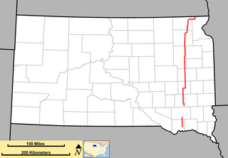
Interstate 229 (I-229) in South Dakota runs just more than ten miles (16 km) mostly within the city limits of Sioux Falls, the largest city in the state. It runs from a trumpet interchange Interstate 29 in the southern extremities of Sioux Falls to Interstate 90 just north of Sioux Falls. In between, the interstate travels through parts of southern and eastern Sioux Falls.

South Dakota Highway 10 (SD 10) is a 175.945-mile (283.156 km) state highway in the north-central and northeastern portions of South Dakota, United States. It connects SD 1804 in Pollock with the Minnesota state line southeast of Sisseton.

South Dakota Highway 44 (SD 44) is a state highway in southern South Dakota that runs from U.S. Route 385 (US 385) west of Rapid City to Interstate 29 (I-29) south of Sioux Falls. It is just more than 379 miles (610 km) long.

South Dakota Highway 115 is a 40-mile (64 km) state highway in Lincoln and Minnehaha countess in South Dakota, United States, that was created from the routing of US 77, "Old 77", when its alignment was moved west to become Interstate 29 around 1980 and SD 15's route from US 18 to Sioux Falls. SD 115 routes from its intersection with US 18 about 13 miles (21 km) south of Sioux Falls to Interstate 29 three miles west of Dell Rapids. It is about 40.5 miles (65.2 km) in length.

South Dakota Highway 13 (SD 13) is a 23.835-mile-long (38.359 km) state highway in Moody and Brookings counties in the U.S. state of South Dakota. It connects Flandreau with Elkton. SD 13 was originally part of SD 11's path.

South Dakota Highway 21 (SD 21) is a 9.470-mile (15.240 km) state highway in south-central Hamlin Countym South Dakota, that connects Lake Norden and Hayti.
South Dakota Highway 25 (SD 25) is a 194.524-mile-long (313.056 km) state highway in the eastern part of the U.S. state of South Dakota. It connects Scotland, Howard, De Smet, and Webster.

South Dakota Highway 15 (SD 15) is a 67.562-mile-long (108.730 km) state highway in the northeastern South Dakota, United States. It connects Clear Lake, Milbank, and Wilmot.

South Dakota Highway 27 (SD 27) is a 42.639-mile (68.621 km) state highway in Day and Marshall counties in South Dakota, United States, that connects Pierpont, Langford, and Britton.

South Dakota Highway 28 (SD 28) is a 105.937-mile (170.489 km) state highway in the east-central South Dakota, United States, that connects Hitchcock, Estelline, and Toronto.

South Dakota Highway 30 (SD 30) is a 17.077-mile-long (27.483 km) state highway in the east-central part of the U.S. state of South Dakota. It connects the north-central part of Brookings with the northeastern part of it.

South Dakota Highway 19 (SD 19) is a 86.974-mile (139.971 km) state highway in southeastern South Dakota, United States. It connects the Nebraska state line, south of Vermillion, with the southeastern part of the Madison area, via Viborg, Hurley, Parker, and Humboldt. SD 19 formerly entered Centerville, but was shifted to the south. Its former path was redesignated as SD 19A. Its former southern terminus was at Vermillion, but was extended when a new bridge from Nebraska opened.

South Dakota Highway 11 (SD 11) is a 77.724-mile (125.085 km) state highway in eastern South Dakota, United States. It connects the northern part of the Sioux City metropolitan area with the Sioux Falls metropolitan area.

South Dakota Highway 42 (SD 42) is a segmented state highway in southeastern South Dakota, United States. The first segment is a six-mile-long (9.7 km) highway in Aurora County. The second and longest is 60 miles (97 km) long and connects Ethan and Sioux Falls. The final segment connects Sioux Falls to Iowa Highway 9 southeast of Rowena.
Interstate 29 (I-29) is a north–south Interstate Highway in the midwestern United States. In the state of South Dakota, I-29 traverses on the eastern side of the state from the Iowa border near Sioux City to the North Dakota border near New Effington. On its route, I-29 passes through western portions of Sioux Falls, the state's largest city. It travels 252.5 miles (406.4 km) in the state, the longest stretch of any of the four states through which it passes. Interstate 229, the highway's lone auxiliary route in South Dakota, serves as a bypass around southern and eastern Sioux Falls.
South Dakota Highway 38 is a 63.393-mile (102.021 km) state highway in southeastern South Dakota, United States, that runs from Mitchell to Sioux Falls.

South Dakota Highway 40 (SD 40) is a state highway in southwest South Dakota, United States. The highway is just over 37 miles (60 km) long and runs from U.S. Route 16A (US 16A) in Keystone to Bureau of Indian Affairs Highway 41 in Red Shirt. The highway runs near Mount Rushmore National Memorial in Keystone, and its eastern terminus is on the Pine Ridge Indian Reservation near the edge of Badlands National Park.

South Dakota Highway 314 (SD 314) is a 3.751-mile-long (6.037 km) state highway in southwestern Yankton County, South Dakota, United States, that runs from South Dakota Highway 50 (SD 50) to the western city limits of Yankton.
South Dakota Highway 100 is the designation of a future state highway that will be built south and east of Interstate 229 (I-229) as a second southeastern bypass of Sioux Falls. The highway will run from exit 73 on I-29 east and north to exit 402 on I-90. This highway is currently named Veterans Parkway on its route from Interstate 90 to 57th Street in Sioux Falls.
South Dakota Highway 63 (SD 63) is a 167.455-mile (269.493 km) state highway in central South Dakota, United States, that connects U.S. Route 18 (US 18) south-southeast of Parmelee with the North Dakota state line north of McLaughlin.


