
Helijet International is a helicopter airline and charter service based in Richmond, British Columbia, Canada. Its scheduled passenger helicopter airline services operates flights from heliports at Vancouver International Airport (YVR), downtown Vancouver, downtown Nanaimo and downtown Victoria. It also operates a charter division serving the film, television, aerial tour, industrial and general helicopter and corporate jet charter markets, as well as helicopter and jet air ambulance services. Its head office and main hangar is Vancouver International Airport (YVR).

Olympia Regional Airport is a public use airport located four nautical miles (7 km) south of the central business district of Olympia, a city in Thurston County and the capital of the U.S. state of Washington. It is owned by the Port of Olympia. It is about one mile (1.6 km) east of Interstate 5, actually within the boundaries of the city of Tumwater which is south of and adjacent to Olympia. The airport was identified in the Washington State Department of Transportation Long Term Aviation Study as a field that could potentially serve to relieve Seattle-Tacoma International Airport of increasing congestion.

Igor I. Sikorsky Memorial Airport is a public airport in Fairfield County, Connecticut, United States, owned by the city of Bridgeport. It is three miles (6 km) southeast of downtown, in the town of Stratford. It was formerly Bridgeport Municipal Airport.
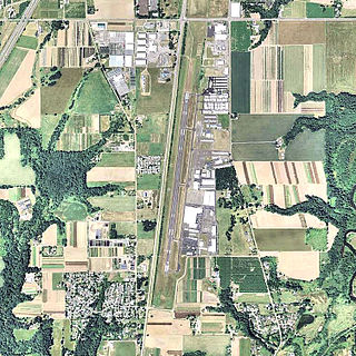
Aurora State Airport is a public airport located one mile (2 km) northwest of the central business district of Aurora, a city in Marion County, Oregon, United States. It is owned by the Oregon Department of Aviation.
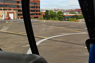
Portland Downtown Heliport is a public heliport located in the Old Town Chinatown neighborhood in the northwest section of the city of Portland, Multnomah County, Oregon, United States. It occupies the roof of a 1989 parking garage located at the intersection of NW Naito Parkway and NW Davis Street, not far from the Steel Bridge over the Willamette River.

Oxbow Dam is a hydroelectric run-of-the-river rockfill dam in the western United States, on the Snake River in Hells Canyon along the Idaho-Oregon border.

McNary ARNG Field Heliport is a military heliport located two miles (3 km) southeast of the city of Salem in Marion County, Oregon, United States. It is located on the north east corner of Salem Municipal Airport. The heliport serves as the primary base of activity for the Oregon National Guard Army Aviation Support Facility.
Camp Rilea Heliport is a military heliport three miles (4.8 km) south of the city of Warrenton in Clatsop County, Oregon, United States.
Croman Corporation is a helicopter operating company based in White City, Oregon, United States. These helicopters are used in Heli-logging, fire suppression, construction and many other activities. In addition the company operates an FAA Repair Station.
Roberts Army Heliport is a U.S. Army heliport at Camp Roberts in extreme southern Monterey County, California, United States. It is located just off U.S. Route 101, four nautical miles northwest of the central business district of San Miguel, about halfway between it and the tiny community of Bradley in southern Monterey County. Roberts AHP has one helipad designated H1 with a 2,740 x 100 ft asphalt surface.

Rentschler Heliport is a private heliport for the exclusive use of Raytheon Technologies, located 2 miles southeast of East Hartford, Connecticut.
Camp Edwards Heliport is a private use heliport located at Camp Edwards, a U.S. Army facility in Barnstable County, Massachusetts, United States. The airport is located three nautical miles (6 km) north of the central business district of Bourne, Massachusetts. It is owned by the Massachusetts Army National Guard.
Sabre Army Heliport is a military use heliport located at Fort Campbell, seven nautical miles (13 km) northwest of the central business district of Clarksville, in Montgomery County, Tennessee, United States. Owned by the United States Army, it has one runway designated 4/22 with a concrete surface measuring 4,451 by 109 feet.
Haverstraw Heliport is a privately owned, public use heliport located one nautical mile (2 km) east of Haverstraw, a village in the Town of Haverstraw, Rockland County, New York, United States.

Garland/DFW Heloplex is a city-owned public heliport in Garland, in Dallas County, Texas, United States, located approximately 2 nautical miles (3.7 km) southwest of the central business district. The facility is used for general aviation and air taxi purposes and is operated by SKY Helicopters. The heliport has no IATA or ICAO designation. The facility is alternately known as the Garland/DFW Heliport, Garland Heliport, or Garland/DFW Heliplex.
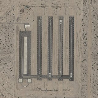
Picacho Army National Guard Heliport, also known as Picacho Stagefield Heliport, formally Marana Auxiliary Army Airfield No. 1, is an Arizona Army National Guard towered training field 4 miles southeast of Picacho, Arizona. The airport is owned and operated by the United States Army. The field serves as a training facility for the Western Army National Guard Aviation Training Site based out of Pinal Airpark.
Ferris Red Oak Muni Heliport is a city-owned public heliport in Ellis County, Texas, United States, serving the cities of Ferris, Texas and Red Oak, Texas. The heliport has no IATA or ICAO designation. The facility is alternatively known as the Ferris Red Oak Municipal Heliport.
Dallas CBD Vertiport is a city-owned public heliport/vertiport in the city of Dallas, Dallas County, Texas, United States. The facility is located at the south end of the Kay Bailey Hutchison Convention Center in the Dallas Central Business District, and is claimed to be the world's largest elevated heliport/vertiport.
DeSoto Heliport is a city-owned public heliport in DeSoto, Dallas County, Texas, United States, located 3 nautical miles (5.6 km) north of the central business district. The heliport has no IATA or ICAO designation.

Papago Army Heliport is a United States Army heliport at Papago Park Military Reservation. It is home to the 2nd Battalion, 285th Aviation Regiment. The airport is 6 miles east of the central business district of Phoenix, a city in Maricopa County, Arizona, United States. It is 3.5 miles northeast of Phoenix Sky Harbor International Airport.
