Southern Huntingdon County School District

Last updated
Southern Huntingdon County School District
Map of Huntingdon County Pennsylvania School Districts.png
Address
10339 Pogue Road
Three Springs
, PA, 17264
United States
District information
TypePublic
Established1956
SuperintendentDwayne Northcraft
Students and staff
District mascotRockets
ColorsBlue, White, and Gold
Other information
Website http://shcsd.org/

The Southern Huntingdon County School District is a public rural school district based in the southeastern part of Huntingdon County, Pennsylvania in Three Springs, Pennsylvania. The school district includes all of Three Springs Borough, Cassville Borough, Orbisonia Borough, Rockhill Furnace Borough, Saltillo Borough, Shade Gap Borough, and including the townships of Cass Township, Clay Township, Cromwell Township, Dublin Township, Springfield Township and Tell Township. The district encompasses approximately 221 square miles. According to 2000 federal census data, it serves a resident population of 8,030.

Contents

District History

The Southern Huntingdon County School System became effective on July 1, 1956, at which time all school boards of all twelve municipalities signed the district's Articles of Agreement. Two high Schools were consolidated (Orbisonia and Saltillo). Rockhill and Shade Gap Elementary Schools were the first two buildings constructed in 1956, followed by Spring Farms and Trough Creek Valley Elementary Schools in 1961, consolidating 55 one-room schoolhouses [1] into only four buildings. Ground was broken on the High School on July 11, 1960, students occupied the facility on September 1, 1962, and dedication was held November 4 that year. In 2004, an renovtion/addition project was completed adding a middle school to the secondary campus. The final action was completed on July 1, 1966, officially forming the Southern Huntingdon County School District.

Superintendents

SuperintendentYears Served
Fred G. Angle1962-1978
John O. Yetter1978-1982
Dr. Gerald D. Bau1982-1987
Dr. Edward Hasson*1987-1988
Harry J. King1988-1994
Dr. Charles J. Borchetta1995-1997
Anthony F. Labriola1997
Robert W. Holmes*1997
Ronald G. Fourtney1998-2002
Charles P. McCabe2002-2005
Grant Stiffler2005-2010
Dr. Tod Kline2010–2015
Stacey Miller*2015
Mr. Michael Zinobile2015-2016
Stacey Miller*2016
Mr. Dwayne NorthcraftCurrent

*Denotes Acting Superintendent

Schools

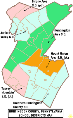
The Southern Huntingdon County School District operates one combined high school/middle school and three elementary schools. The school also sends students to the regional career & technology center, used by every school district in Huntingdon County. The district administrative office is located on 10339 Pogue Road, Three Springs, PA 17264.

Middle / High School

Elementary schools

There are three Elementary Schools, all Grades K-5

Extracurriculars

The district offers a variety of clubs, activities and sports.

Athletics

Career & Technology Centers

Related Research Articles

<span class="mw-page-title-main">Huntingdon County, Pennsylvania</span> County in Pennsylvania, United States

Huntingdon County is a county in the Commonwealth of Pennsylvania. As of the 2020 census, the population was 44,092. Its county seat is Huntingdon. The county was created on September 20, 1787, mainly from the northern part of Bedford County, plus an addition of territory on the east from Cumberland County.

<span class="mw-page-title-main">Huntingdon, Pennsylvania</span> Borough in Pennsylvania, United States

Huntingdon is a borough in Huntingdon County, Pennsylvania, United States. It is located along the Juniata River, approximately 32 miles (51 km) east of Altoona and 92 miles (148 km) west of Harrisburg. With a population of 6,827 at the 2020 census, it is the largest population center near Raystown Lake, a winding, 28-mile-long (45 km) flood-control reservoir managed by the U.S. Army Corps of Engineers.

<span class="mw-page-title-main">Orbisonia, Pennsylvania</span> Borough in Pennsylvania, United States

Orbisonia is a borough in Huntingdon County, Pennsylvania, United States. The population was 428 at the 2010 census.

<span class="mw-page-title-main">Rockhill, Pennsylvania</span> Borough in Pennsylvania, United States

Rockhill or Rockhill Furnace is a borough in Huntingdon County, Pennsylvania, United States. The population was 371 at the 2010 census, down from 414 at the 2000 census. It is the site of the East Broad Top Railroad and the Rockhill Trolley Museum.

<span class="mw-page-title-main">East Broad Top Railroad and Coal Company</span> Historic district in Pennsylvania, United States

The East Broad Top Railroad (EBT) is a 3 ft narrow gauge historic and heritage railroad headquartered in Rockhill Furnace, Pennsylvania.

<span class="mw-page-title-main">Pennsylvania Route 994</span> State highway in Huntingdon County, Pennsylvania, US

Pennsylvania Route 994 is a Pennsylvania highway which runs for 27+12 miles (44.3 km). It runs from PA 26 in Entriken to U.S. Route 522 (US 522) in Orbisonia.

Pinelands Regional School District is a regional school district in Ocean County, in the U.S. state of New Jersey, serving students from Eagleswood Township, Little Egg Harbor Township and Tuckerton Borough along with the Burlington County municipality of Bass River Township. Both schools are accredited by the Middle States Association of Colleges and Schools and the New Jersey Department of Education.

Blacklog Creek is a 28.5-mile-long (45.9 km) tributary of Aughwick Creek in Huntingdon County, Pennsylvania, in the United States.

The Monroe Township School District is a comprehensive community public school district that serves students in kindergarten through twelfth grade from Monroe Township, in Middlesex County, New Jersey, United States.

<span class="mw-page-title-main">Pennsylvania Route 641</span> State highway in Pennsylvania, US

Pennsylvania Route 641 is a state route that is located in Central Pennsylvania in the United States. The route is 57.9 miles (93.2 km) long and runs from U.S. Route 522 near Shade Gap east to US 11/US 15 in Camp Hill.

<span class="mw-page-title-main">Huntingdon Area School District</span> School district in Pennsylvania

The Huntingdon Area School District, commonly abbreviated HASD, is a midsized rural public school district based in the borough of Huntingdon, Pennsylvania. The school district includes all of Huntingdon borough, Brady Township, Smithfield Township, Henderson Township, Juniata Township, Walker Township, Oneida Township, Penn Township, Marklesburg borough, Jackson Township, Mill Creek borough, Miller Township, and Lincoln Township. The district encompasses approximately 286 square miles (740 km2). The school's mascot is the bearcat. The school's official colors are red and blue.

<span class="mw-page-title-main">Pennsylvania Route 829</span> State highway in Huntingdon County, Pennsylvania, US

Pennsylvania Route 829 is a 17.04-mile-long (27.42 km) state highway located in Huntingdon County, Pennsylvania. The southern terminus is at PA 655 in Cass Township. The northern terminus is at U.S. Route 22 (US 22) in Mill Creek.

<span class="mw-page-title-main">Mount Union Area School District</span> School district in Pennsylvania

The Mount Union Area School District is a public school district based in Mount Union, Pennsylvania. The district encompasses approximately 151 square miles. According to 2000 federal census data, it serves a resident population of 9,678. The school district includes all of Mount Union borough, Mapleton borough, Shirley Township and Union Township in Huntingdon County. The school district also includes Kistler borough, Newton Hamilton borough, and Wayne Township, all located in Mifflin County.

<span class="mw-page-title-main">Southern Columbia Area School District</span> School district in Pennsylvania, U.S.

Southern Columbia Area School District is a small, rural, public school district located in Catawissa, Pennsylvania. It serves communities in two counties. In Columbia County the district serves: Catawissa Borough, Catawissa Township, Locust Township, Roaring Creek Township, Franklin Township and Cleveland Township. In Northumberland County it serves Ralpho Township. Southern Columbia Area School District encompasses approximately 108 square miles (280 km2). According to 2000 federal census data, it serves a resident population of 9,803. By 2010, the US Census Bureau reported that the district's population increased to 10,386 people. The per capita income of residents was $18,969 in 2009, while the median family income was $45,889. In the Commonwealth, the median family income was $49,501 and the United States median family income was $49,445, in 2010. The district is one of the 500 public school districts of Pennsylvania.

<span class="mw-page-title-main">Fleetwood Area School District</span> School district in Pennsylvania

Fleetwood Area School District is a public school district located in north central Berks County in Fleetwood, Pennsylvania. The district serves students in the community of Fleetwood as well as Richmond Township to the north and Maidencreek Township to the south. The district offers a wide variety of academic courses, music, the arts, sports programs and extra curricular activities. The district meets state requirements across their academic areas.

<span class="mw-page-title-main">Pennsylvania House of Representatives, District 81</span> American legislative district

The 81st Pennsylvania House of Representatives District is located in central Pennsylvania and has been represented by Rich Irvin since 2015.

<span class="mw-page-title-main">Juniata Valley School District</span> School district in Pennsylvania

The Juniata Valley School District, commonly abbreviated JVSD, is a rural public school district based in the borough of Alexandria, Pennsylvania. The school district includes all of Alexandria borough, Petersburg borough, Barree Township, Logan Township, West Township, Morris Township and Spruce Creek township. The district encompasses approximately 125 square miles. According to 2000 federal census data, it serves a resident population of 5,334.

<span class="mw-page-title-main">Northern Bedford County School District</span> School district in Pennsylvania

The Northern Bedford County School District is a public school district serving parts of Bedford County, Pennsylvania. The boroughs of Hopewell and Woodbury and the townships of Bloomfield, Hopewell, Woodbury, and South Woodbury are located within district boundaries. It encompasses approximately 112 square miles. According to 2000 federal census data, it serves a resident population of 6,556.

<span class="mw-page-title-main">Shade-Central City School District</span> School district in Pennsylvania

The Shade-Central School District is a public school district located in Somerset County, Pennsylvania. It is eponymous, serving the borough of Central City and the Township of Shade.

Southern Huntingdon County High School\Middle School is a public middle & high school, located in Cromwell Township in southeastern Huntingdon County, Pennsylvania that houses about 700 students in grades 6-12 that reside in the twelve municipalities that make up the Southern Huntingdon County School District.

References

  1. "Southern Huntingdon County High School Student Handbook" (PDF). shcsd.k12.pa.us.