
Dhilba Guuranda–Innes National Park, formerly Innes National Park, is an IUCN-designated protected area in the Australian state of South Australia located on the southwest tip of Yorke Peninsula about 300 kilometres (190 mi) west of the state capital of Adelaide. It is a popular destination for camping, bushwalking, fishing, surfing and scuba diving.

The Spencer Gulf is the westernmost and larger of two large inlets on the southern coast of Australia, in the state of South Australia, facing the Great Australian Bight. It spans from the Cape Catastrophe and Eyre Peninsula in the west to Cape Spencer and Yorke Peninsula in the east.

The Yorke Peninsula, known as Guuranda by the original inhabitants, the Narungga people, is a peninsula located northwest and west of Adelaide in South Australia, between Spencer Gulf on the west and Gulf St Vincent on the east. The peninsula is separated from Kangaroo Island to the south by Investigator Strait.
Eclipse Island is a barren island in Western Australia, 17 kilometres (10.6 mi) due south of Albany, and 6.1 km (3.8 mi) south of the nearest point of the mainland coast, which is Cave Point on the southern coast of Torndirrup Peninsula. Eclipse Island Lighthouse is located near the centre of the island. Nearby South West Island contains Western Australia's southernmost landmass.
Lake Muir is a freshwater lake, with a larger surrounding wetlands area, that is located in the South West region of Western Australia. The lake lies near Muirs Highway, north of Walpole and southeast of Manjimup.

Broad Sound is a large bay on the east coast of Australia, in the state of Queensland, 675 kilometers northwest of the state capital, Brisbane. It is about 50 kilometers long and 20 kilometers across at its widest point. The Torilla Peninsula forms the eastern side of the bay; Shoalwater Bay is on the other side of the peninsula. The sound has a large tidal range of about 10 metres (33 ft). This is the largest variance on the eastern Australia coastline.

The Rallier du Baty Peninsula is a peninsula of Grande Terre, the main island of the subantarctic Kerguelen archipelago in the southern Indian Ocean. It occupies the south-western corner of the island, and is about 35 km long, extending from north to south, and 25 km across at its widest. The 1,202 m high Bicorne rises in the southern coast of the peninsula. It is named for Raymond Rallier du Baty, a French sailor who charted the archipelago in the early 20th century. The Îles Boynes, France's southernmost land apart from Adélie Land in Antarctica, lie 30 km south of the tip of the peninsula.

Prince Regent National Park, formerly the Prince Regent Nature Reserve, is a protected area in the Kimberley region of Western Australia. In 1978 the area was nominated as a UNESCO World Biosphere Reserve.

The Eyre Yorke Block, also known as the Eyre and Yorke mallee, is an interim Australian (IBRA) bioregion and a World Wildlife Fund ecoregion covering part of the Eyre Peninsula and all of Yorke Peninsula as well as land to its immediate east in South Australia.
The Gulf St Vincent Important Bird Area comprises land extending along the coast of Gulf St Vincent, north of Adelaide, South Australia.
The Lake Hawdon System Important Bird Area comprises an area of 374 square kilometres covering a series of five coastal lakes in the Limestone Coast of South Australia. They are the most important of a string of regional lakes occupying swale corridors between modern and historical sand dunes.
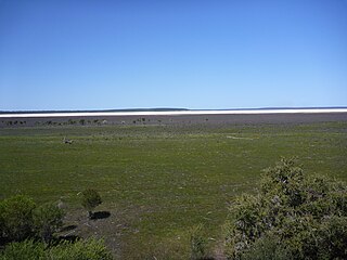
Lake Newland Conservation Park is a protected area in the Australian state of South Australia located on the west coast of the Eyre Peninsula about 10 kilometres (6.2 mi) north of the town of Elliston. It was proclaimed in 1991 in order to protect Lake Newland, a hypersaline lake, and an associated wetland complex. It lies in the traditional lands of the Wirangu people.

The Riverland Mallee Important Bird Area comprises a 12,200 square kilometres tract of mallee habitat and riverine woodland extending from near Waikerie in the Riverland region in eastern South Australia north-eastwards into south-western New South Wales.
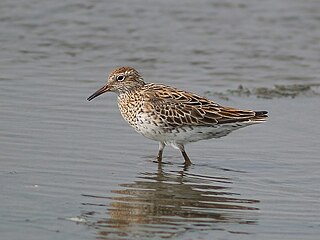
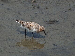
The Spencer Gulf Important Bird Area comprises a 460.38 square kilometres strip of coastal land extending for about 100 kilometres along the north-eastern coast of the Spencer Gulf in South Australia. It is considered to be an important site for waders, or shorebirds.

Tourville and Murat Bays Important Bird Area is an important bird area in South Australia with a combined area of 117 square kilometres, located west to the town of Ceduna on the north-west corner of the Eyre Peninsula in the Great Australian Bight. It is considered to be an important area because of the resident populations of waders, or shorebirds.

Troubridge Island is an island located in the south west corner of Gulf St Vincent in South Australia near the eastern edge of the Troubridge Shoals off the east coast of Yorke Peninsula about 8 kilometres (5.0 mi) southeast by east of the town of Edithburgh It is notable for being a site of an operating lighthouse from 1856 until 2002 and as a site for a sea bird rookery. Since 1982, the island has been part of the Troubridge Island Conservation Park.

The Cierva Point and offshore islands Important Bird Area is a 6540 ha tract of land and sea on the Danco Coast of the Antarctic Peninsula.
Warrenben Conservation Park is a protected area located in the Australian state of South Australia on the Yorke Peninsula of about 12 kilometres north-east of Marion Bay.

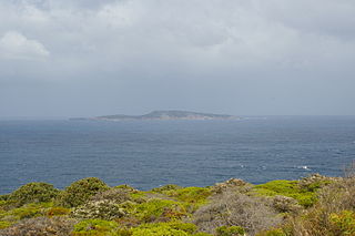
South Island is an island located in the Australian state of South Australia at the south end of Pondalowie Bay on the south-west extremity of Yorke Peninsula about 11 kilometres north-west by west of the town of Stenhouse Bay. The island has enjoyed protected area status since 1970 and since 1977, it has been part of the Innes National Park.
County of Fergusson is a cadastral unit located in the Australian state of South Australia which spans Yorke Peninsula south of Price. It was proclaimed in 1869 by Governor Fergusson after whom the county was named.

