
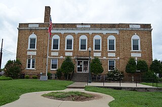
Wayne County is a county located in Tennessee. As of the 2010 census, the population was 17,021. Its county seat is Waynesboro. The county is named after General "Mad Anthony" Wayne.

Washington County is a county located in the U.S. state of Tennessee. As of the 2010 census, the population was 122,979. Its county seat is Jonesborough. The county's largest city and a regional educational, medical and commercial center is Johnson City. Washington County is Tennessee's oldest county, having been established in 1777 when the state was still part of North Carolina.

Stewart County is a county located in the U.S. state of Tennessee. As of the 2010 census, the population was 13,324. Its county seat is Dover.

Sevier County ( "severe") is a county of the U.S. state of Tennessee. As of the 2010 census, the population was 89,889. Its county seat and largest city is Sevierville.

Monroe County is a county located in the U.S. state of Tennessee. As of the 2010 census, the population was 44,519. Its county seat is Madisonville.

Johnson County is a county located in the U.S. state of Tennessee. As of the 2010 census, the population was 18,244. Its county seat is Mountain City. It is the state's northeasternmost county, sharing borders with Virginia and North Carolina.
Hickman County is a county located in the U.S. state of Tennessee. As of the 2010 census, the population was 24,690. Its county seat is Centerville.

Carter County is a county located in the U.S. state of Tennessee. As of the 2010 census, the population was 57,424. Its county seat is Elizabethton. The county is named in honor of Landon Carter (1760-1800), an early settler active in the "Lost State of Franklin" 1784-1788 secession from the State of North Carolina.

Campbell County is a county located in the U.S. state of Tennessee. As of the 2010 census, the population was 40,716. Its county seat is Jacksboro.
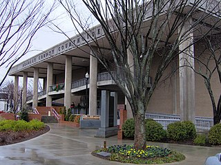
Bradley County is a county located in the southeastern portion of the U.S. state of Tennessee. As of the 2010 census, the population was 98,963, making it the thirteen most populous county in Tennessee. Its county seat is Cleveland. It is named for Colonel Edward Bradley of Shelby County, Tennessee, who was colonel of Hale's Regiment in the American Revolution and the 15th Regiment of the Tennessee Volunteers in the War of 1812.
Bledsoe County is a county located in the U.S. state of Tennessee. As of the 2010 census, the population was 12,876. Its county seat is Pikeville.

Cleveland is a city in Bradley County, Tennessee, United States. The population was 41,285 at the 2010 census. It is the county seat and largest city in Bradley County, and the principal city of the Cleveland, Tennessee metropolitan area, which is included in the Chattanooga–Cleveland–Dalton, TN–GA–AL Combined Statistical Area. Cleveland is the fourteenth-largest city in Tennessee and the fifth-largest industrially, having thirteen Fortune 500 manufacturers.
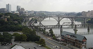
The Tennessee River is the largest tributary of the Ohio River. It is approximately 652 miles (1,049 km) long and is located in the southeastern United States in the Tennessee Valley. The river was once popularly known as the Cherokee River, among other names, as many of the Cherokee had their territory along its banks, especially in eastern Tennessee and northern Alabama. Its current name is derived from the Cherokee village Tanasi.
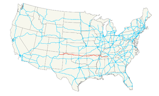
U.S. Route 412 is an east–west United States highway, first commissioned in 1982. Its route number is a "violation" of the usual AASHTO numbering scheme, as it comes nowhere near its implied "parent", US 12. U.S. 412 overlaps expressway-grade Cimarron Turnpike from Tulsa west to Interstate 35 and the Cherokee Turnpike from 5 miles (8.0 km) east of Chouteau, Oklahoma, to 8 miles (13 km) west of the Arkansas state line. A curiosity of this highway is that it runs the entire length of the Oklahoma Panhandle and traverses the Missouri Bootheel.

U.S. Route 19 (US 19) is a north–south U.S. Highway. Despite encroaching Interstate Highways, the route has remained a long-haul route, connecting the Gulf of Mexico with Lake Erie.
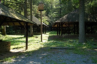
Big Spring State Forest Picnic Area is a 45-acre (18 ha) Pennsylvania state park in Toboyne Township, Perry County, Pennsylvania in the United States. The park is on Pennsylvania Route 274, 5.5 miles (8.9 km) southwest of New Germantown. Big Spring State Forest Picnic Area is a hiking and picnic area. A partially completed railroad tunnel in Conococheague Mountain is a feature of the park.

The Coal Creek War was an early 1890s armed labor uprising in the southeastern United States that took place primarily in Anderson County, Tennessee. This labor conflict ignited during 1891 when coal mine owners in the Coal Creek watershed began to remove and replace their company-employed, private coal miners then on the payroll with convict laborers leased out by the Tennessee state prison system.

Coker Creek is an unincorporated community in Monroe County, Tennessee, United States. It is located on Tennessee State Route 68 6.7 miles (10.8 km) south of Tellico Plains. Coker Creek had a post office from October 26, 1841, to September 27, 2008; it still has its own ZIP code, 37314.

Doaks Crossroads is an unincorporated community in Wilson County, Tennessee, United States. Doaks Crossroads is located at the junction of Tennessee State Route 265 and Tennessee State Route 266 7.3 miles (11.7 km) south-southeast of Lebanon. The Spring Creek Presbyterian Church, which is listed on the National Register of Historic Places, is located in Doaks Crossroads. Doaks Crossroads is also home to the "40 acre hackerspace" blog, http://www.chickenroadlabs.com/ and the Wilson County Radio League http://www.wilsonradioleague.wordpress.com/


