
St. Clair Shores is a city in Macomb County in the U.S. state of Michigan. An inner-ring suburb of Detroit, St. Clair Shores is located roughly 14 miles (22.5 km) northeast of downtown Detroit. As of the 2020 census, the city had a population of 58,874.

Clay Township is a civil township of St. Clair County in the U.S. state of Michigan. The population was 8,446 at the 2020 census.

Cottrellville Township is a civil township of St. Clair County in the U.S. state of Michigan. The population was 3,406 at the 2020 Census.

Kimball Township is a civil township of St. Clair County in the U.S. state of Michigan. As of the 2020 census, the township population was 9,609.
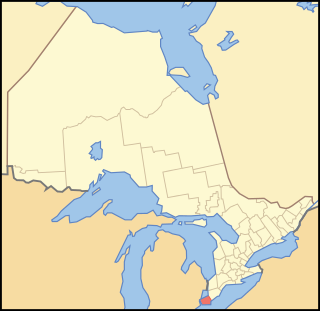
Essex County is a primarily rural county in Southwestern Ontario, Canada comprising seven municipalities: Amherstburg, Kingsville, Lakeshore, LaSalle, Leamington, Tecumseh and the administrative seat, Essex.

Tecumseh is a town in Essex County in Southwestern Ontario, Canada. It is on Lake St. Clair east of Windsor and had a population of roughly 23,300 as of the 2021 census according to Statistics Canada. It is part of the Windsor census metropolitan area, and is a part of the Windsor-Essex County region along with the towns of Amherstburg, Essex, Kingsville, LaSalle, and the municipalities of Lakeshore and Leamington. Tecumseh was originally a Franco-Ontarian settlement.

Lake St. Clair is a freshwater lake that lies between the Canadian province of Ontario and the U.S. state of Michigan. It was named in 1679 by French Catholic explorers after Saint Clare of Assisi, on whose feast day they first saw the lake.

Lakeshore is a municipality on Lake St. Clair, in Essex County, Ontario, Canada. It was incorporated in 1999 by amalgamating the Town of Belle River with the townships of Maidstone, Rochester, Tilbury North, and Tilbury West. It is the largest and the most populous municipality within Essex County. However, it is part of the Windsor census metropolitan area.

Essex is a federal electoral district in Ontario, Canada, represented in the House of Commons of Canada from 1867 to 1882 and since 1968.

Windsor—Tecumseh is a federal electoral district in Ontario, Canada, that has been represented in the House of Commons of Canada since 2004.
Essex West was a federal electoral district in the province of Ontario, Canada, that was represented in the House of Commons of Canada from 1925 to 1968. This riding was created in 1924 from parts of Essex North riding.
White Rock is an unincorporated community in Huron County in the U.S. state of Michigan. The community is located within Sherman Township. As an unincorporated community, White Rock has no legal autonomy, defined boundaries, or population statistics of its own. It is located at 43°42′35″N82°36′31″W, about three miles north of Forestville and about nine miles south of Harbor Beach on M-25 at the junction with White Rock Road.
Wheatley is a community in Southwestern Ontario, Canada, within the municipality of Chatham-Kent. It lies about 12 kilometres (7 mi) east of Leamington. Nearby parks include Two Creeks Conservation Area, which has 15 km of hiking and bicycling paths, Kopegaron Woods Conservation Area, Hillman Marsh Conservation Area and Point Pelee National Park. Rondeau Provincial Park is only a forty-five-minute drive to the east. It also boasts Wheatley Provincial Park, home to the endangered Blue Racer snake, which can only be found in the park as well as the Point Pelee National Park and on Pelee Island.

On June 17, 1946, the most powerful tornado to strike Windsor, Ontario, moved through the town at F4 intensity. The tornado touched down near River Rouge, Michigan, then crossed the Detroit River and made landfall in the Brighton Beach neighbourhood of Windsor. It then cut across southern Windsor and northern Sandwich West Township, Ontario, along a path 60 kilometres (40 mi) in length. It also cut across Highway 3 before weakening somewhat. The storm then touched down as an F4 again at the modern-day intersection of Walker Road and Grand Marais Road, near the center of the city.
The Ganatchio Trail is the second bike trail built in Windsor, Ontario, Canada. Construction on the trail started upon the closure of Clairview Avenue. The trail extends over 5.3 km, and passes through several neighbourhoods, including Riverside and Little River, and serves Sandpoint Beach and Stop 26 Beach and Park. It was the second major trail constructed, after the Riverfront Bike Trail, with extensions east towards Tecumseh built in stages. The trail has a posted speed limit of 20 km/h. The Riverfront and the Ganatchio Trails are wide enough for two cycle lanes in each direction.
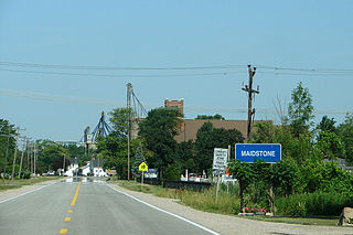
Maidstone, Ontario, is a small village on Essex County Road 34 in the municipality of Tecumseh, Ontario, Canada, since amalgamation in 1999. The town has a post office, a school, baseball diamonds, a park, a church, a church hall, a community center and a grain elevator.
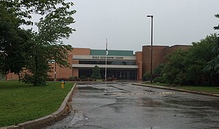
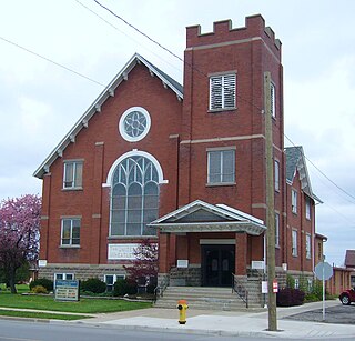
École secondaire catholique l'Essor is a publicly funded separate (Catholic), French-language high school located in Tecumseh, Ontario, Canada, established in 1979. It serves the Francophone population of Essex County. The name l'Essor, coined by local resident Florence Limoges, is a portmanteau combining "Essex" and "Windsor". Essor also refers to the French word "to take flight". The school belongs to the Conseil scolaire catholique Providence.
King's Highway 39, commonly referred to as Highway 39, was a provincially maintained highway in the Canadian province of Ontario. The 33.8-kilometre (21.0 mi)-long route connected Highway 3 in downtown Windsor with Highway 2 south of Belle River, travelling along the southern shoreline of Lake St. Clair. Highway 39 was established in 1934. By 1961, the Pike Creek Bypass was opened and Highway 39 was rerouted along it, with the former route briefly becoming Highway 39B. The route was renumbered as Highway 2 in 1970, retiring the designation from the provincial highway system. Highway 2 was itself decommissioned along the former route of Highway 39 on January 1, 1998, and transferred to Essex County and the City of Windsor. It was subsequently redesignated as Essex County Road 22.
Essex is a provincial electoral district in southwestern, Ontario, Canada. It elects one member to the Legislative Assembly of Ontario.

Windsor—Tecumseh is a provincial electoral district in Ontario, Canada, that has been represented in the Legislative Assembly of Ontario since the 2007 provincial election and as Windsor—St. Clair for the 1999 provincial election and 2003 provincial elections.
