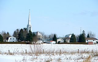
Spruce Grove is a city that is 11 km (6.8 mi) west of Edmonton, Alberta in Canada. The city is adjacent to the Town of Stony Plain and is surrounded by Parkland County.

The Nation is a municipality in Eastern Ontario, located within Canada's National Capital Region, in the United Counties of Prescott and Russell. The municipality consists of the former geographic townships of Caledonia, Cambridge and South Plantagenet.

Casselman is a village in eastern Ontario, Canada, in the United Counties of Prescott and Russell on the South Nation River.

The United Counties of Prescott and Russell are consolidated counties located in the Canadian province of Ontario. Its county seat is L'Orignal. It was created as a result of a merger between Russell County and Prescott County in 1820. It is located in Eastern Ontario, in the wedge-shaped area between the Ottawa River and St. Lawrence River, approximately 55 km east of the City of Ottawa.

Plamondon is a hamlet in northern Alberta, Canada within Lac La Biche County. It is located on Highway 858, approximately 3 kilometres (1.9 mi) north of Highway 55, and has an elevation of 555 metres (1,821 ft).

Témiscaming is a city located at the south end of Lac Témiscamingue on the upper Ottawa River in the Témiscamingue Regional County Municipality of western Quebec, Canada. Also nearby is Lake Kipawa.

St. Isidore is a hamlet in northwest Alberta, Canada, within Northern Sunrise County. It is located approximately 16 kilometres (9.9 mi) east of the Town of Peace River on Range Road 204 off Highway 688. St. Isidore is flanked by deep ravines cut by Pat's Creek to the north and Pat's Creek tributary to the south. The ravines are surrounded by pine forests.

Smoky Lake is a town in central Alberta, Canada. It is located 116 km (72 mi) northeast of Edmonton at the junction of Highway 28 and Highway 855. It lies between the North Saskatchewan River, Smoky Creek and White Earth Creek, in a mainly agricultural area. The provincial historic site of Victoria Settlement is nearby. Long Lake Provincial Park is located 60 km (37 mi) north of the town. Since time immemorial, the Woods Cree, a First Nations people, named "Smoking Lake" for the smoke from ceremonies performed on the shore; the name Smoky Lake may also be based in the mist that rose from the lake in great quantities at sundown. One of its churches, the St. Onuphrius Ukrainian-Catholic, built in 1907, has been moved to the Canadian Museum of History in Gatineau, Quebec. It is in Census Division No. 12 and is the municipal office for the Smoky Lake County.

Wabasca, also known as Wabasca-Desmarais, is a hamlet in northern Alberta, Canada, within the Municipal District of Opportunity No. 17. It is located between and along the South and North Wabasca Lakes, at the intersection of highways 813 and 754. It is approximately 123 km (76 mi) northeast of Slave Lake.

Cayley is a hamlet in southern Alberta, Canada within the Municipal District (M.D.) of Foothills No. 31. It is also recognized as a designated place by Statistics Canada.

Blackie is a hamlet in Alberta, Canada within the Municipal District of Foothills No. 31. It is located approximately 70 kilometres (43 mi) southeast of Calgary on Highway 799.
A designated place (DPL) is a type of community or populated area identified by Statistics Canada for statistical purposes. DPLs are delineated for each decennial census as the statistical counterparts of incorporated places such as cities, towns and villages.

Pierceland is a village in the Canadian province of Saskatchewan within the Rural Municipality of Beaver River No. 622 and Census Division No. 17. It is north of the Beaver River on Saskatchewan Highway 55. This village is the administrative centre of the Big Island Lake Cree Nation and Island Lake Cree band governments.

Calahoo is a hamlet in Alberta, Canada within Sturgeon County. It is located on Highway 37 near the Sturgeon River, approximately 21 kilometres (13 mi) northwest of Edmonton's city limits. It has an elevation of 680 metres (2,230 ft).

Dapp is a hamlet in central Alberta, Canada within Westlock County. It is located 4 kilometres (2.5 mi) west of Highway 44, approximately 81 kilometres (50 mi) northwest of St. Albert.

Janvier South or Janvier is a hamlet in northern Alberta, Canada within the Regional Municipality (R.M.) of Wood Buffalo. The hamlet's official name is Janvier South according to Alberta Municipal Affairs. However, it is more commonly known and referred to as Janvier by the R.M. of Wood Buffalo and its residents. It is further alternately known as Chard. The latter name is after A. Chard, a transportation official.

The Rural Municipality of St. Louis No. 431 is a rural municipality (RM) in the Canadian province of Saskatchewan within Census Division No. 15 and SARM Division No. 5.


