
Epsom is a suburb of Auckland, New Zealand. It is located in the centre of the Auckland isthmus between Mount Eden and Greenlane, south of Newmarket, and 5 km (3.1 mi) south of the Auckland City Centre.
Remuera is an affluent suburb in Auckland, New Zealand. It is located four kilometres southeast of the city centre. Remuera is characterised by many large houses, often Edwardian or mid 20th century. A prime example of a "leafy" suburb, Remuera is noted for its quiet tree-lined streets. The suburb has numerous green spaces, most obvious of which is Ōhinerau / Mount Hobson – a volcanic cone with views from the top overlooking Waitematā Harbour and Rangitoto.
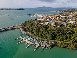
Ōrākei is a suburb of Auckland city, in the North Island of New Zealand. It is located on a peninsula five kilometres to the east of the city centre, on the shore of the Waitematā Harbour, which lies to the north, and Hobson Bay and Ōrākei Basin, two arms of the Waitematā, which lie to the west and south. To the east is the suburb of Mission Bay. Takaparawhau / Bastion Point is a coastal piece of land in Ōrākei. Between Takaparawhau and Paritai Drive is Ōkahu Bay and Reserve.
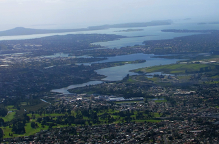
The Tāmaki River or Tāmaki Estuary is mostly an estuarial arm and harbour of the Hauraki Gulf, within the city of Auckland in New Zealand. It extends south for 15 kilometres (9 mi) from its mouth between the suburb of Saint Heliers and the long thin peninsula of Bucklands Beach, which reaches its end at Musick Point. The inlet extends past the suburbs of Glendowie, Wai o Taiki Bay, Point England, Glen Innes, Tāmaki, Panmure, and Ōtāhuhu to the west, and Bucklands Beach, Half Moon Bay, Farm Cove, Sunnyhills and Pakuranga to the east.

Mission Bay is a seaside suburb of Auckland city, on the North Island of New Zealand. The suburb's beach is a popular resort, located alongside Tamaki Drive. The area also has a wide range of eateries. Mission Bay is located seven kilometres to the east of the city centre, and east of the Waitematā Harbour, between Ōrākei and Kohimarama. It covers an area of 1.08 km2, about three quarters of which comprises low hills, surrounding the remaining quarter, which slopes down to the sea. Local government of Mission Bay is the responsibility of the Ōrākei Local Board, which also includes the suburbs of Ōrākei, Kohimarama, St Heliers, Glendowie, St Johns, Meadowbank, Remuera and Ellerslie.
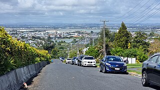
Hillsborough is a suburb of Auckland, New Zealand. It is under the local governance of the Auckland Council. Hillsborough is a leafy suburb of 20th-century houses. The area is serviced by two shopping areas; Onehunga and Three Kings. The area is served by secondary schools Mount Roskill Grammar School and Marcellin College.
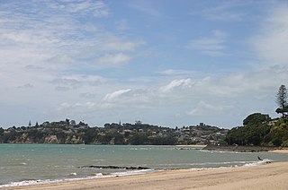
Kohimarama is a coastal residential Auckland suburb, located to the east of the city. Kohimarama is situated between Mission Bay and St Heliers and has an accessible beach with a boardwalk and green recreational spaces located amongst residential areas. Local government of Kohimarama is the responsibility of the Ōrākei Local Board, which also includes the suburbs of Ōrākei, Mission Bay, St Heliers, Glendowie, St Johns, Meadowbank, Remuera and Ellerslie.
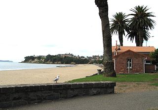
St Heliers is a seaside suburb of Auckland with a population of 11,710 as of June 2024. This suburb is popular amongst visitors for the beaches, cafés, and views of Rangitoto Island, the distinctive volcanic island in the Hauraki Gulf.

Sir Ian Hugh Kāwharu was an academic and paramount chief of the Ngāti Whātua Māori tribe in New Zealand.

Takaparawhau / Bastion Point is a coastal piece of land in Ōrākei, Auckland, New Zealand, overlooking the Waitematā Harbour. The area is significant in New Zealand history as the site of protests in the late 1970s by Māori against forced land alienation by Pākehā. Takaparawhau is now the site of the private Ōrākei Marae, the public Michael Joseph Savage Memorial, and privately-owned reserve land that is accessible to the public.

The Auckland isthmus, also known as the Tāmaki isthmus, is a narrow stretch of land on the North Island of New Zealand in the Auckland Region, and the location of the central suburbs of the city of Auckland and the central business district. The isthmus is located between two rias : the Waitematā Harbour to the north, which opens to the Hauraki Gulf / Tīkapa Moana and Pacific Ocean, and the Manukau Harbour to the south, which opens to the Tasman Sea. The isthmus is the most southern section of the Northland Peninsula.
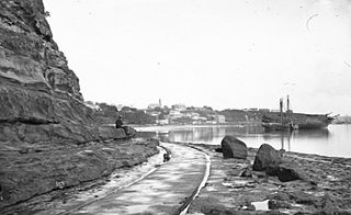
Point Britomart was a headland in the Waitematā Harbour, in Auckland, New Zealand. Located between Commercial Bay and Official Bay, the point was later quarried away to produce fill for land reclamation in Mechanics Bay, and almost no physical trace remains at street level in what is today an area of the Auckland CBD and the Auckland waterfront.

Apihai Te Kawau was a paramount chief of the Ngāti Whātua Māori iwi (tribe) of Auckland, New Zealand in the 19th century.
This is a timeline of the history of the city of Auckland in New Zealand.

Tamaki Drive is the coastal road which follows the contours of the Waitematā Harbour, Auckland, New Zealand. The road links the suburbs Ōrākei, Mission Bay, and Kohimarama ending in Saint Heliers providing easy access to the local beaches. Tamaki Drive was completed in 1932 and incorporates The Strand, Bice Esplanade and, what was once part of the old Kohimarama Road. It is also referred to as the Waterfront Road. Tamaki Drive is a flat road around 8 km long and popular with walkers, runners and roller skaters, and includes a dedicated cycle lane. Those travelling along Tamaki Drive can find scenic highlights and peaceful views across the harbour to the volcanic island Rangitoto. The cliffs backing onto Tamaki Drive are made of Waitematā Sandstone strata clothed in places with pōhutukawa. These trees seem to flower out of season, because these are actually Kermadec pōhutukawa with small distinctive roundish leaves.

Ngāti Whātua Ōrākei or Ngāti Whātua-o-Ōrākei is an Auckland-based Māori hapū (sub-tribe) in New Zealand. Together with Te Uri-o-Hau, Te Roroa and Te Taoū, it comprises the iwi (tribe) of Ngāti Whātua. These four hapū can act together or separately as independent tribes. The hapū's rohe is mostly in Tāmaki Makaurau, the site of present-day Auckland. Ngāti Whātua Ōrākei has around 6,000 members whose collective affairs are managed by the Ngāti Whātua Ōrākei Trust.

Karaka Bay or Waiarohe is on the western shore of the Tāmaki River mouth in the suburb of Glendowie, Auckland. The bay is bordered to the north by Te Papa a Tamatera and looks out to the islands of the eastern Waitematā Harbour: Rangitoto, Motutapu, Motukorea, Motuihe and Waiheke as well as to Musick Point across the estuary. It is accessed by boat or by a steep path that winds down the hill from the end of Peacock Street; there is no road access to the bay itself. This lack of road access has given Karaka Bay a unique sense of identity; it is unlike anywhere else in Auckland.

Arthur Thomas Pycroft was a New Zealand naturalist and collector, known especially for his ornithological work. Pycroft worked for the New Zealand Railways Department and became a senior manager, but he retired young after receiving a large inheritance. This gave him more time for his real passion as a naturalist and ornithologist. He organised expeditions, mostly to islands off the coast of the North Island, with a focus on birds and plants. He grew rare plants at his large property in the Auckland suburb of Saint Heliers. Another of his interests was collecting rare books. When his library was put up for sale 40 years after his death, it was dubbed the "last great private library" in New Zealand. Pycroft held membership with the Auckland Institute at Auckland Museum for 75 years and was the organisation's president in 1935–36.

Ōrākei is a local government area in Auckland, in New Zealand's Auckland Region. It is governed by the Ōrākei Local Board and Auckland Council. It currently aligns with the council's Ōrākei Ward.

Dingle Dell is a nature reserve in the suburb of St Heliers in Auckland, New Zealand. It consists of 6.48 hectares of native bush and a small grass field. The walk contains stairs and may not be suitable for pushchairs. Dogs are permitted off-leash. Dingle Dell has long been overlooked as a nature reserve, named by the New Zealand Herald in the 1950s the "Cinderella of Auckland's Parks."


