St Johns, New Zealand

Last updated

St Johns
Eastern Suburbs Railway Line Corridor.jpg
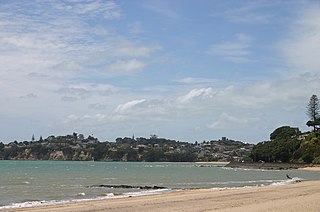
St Johns, in the foreground and left.
St Johns, New Zealand
Coordinates: 36°52′28″S174°50′33″E / 36.874498°S 174.842433°E / -36.874498; 174.842433
CountryNew Zealand
City Auckland
Local authority Auckland Council
Electoral ward
Local board Ōrākei Local Board
Area
[1]
  Land165 ha (408 acres)
Population
 (June 2022) [2]
  Total6,120
Meadowbank (1.9 km) Kohimarama (2.0 km) Saint Heliers (3.0 km)
Remuera (3.9 km)
Pfeil oben.svg
Pfeil links.svgSt JohnsPfeil rechts.svg
Pfeil unten.svg
Glen Innes (1.8 km)
Ellerslie (3.6 km) Mount Wellington (4.0 km) Point England (1.9 km)
St John's Bush St John's Bush - 51648883553.jpg
St John's Bush

St Johns is a suburb in Auckland, New Zealand.

The suburb was named after St John's College, a religious training college established in what became the suburb in 1844 by Bishop Selwyn. [3] The College of St John the Evangelist is the theological college of the Anglican Church in New Zealand and Polynesia. The complex of buildings occupies the crest of the hill and once commanded expansive views of the harbour to the north. The earliest buildings from the 1840s are the work of Frederick Thatcher, Bishop Selwyn's primary architect. Thatcher is largely responsible for what is now referred to as the "Selwyn Style"; wooden gothic buildings based on Saxon examples, primarily Greensted Church, in the small village of Greensted in Essex. These structures tend to have pronounced exposed wooden beams on the exterior, gabled 60-degree-pitch roofs and lancet windows.

Contents

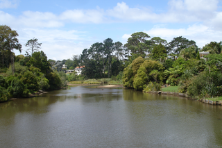
To the south of Remuera Road lies Waiatarua Reserve. This is a natural basin, prone to seasonal flooding. On several 19th century maps this was shown as a lake and referred to as 'Lake Remuera', 'Lake St John' or 'Lake Waiatarua' although in reality it was largely an area of swampy ground in which a sheet of shallow water would appear sporadically in the wet season. In 1918, 133 acres (54 hectares) of this land was given to the City Council to create Waiatarua Reserve. As the surrounding farm land was transformed into suburban housing this area became problematic - although in theory the "lake" afforded a picturesque view for the new houses but as it wasn't constantly present it couldn't really be used as a selling feature like Lake Pupuke on the North Shore. Conversely it was a breeding ground for mosquitoes and a source of smells as the basin was composed of a peat-like substance subject to smouldering fires which were difficult to put out. In 1929, a drain was bored through the hill to the south west enabling the water to be drained into the adjacent natural stream which feeds into the nearby Ōrākei Basin; this drainage system is still in place.

In 1934, 50 acres (20 hectares) of the park were leased to the Remuera Golf Club and a course was laid out. The clubhouse was completed in 1935. In 1938 a new course was built around the original layout in response to members’ complaints about the course conditions. In 1968 the course was redesigned by golf course specialist Harold Babbage and a new club house was built.

Much of the suburb was developed in the 1960s and 70s when at that time it was seen as a popular place for families to live. The area is part of the zoning for Selwyn College, the local state secondary school. The nearby St John's Bush is a small chunk of remaining bush.

Demographics

Saint Johns covers 1.65 km2 (0.64 sq mi) [1] and had an estimated population of 6,120 as of June 2022, [2] with a population density of 3,709 people per km2.

Historical population
YearPop.±% p.a.
20065,442    
20135,496+0.14%
20185,916+1.48%
Source: [4]

Saint Johns had a population of 5,916 at the 2018 New Zealand census, an increase of 420 people (7.6%) since the 2013 census, and an increase of 474 people (8.7%) since the 2006 census. There were 2,055 households, comprising 2,859 males and 3,057 females, giving a sex ratio of 0.94 males per female, with 1,041 people (17.6%) aged under 15 years, 1,194 (20.2%) aged 15 to 29, 2,799 (47.3%) aged 30 to 64, and 876 (14.8%) aged 65 or older.

Ethnicities were 54.5% European/Pākehā, 6.0% Māori, 5.1% Pacific peoples, 38.8% Asian, and 4.1% other ethnicities. People may identify with more than one ethnicity.

The percentage of people born overseas was 49.3, compared with 27.1% nationally.

Although some people chose not to answer the census's question about religious affiliation, 43.1% had no religion, 38.7% were Christian, 0.2% had Māori religious beliefs, 4.3% were Hindu, 1.4% were Muslim, 3.6% were Buddhist and 3.2% had other religions.

Of those at least 15 years old, 2,046 (42.0%) people had a bachelor's or higher degree, and 381 (7.8%) people had no formal qualifications. 1,176 people (24.1%) earned over $70,000 compared to 17.2% nationally. The employment status of those at least 15 was that 2,559 (52.5%) people were employed full-time, 672 (13.8%) were part-time, and 174 (3.6%) were unemployed. [4]

Individual statistical areas
NameArea (km2)PopulationDensity
(per km2)
HouseholdsMedian ageMedian income
Saint Johns West1.043,0782,9601,02042.2 years$38,900 [5]
Saint Johns East0.612,8384,6521,03534.1 years$40,400 [6]
New Zealand37.4 years$31,800

Related Research Articles

<span class="mw-page-title-main">Epsom, New Zealand</span> Suburb in Auckland, New Zealand

Epsom is a suburb of Auckland, New Zealand. It is located in the centre of the Auckland isthmus between Mount Eden and Greenlane, south of Newmarket, and five km south of Auckland CBD.

<span class="mw-page-title-main">Remuera</span> Suburb in Auckland, New Zealand

Remuera is an affluent suburb in East Auckland, New Zealand. It is located four kilometres southeast of the city centre. Remuera is characterised by many large houses, often Edwardian or mid 20th century. A prime example of a "leafy" suburb, Remuera is noted for its quiet tree lined streets. The suburb has numerous green spaces, most obvious of which is Ōhinerau / Mount Hobson – a volcanic cone with views from the top overlooking Waitematā Harbour and Rangitoto.

<span class="mw-page-title-main">Freemans Bay</span> Suburb in Auckland, New Zealand

Freemans Bay is the name of a former bay and now inner city suburb of Auckland, in the North Island of New Zealand. The bay has been filled in to a considerable extent, with the reclamation area now totally concealing the ancient shoreline. Historically a poor and often disreputable quarter, it is now a comparatively wealthy and desirable neighbourhood known for its mix of heritage homes and more recent single-dwelling houses, as well as for its two large parks.

<span class="mw-page-title-main">Ōrākei</span> Suburb of Auckland

Ōrākei is a suburb of Auckland city, in the North Island of New Zealand. It is located on a peninsula five kilometres to the east of the city centre, on the shore of the Waitematā Harbour, which lies to the north, and Hobson Bay and Ōrākei Basin, two arms of the Waitematā, which lie to the west and south. To the east is the suburb of Mission Bay. Takaparawhau / Bastion Point is a coastal piece of land in Ōrākei. Between Takaparawhau and Paritai Drive is Ōkahu Bay and Reserve.

<span class="mw-page-title-main">Ellerslie, New Zealand</span> Suburb in Auckland, New Zealand

Ellerslie is a suburb of the city of Auckland, in the North Island of New Zealand. Ellerslie lies seven kilometres to the southeast of the city centre, close to State Highway 1.

<span class="mw-page-title-main">Mission Bay, New Zealand</span> Suburb in Auckland, New Zealand

Mission Bay is a seaside suburb of Auckland city, on the North Island of New Zealand. The suburb's beach is a popular resort, located alongside Tamaki Drive. The area also has a wide range of eateries. Mission Bay is located seven kilometres to the east of the city centre, on the southern shore of the Waitematā Harbour, between Ōrākei and Kohimarama. It covers an area of 1.08 km2, about three quarters of which comprises low hills, surrounding the remaining quarter, which slopes down to the sea. Local government of Mission Bay is the responsibility of the Ōrākei Local Board, which also includes the suburbs of Ōrākei, Kohimarama, St Heliers, Glendowie, St Johns, Meadowbank, Remuera and Ellerslie.

<span class="mw-page-title-main">Parnell, New Zealand</span> Suburb in Auckland, New Zealand

Parnell is a suburb of Auckland, New Zealand. It is one of New Zealand's most affluent suburbs, consistently ranked within the top three wealthiest, and is often billed as Auckland's "oldest suburb" since it dates from the earliest days of the European settlement of Auckland in 1841. It is characterised by its mix of tree-lined streets with large estates; redeveloped industrial zones with Edwardian town houses and 1920s bay villas; and its hilly topography that allows for views of the port, the Waitematā Harbour, Rangitoto Island and the Auckland Domain. To its west lies the Auckland Domain, to the south Newmarket, and to the north the Ports of Auckland.

<span class="mw-page-title-main">Kohimarama</span> Suburb in Auckland, New Zealand

Kohimarama is a coastal residential Auckland suburb, located to the east of the city. Kohimarama is situated between Mission Bay and St Heliers and has an accessible beach with a boardwalk and green recreational spaces located amongst residential areas. Local government of Kohimarama is the responsibility of the Ōrākei Local Board, which also includes the suburbs of Ōrākei, Mission Bay, St Heliers, Glendowie, St Johns, Meadowbank, Remuera and Ellerslie.

<span class="mw-page-title-main">Meadowbank, New Zealand</span> Suburb in Auckland, New Zealand

Meadowbank is a suburb of Auckland city, situated in the North Island of New Zealand. Meadowbank is governed under the local governance of the Auckland Council. It has one shopping centre: Meadowbank Shopping Centre, on the corner of Gerard Way and St John's Road. Purewa Cemetery, one of central Auckland's largest cemeteries, is situated in Meadowbank and can be accessed from St John's Road.

<span class="mw-page-title-main">Saint Heliers</span> Suburb in Auckland, New Zealand

Saint Heliers is an affluent seaside suburb of Auckland with a population of 11,520 as of June 2022. This suburb is popular amongst visitors for the beaches, cafés, and views of Rangitoto Island, the distinctive volcanic island in the Hauraki Gulf.

<span class="mw-page-title-main">Lincoln, Auckland</span> Suburb in Auckland, New Zealand

Lincoln is a suburb in West Auckland, New Zealand. It is also the filming location of Shortland Street. The suburb is sometimes called Lincoln North or treated as part of Henderson North to avoid confusion with Lincoln in Canterbury.

<span class="mw-page-title-main">Waiatarua</span> Place in Auckland, New Zealand

Waiatarua is a small settlement near the top of the Waitākere Ranges in West Auckland, close to the junction of Scenic Drive, West Coast Road and Piha Road to Piha and runs east until the junction of Scenic Drive and Mountain Road. Surrounded by native bush in the Centennial Memorial Park and the water catchment area, Waiatarua is over 300 metres above sea level and some houses are over 400 metres above sea level. Waiatarua means “song of two waters”, possibly referring to the ability to see both the wild west coast, and the still, sparkling waters of the Manukau and Waitemata harbours from certain points in the area.

<span class="mw-page-title-main">Taupiri</span> Town in Waikato, New Zealand

Taupiri is a small town of about 500 people on the eastern bank of the Waikato River in the Waikato District of New Zealand. It is overlooked by Taupiri mountain, the sacred burial ground for the Waikato tribes of the Māori people, located just to the north.

Wakari is a residential suburb of the New Zealand city of Dunedin. It is located 2.5 kilometres (1.6 mi) to the northwest of the city centre, immediately to the west of the ridge which runs to the west of the city's centre. Wakari lies to the north of the upper reaches of the Kaikorai Valley, and is also north of the suburb of Kaikorai. The suburbs of Roslyn and Maori Hill are situated on the ridge immediately to the southeast and east of Wakari. The suburb of Halfway Bush lies to the northwest, and the smaller suburb of Helensburgh lies to the north.

Pyes Pa is a suburb of Tauranga, New Zealand.

<span class="mw-page-title-main">Sunnyhills</span> Suburb in Auckland, New Zealand

Sunnyhills is a suburb of Auckland, New Zealand. It is part of the Pakuranga Electorate.

Mayfair is a suburb of Hastings City, in the Hawke's Bay Region of New Zealand's North Island.

<span class="mw-page-title-main">Selwyn Heights</span> Suburb of Rotorua, New Zealand

Selwyn Heights is a suburb of Rotorua in the Bay of Plenty Region of New Zealand's North Island.

<span class="mw-page-title-main">St Johns Hill</span> Suburb of Whanganui, New Zealand

St Johns Hill is a suburb of Whanganui, in the Whanganui District and Manawatū-Whanganui region of New Zealand's North Island.

<span class="mw-page-title-main">Waiatarua Reserve</span> Nature reserve in Auckland, New Zealand

The Waiatarua Reserve is a nature reserve on the eastern Auckland isthmus in New Zealand, close to the suburbs of Remuera, Meadowbank and St Johns. Originally the site of a freshwater lake, Waiatarua was drained in 1929. Since 1987, the reserve has been redeveloped as an urban wetland, and is currently the largest urban wetland restoration project in New Zealand.

References

  1. 1 2 "ArcGIS Web Application". statsnz.maps.arcgis.com. Retrieved 20 July 2022.
  2. 1 2 "Population estimate tables - NZ.Stat". Statistics New Zealand . Retrieved 25 October 2022.
  3. "St John's Theological College". www.stjohnscollege.ac.nz.
  4. 1 2 "Statistical area 1 dataset for 2018 Census". Statistics New Zealand. March 2020. Saint Johns West (143700) and Saint Johns East (144500).
  5. 2018 Census place summary: Saint Johns West
  6. 2018 Census place summary: Saint Johns East