St Mary & St Lawrence's Church, Stratford Tony

Last updated

St Mary & St Lawrence's Church
Church of St Mary and St Lawrence, Stratford Tony - geograph.org.uk - 196490.jpg
Location Stratford Tony, Wiltshire, England
Coordinates 51°02′13″N1°52′14″W / 51.03694°N 1.87056°W / 51.03694; -1.87056 Coordinates: 51°02′13″N1°52′14″W / 51.03694°N 1.87056°W / 51.03694; -1.87056
Built13th century
Listed Building – Grade I
Official nameChurch of St. Mary and St. Lawrence
Designated23 March 1960 [1]
Reference no.1181901
Wiltshire UK location map.svg
Red pog.svg
Location of St Mary & St Lawrence's Church in Wiltshire

The Church of St Mary & St Lawrence in the village of Stratford Tony, south Wiltshire, England, was built in the 13th century. It stands on the south bank of the River Ebble, accessed from the north down a lane, across the river and up a bank. [2]

Contents

It is recorded in the National Heritage List for England as a Grade I listed building, [1] and is a redundant church, in the care of the Churches Conservation Trust since 1986. [2]

Architecture

The chancel dates from the 14th century, and was built on the site of an earlier church. [1] [3] The low 14th-century west tower is built with large Chilmark stone blocks and flint chequers, and has a pyramid-shaped tiled roof. [4] Around the church walls are a collection of gargoyles. [1] In the 18th century, the nave was rebuilt in banded brick and flint, [1] and in the construction of the north porch a doorway from the 12th or 13th century was reused. [4]

Status

The church was declared redundant on 1 October 1984, and was vested in the Churches Conservation Trust on 26 March 1986. [5] An annual service is held. [6]

Interior

Small box pews at the east end of the nave Stratford Tony - St Marys church Box Pews.jpg
Small box pews at the east end of the nave
Looking east Stratford Tony - St Marys inside.jpg
Looking east

The church has a cylindrical stone font from the 12th or 13th century, and a fine piscina in Purbeck stone from the mid-13th century. [4]

The stalls and pews – including box pews with colonnaded tops – are from the 17th century; [7] [8] some alterations are from the re-ordering of 1882. [4]

Memorials include a marble plaque to George Taunton and a wall tablet to Elizabeth Hill who died in 1715. [1] The stained glass in the east window was installed by the studio of Charles Eamer Kempe in 1884. [2]

In 2012 Loyd Grossman, who is the chairman of the Churches Conservation Trust, visited the church and presented certificates to local school children who had researched the history of the church. [9]

Churchyard

There is a large Yew tree in the churchyard with a girth of over 11 feet (3.4 m). [10] [11]

Among the graves and tombs in the churchyard is a chest tomb to Anthony Bradbury who died in 1845. [12]

Former parish

The benefice was united with neighbouring Bishopstone in 1925, with the incumbent to live at Bishopstone, although the parishes remained distinct. [13] Later that year, outlying portions of the parish were transferred to the parishes in which they lay, namely Coombe Bissett, Homington and Britford. [14] A group ministry was established for the Ebble valley in 1972, [15] and today the area is part of the Chalke Valley Churches benefice. [16] [6]

See also

Related Research Articles

<span class="mw-page-title-main">Odstock</span> Human settlement in England

Odstock is a village and civil parish 3 miles (4.8 km) south of Salisbury in Wiltshire, England. The parish includes the village of Nunton with its nearby hamlet of Bodenham. The parish is in the valley of the River Ebble, which joins the Hampshire Avon near Bodenham.

<span class="mw-page-title-main">Coombe Bissett</span> Human settlement in England

Coombe Bissett is a village and civil parish in the English county of Wiltshire in the River Ebble valley, 3 miles (4.8 km) southwest of Salisbury on the A354 road that goes south towards Blandford Forum.

<span class="mw-page-title-main">Alvediston</span> Human settlement in England

Alvediston is a small village and civil parish in Wiltshire, England, about 7 miles (11 km) east of Shaftesbury and 11 miles (18 km) southwest of Salisbury. The area is the source of the River Ebble and is within the Cranborne Chase and West Wiltshire Downs Area of Outstanding Natural Beauty.

<span class="mw-page-title-main">Berwick St John</span> Human settlement in England

Berwick St John is a village and civil parish in south-west Wiltshire, England, about 5 miles (8 km) east of Shaftesbury in Dorset.

<span class="mw-page-title-main">Bishopstone, Salisbury</span> Human settlement in England

Bishopstone is a village and civil parish in Wiltshire, England, in the Ebble valley about 5.5 miles (9 km) south-west of Salisbury. The parish is on the county boundary with Hampshire and includes the small village of Croucheston and the hamlet of The Pitts.

<span class="mw-page-title-main">Bowerchalke</span> Human settlement in England

Bowerchalke is a village and civil parish in Wiltshire, England, about 9 miles (14 km) southwest of Salisbury. It is in the south of the county, about 1 mile (1.6 km) from the boundary with Dorset and 2 miles (3.2 km) from that with Hampshire. The parish includes the hamlets of Mead End, Misselfore and Woodminton.

<span class="mw-page-title-main">Wylye</span> Human settlement in England

Wylye is a village and civil parish on the River Wylye in Wiltshire, England. The village is about 9+12 miles (15 km) northwest of Salisbury and a similar distance southeast of Warminster.

<span class="mw-page-title-main">Broad Chalke</span> Human settlement in England

Broad Chalke, sometimes spelled Broadchalke, Broad Chalk or Broadchalk, is a village and civil parish in Wiltshire, England, about 8 miles (13 km) west of the city of Salisbury. The civil parish includes the hamlets of Knapp, Mount Sorrel and Stoke Farthing.

<span class="mw-page-title-main">Ebbesbourne Wake</span> Village in Wiltshire, England

Ebbesbourne Wake is a village and civil parish in Wiltshire, England, some 10 miles (16 km) south-west of Salisbury, near the head of the valley of the small River Ebble. The parish includes the hamlets of Fifield Bavant and West End.

<span class="mw-page-title-main">River Ebble</span> River in Wiltshire, England

The River Ebble is one of the five rivers of the English city of Salisbury. Rising at Alvediston to the west of the city, it joins the River Avon at Bodenham, near Nunton.

<span class="mw-page-title-main">Grittleton</span> Human settlement in England

Grittleton is a village and civil parish in Wiltshire, England, 6 miles (10 km) northwest of Chippenham. The parish includes the hamlets of Foscote, Leigh Delamere, Littleton Drew and Sevington, and part of the hamlet of The Gibb.

<span class="mw-page-title-main">Shrewton</span> Human settlement in England

Shrewton is a village and civil parish on Salisbury Plain in Wiltshire, England, around 6 miles (9.7 km) west of Amesbury and 14 miles (23 km) north of Salisbury. It lies on the A360 road between Stonehenge and Tilshead. It is close to the source of the River Till, which flows south to Stapleford.

<span class="mw-page-title-main">Fifield Bavant</span> Human settlement in England

Fifield Bavant is a small village and former civil parish in Wiltshire, England, about 6 miles (10 km) southwest of Wilton, midway between Ebbesbourne Wake and Broad Chalke on the north bank of the River Ebble.

<span class="mw-page-title-main">St Nicholas's Church, Berwick Bassett</span> Historic site in Berwick Bassett, Wiltshire England

St Nicholas's Church in Berwick Bassett, Wiltshire, England dates from the early 13th century. It is recorded in the National Heritage List for England as a Grade II* listed building, and is now a redundant church in the care of the Churches Conservation Trust. It was declared redundant in 1972, and was vested in the Trust the next year. Services continue to be held at the church a few times a year.

<span class="mw-page-title-main">St Nicholas's Church, Fisherton Delamere</span> Historic site in Wiltshire, England

St Nicholas's Church in Fisherton Delamere, Wiltshire, England, was built in the 14th century. It is recorded in the National Heritage List for England as a designated Grade II* listed building, and is now a redundant church in the care of the Churches Conservation Trust. It was declared redundant on 1 June 1982, and was vested in the Trust on 30 October 1984.

<span class="mw-page-title-main">Inglesham</span> Human settlement in England

Inglesham is a small village and civil parish in the Borough of Swindon, Wiltshire, England, notable for the Grade-I listed St John the Baptist Church. The village is just off the A361 road about 1 mile (1.6 km) south-west of Lechlade in Gloucestershire. Most of the population lives in the hamlet of Upper Inglesham, which is on the main road about 1.3 miles (2 km) south of the village.

<span class="mw-page-title-main">St Mary's Church, South Tidworth</span> Historic site in Wiltshire, England

St Mary's Church in South Tidworth, Wiltshire, England, was built in 1878. It is recorded in the National Heritage List for England as a designated Grade I listed building, and is now a redundant church in the care of the Churches Conservation Trust.

<span class="mw-page-title-main">St Mary's Church, North Cockerington</span> Church in Lincolnshire, England

St Mary's Church is a redundant Anglican church in the village of Alvingham, adjacent to the village of North Cockerington, Lincolnshire, England. It is recorded in the National Heritage List for England as a designated Grade I listed building, and is under the care of the Churches Conservation Trust.

<span class="mw-page-title-main">Stratford Tony</span> Human settlement in England

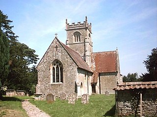
Stratford Tony, also spelt Stratford Toney, formerly known as Stratford St Anthony and Toney Stratford, is a small village and civil parish in southern Wiltshire, England. It lies on the River Ebble and is about 4 miles (6.4 km) southwest of Salisbury.

References

  1. 1 2 3 4 5 6 Historic England. "Church of St. Mary and St. Lawrence, Stratford Tony (1181901)". National Heritage List for England . Retrieved 13 June 2014.
  2. 1 2 3 "Church of St Mary & St Lawrence, Stratford Tony, Wiltshire". Churches Conservation Trust . Retrieved 11 January 2022.
  3. "Stratford Tony Church". The Bishopstone Village Website. Retrieved 4 September 2016.
  4. 1 2 3 4 Orbach, Julian; Pevsner, Nikolaus; Cherry, Bridget (2021). Wiltshire. The Buildings Of England. New Haven, US and London: Yale University Press. p. 682. ISBN   978-0-300-25120-3. OCLC   1201298091.
  5. Diocese of Salisbury: All Schemes (PDF). Church Commissioners/Statistics. Church of England. 2011. p. 10. Retrieved 1 April 2011.
  6. 1 2 "Stratford Tony - St Mary and St Lawrence". Chalke Valley Churches. Retrieved 11 January 2022.
  7. "Church of St Mary and St Lawrence, Stratford Tony". Visit Wiltshire. Retrieved 4 September 2016.
  8. "Through the Nadder and Chalke Valleys". Wiltshire Historic Churches Trust. Retrieved 4 September 2016.
  9. Blake, Morwena (28 May 2012). "Pupils meet Loyd Grossman". Salisbury Journal. Retrieved 4 September 2016.
  10. "Stratford Tony". Discover Chalke Valley. Retrieved 4 September 2016.
  11. Norton, Peter. "Wiltshire Yews: An Inventory of Churchyard Yews Along the Ebble Valley" (PDF). Retrieved 14 October 2010.
  12. Historic England. "Bradbury monument, in the Churchyard (1023851)". National Heritage List for England. Retrieved 11 January 2022.
  13. "No. 33062". The London Gazette . 30 June 1925. pp. 4361–4363.
  14. "No. 33118". The London Gazette. 29 December 1925. pp. 8638–8641.
  15. "No. 45811". The London Gazette . 26 October 1972. p. 12603.
  16. "Bishopstone and Stratford Tony". A Church Near You. The Archbishops' Council. Retrieved 11 January 2022.