
Olivette is an inner-ring suburb of St. Louis, located in St. Louis County, Missouri, United States. The population was 8,504 at the 2020 census.
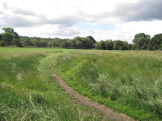
Hampstead Heath is an ancient heath in London, spanning 320 hectares. This grassy public space sits astride a sandy ridge, one of the highest points in London, running from Hampstead to Highgate, which rests on a band of London Clay. The heath is rambling and hilly, embracing ponds, recent and ancient woodlands, a lido, playgrounds, and a training track, and it adjoins the former stately home of Kenwood House and its estate. The south-east part of the heath is Parliament Hill, from which the view over London is protected by law.

The Sepulveda Dam is a dry dam constructed by the U.S. Army Corps of Engineers to withhold winter flood waters along the Los Angeles River. Completed in 1941, at a cost of $6,650,561, it is located south of center in the San Fernando Valley, approximately eight miles (13 km) east of the river's source in the western end of the Valley, in Los Angeles, California.
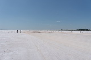
The Salt Plains National Wildlife Refuge is part of the United States system of national wildlife refuges. It is located in Alfalfa County in northern Oklahoma, north of Jet, along Great Salt Plains Lake, which is formed by a dam on the Salt Fork of the Arkansas River.

Hempstead Lake State Park is a 737-acre (2.98 km2) state park located in Nassau County, New York in the United States. The park is located in West Hempstead and is one of three state parks within the Town of Hempstead. There is a quick-access entrance at exit 18 from the Southern State Parkway. The park contains the largest freshwater lake in Nassau County.
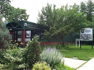
Alley Pond Park is the second-largest public park in Queens, New York City, occupying 655.3 acres (265.2 ha). The park is bordered to the east by Douglaston, to the west by Bayside, to the north by Little Neck Bay, and to the south by Union Turnpike. The Cross Island Parkway travels north-south through the park, while the Long Island Expressway and Grand Central Parkway travel east-west through the park. The park primarily consists of woodlands south of the Long Island Expressway and meadowlands north of the expressway. It is run and operated by the New York City Department of Parks and Recreation.

Laumeier Sculpture Park is a 105-acre open-air museum and sculpture park located in Sunset Hills, Missouri, near St. Louis. Laumeier is maintained in partnership with St. Louis County Parks and Recreation Department. It houses over 70 large-scale outdoor sculptures and features a 1.4-mile (2.3 km) walking trail, an indoor gallery, the Aronson Art Center, and educational programs. A 1917 Tudor stone mansion, the former residence of Henry and Matilda Laumeier, is now the Kranzberg Education Lab. Laumeier is accredited by the American Alliance of Museums. The park sees about 300,000 visitors each year and operates on a $1.5 million budget.

Shore Acres State Park is a state park 13 miles (21 km) south of Coos Bay in the U.S. state of Oregon. It is one of three state parks along the Cape Arago Highway, which runs along the Pacific Ocean west of U.S. Route 101. Sunset Bay State Park is about 1 mile (1.6 km) north of Shore Acres, and Cape Arago State Park is about a mile south.

Kenneth Hahn State Recreation Area, or Kenneth Hahn Park, is a state park unit of California in the Baldwin Hills Mountains of Los Angeles. The park is managed by the Los Angeles County Department of Parks and Recreation. As one of the largest urban parks and regional open spaces in the Greater Los Angeles Area, many have called it "L.A.'s Central Park". The 401-acre (1.62 km2) park was established in 1984. The land was previously the Baldwin Hills Reservoir, which failed catastrophically in the 1963 Baldwin Hills Dam disaster.

The Great Lawn and Turtle Pond are two connected features of Central Park in Manhattan, New York City, United States. The lawn and pond are located on the site of a former reservoir for the Croton Aqueduct system which was infilled during the early 20th century.

Park Hill Recreation Ground is a 15 acres (6.1 ha) park near the centre of Croydon, Greater London, managed by the London Borough of Croydon. It runs from Barclay Road to Coombe Road beside the railway line, with the main entrances on Water Tower Hill and Barclay Road. The nearest stations are East Croydon to the north for Tramlink and National Rail services and South Croydon to the south for National Rail. The park was officially renamed as Park Hill in 1964.

Highland Park is a park located in Brooklyn, New York City, on the border with Queens. Established in 1901, Highland Park borders Cypress Hills, Brooklyn—part of the East New York neighborhood—to its south, and it abuts Glendale and Ridgewood, Queens, to its north.
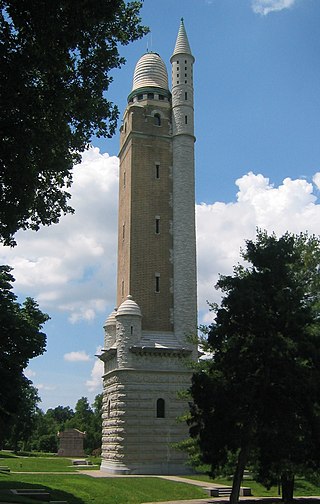
Compton Hill Reservoir Park is a 36-acre (15 ha) public park located in the Compton Heights neighborhood of St. Louis, Missouri, USA. Located on one of the highest elevations within the city, the park surrounds a 28-million-US-gallon (110,000 m3) reservoir used to provide water for many of the city's residents.

St. Vrain State Park, formerly known as Barbour Ponds, is a Colorado state park. The park hosts year-round camping. It is a popular birding destination, hosting the states largest rookery of Blue Heron, it is home to several other bird species as well including migrating waterfowl, songbirds and the occasional bald eagle. Other park activities include year round fishing and hiking. There is a reservoir at the park named Blue Heron Reservoir.
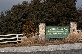
Cromwell Valley Park is a public park just to the north of Baltimore City. The park initially opened in 1993, on 426 acres (172 ha) of rural farm land. It is primarily open fields, woods, cultivated gardens and orchards. The varied terrain provides an excellent habitat for local wildlife, particularly birds of prey which feed on large populations of mice, rabbits and other small mammals. Healthy populations of white-tailed deer, red fox and local songbirds can also be found throughout the park. Several miles of trails traverse the park making it popular among local hikers, birdwatchers and photographers.
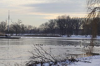
Baisley Pond Park is a public park located in the southeastern part of Queens, New York City, bordering the neighborhoods of South Jamaica, Rochdale, and St. Albans. It covers 109.61 acres (44.36 ha), including the 30-acre (12 ha) Baisley Pond in the center of the park. It is maintained by the New York City Department of Parks and Recreation.
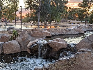
Gene C. Reid Park is a 131-acre urban park in central Tucson, Arizona that includes a 9,500-seat baseball stadium, an outdoor performance center, two man-made ponds, public pools, and a 24-acre zoo along with playgrounds, gardens and picnic areas. The park occupies the western third of a 480-acre parks and recreation complex established in 1925 as Randolph Park which additionally includes two 18-hole golf courses, a tennis and racquetball facility, and an indoor recreation center. A 2-mile loop of paved multi-use trails follows the edge of the park, connecting with another 2.5 miles around the Randolph golf and recreation centers.

Roy Wilkins Park, originally known as Southern Queens Park, is a 54-acre (22 ha) park in the St. Albans neighborhood of southeastern Queens in New York City. It is located on an irregular plot of land bounded by 115th and 116th Avenues to the north, 175th Street to the west, Merrick Boulevard to the southwest, Baisley Boulevard to the southeast, and the St. Albans Community Living Center to the east. Roy Wilkins Park contains the Roy Wilkins Recreation Center, a community center with an indoor swimming pool. It also includes various outdoor sporting facilities, a playground, and an artificial pond.
Parks and recreation in Chehalis, Washington is administered by the Chehalis Parks and Recreation Department. Trails that connect Chehalis with locations beyond the city limits are maintained in conjunction with other local jurisdictions, state government agencies, and/or local non-profit groups and volunteers.


