Stamsried

Last updated
Stamsried
Rathaus Stamsried.JPG
Town hall
DEU Stamsried COA.svg
Location of Stamsried within Cham district
Stamsried in CHA.svgLamRimbachTiefenbachChamSchorndorfRodingReichenbachRettenbachFalkensteinZellWald
Germany adm location map.svg
Red pog.svg
Stamsried
Bavaria location map.svg
Red pog.svg
Stamsried
Coordinates: 49°16′N12°32′E / 49.267°N 12.533°E / 49.267; 12.533
Country Germany
State Bavaria
Admin. region Oberpfalz
District Cham
Municipal assoc. Stamsried
Government
   Mayor (202026) Herbert Bauer [1] (CSU)
Area
  Total43.44 km2 (16.77 sq mi)
Elevation
453 m (1,486 ft)
Population
 (2021-12-31) [2]
  Total2,190
  Density50/km2 (130/sq mi)
Time zone UTC+01:00 (CET)
  Summer (DST) UTC+02:00 (CEST)
Postal codes
93491
Dialling codes 0 94 66
Vehicle registration CHA
Website www.stamsried.de

Stamsried is a village and municipality in the district of Cham in the Upper Palatinate region of Bavaria, Germany, near the Czech border. It is also located in the Roman Catholic diocese of Regensburg. Stamsried has a population of 2,319 as of June 2004 and an area of 4,343 hectares (43.43 square kilometers; 16.77 square miles) which includes surrounding countryside outside the built up area of the village itself, the population density is 53.4 persons per square kilometer (138 persons/sq mi). Stamsried is located 456 meters (1,496 feet) above sea level and contains rolling hills as high as 600 meters (2,000 feet).

Contents

Stamsried is located near the Upper Bavarian Forest Nature Park and therefore tourism makes up a portion of its economy as shown by the number of small hotels and "pensions" or bed and breakfasts. Sites of interest within Stamsried itself include the Catholic parish church of St. John the Baptist built in 1719. Near the church there is a square with the Mariensäule or Marian column erected in 1729 and four other statues of saints erected in 1735 (St. Florian, St. Sebastian, John the Baptist and John of Nepomuk).

History

In the 9th century the Marcomanni were the first settlers in the region. The earliest historical mention of Stamsried dates back to the year 1140, due to a tournament of 63 knights. 1346 Dietrich II of Kürn is mentioned as owner of Stamsried. He built the Kürnburg castle in 1354 and for most of its history it has maintained a low-key rural Bavarian culture relatively isolated from political situations in the larger world. The Bavarian statesman Karl von Abel retired and lived until his death in 1859 on his tenure manor in Stamsried. After the death of Ludwig von Abel the village became property of the kingdom of Bavaria. In the two world wars Stamsried was taken over by allied powers without a single shot being fired or any major resistance, in particular at the end of World War II American tanks entered the village square and were welcomed peaceably with a white flag. In recent times Stamsried and the entire surrounding areas has been a stronghold of the conservative Bavarian political party, the Christian Social Union, of which the current mayor Alfred Long is a member.

Kürnburg

The ruin is located on a hill 600 metres (1,969 ft) above sea level near Stamsried. With the allowance of count palatine Ruprecht II, Dietrich II of Kürn built a castle on the top of the Heitberg in 1354. Due to heritage the castle changed ownership in 1406 to Hermann the Hertenberger; in 1425 to Gabein the Freudenberger; then the Wartenberger family in 1429; and finally to the Füchse of Winklarn in 1590. In 1561 the castle and the village became separated properties. During the Thirty Years' War, on 11 January 1634, Swedish troops under duke Bernhard of Saxe-Weimar destroyed the castle. In the 1970s the ruin was restored.

Related Research Articles

<span class="mw-page-title-main">Flossenbürg, Bavaria</span> Municipality in Bavaria, Germany

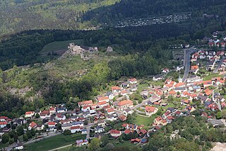
Flossenbürg is a municipality in the district of Neustadt an der Waldnaab in Bavaria in Germany. The state-approved leisure area is located in the Bavarian Forest and borders Bohemia in the east. During World War II, the Flossenbürg concentration camp was located here.

<span class="mw-page-title-main">Ismaning</span> Municipality in Bavaria, Germany

Ismaning is a municipality in Bavaria, Germany, located near Munich.

<span class="mw-page-title-main">Altötting</span> Town in Bavaria, Germany

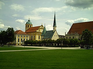
Altötting is a town in Bavaria, capital of the district Altötting of Germany. For 500 years it has been the scene of religious pilgrimages by Catholics in honor of Mary, including a visit by Pope John Paul II in 1980 and one by Pope Benedict XVI in 2006.

<span class="mw-page-title-main">Ostheim</span> Town in Bavaria, Germany

Ostheim vor der Rhön is a town in Northern Bavaria in the district of Rhön-Grabfeld in Franconia. Though politically part of Bavaria since 1947, it was historically a part of Thuringia, and remains religiously, architecturally, and to some extent culturally distinct from its immediate surroundings.

<span class="mw-page-title-main">Regen</span> Town in Bavaria, Germany

Regen is a town in Bavaria, Germany, and the district town of the district of Regen.

<span class="mw-page-title-main">Pfarrkirchen</span> Town in Bavaria, Germany

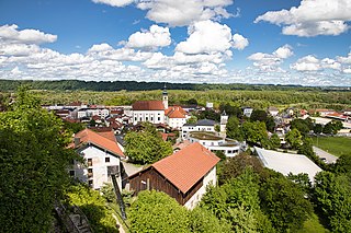
Pfarrkirchen is a municipality in southern Lower Bavaria Germany, the capital of the district Rottal-Inn. It has about 12,500 inhabitants and is an important school centre with about 10,000 pupils from all over Lower Bavaria. The town spreads over an area of about 52 square kilometers and lies approximately 377 meters above sea level. Pfarrkirchen lies at the small river "Rott", which gives the "Rottal" region its name. One of Pfarrkirchen's important industries include abattoirs which is due to the rural environment.

<span class="mw-page-title-main">Donaustauf</span> Municipality in Bavaria, Germany

Donaustauf is a market town in Bavaria, 5 km (3 mi) east of Regensburg at the foothills of the Bavarian Forest. The ruins of a medieval castle, presumably erected between 914 and 930, tower above the small town. Situated nearby on a hill rising from the Danube is the imposing Teutonic temple of fame, Walhalla, a costly reproduction of the Parthenon in Athens. The Walhalla was commissioned by Ludwig I, King of Bavaria, and inaugurated on 18 October 1842.

<span class="mw-page-title-main">Rimbach, Upper Palatinate</span> Municipality in Bavaria, Germany

Rimbach is a municipality in the district of Cham (district) in the Upper Palatinate in Bavaria in Germany.

<span class="mw-page-title-main">Freyung, Bavaria</span> Town in Bavaria, Germany

Freyung is a town in Bavaria, Germany, capital of the Freyung-Grafenau district. It is situated in the Bavarian Forest mountain range, near the border with Austria and the Czech Republic.

<span class="mw-page-title-main">Tittmoning</span> Town in Bavaria, Germany

Tittmoning is a town in the district of Traunstein, in Bavaria, Germany.

<span class="mw-page-title-main">Velburg</span> Town in Bavaria, Germany

Velburg is a town in the district of Neumarkt in Bavaria, Germany. It is situated 17 km southeast of Neumarkt in der Oberpfalz, and 39 km northwest of Regensburg.

<span class="mw-page-title-main">Lenggries</span> Municipality in Bavaria, Germany

Lenggries is a municipality and a town in Bavaria, Germany. It is the center of the Isarwinkel, the region along the Isar between Bad Tölz and Wallgau. The town has about 9,500 inhabitants. By area, it is the largest rural municipality ("Gemeinde") in what was formerly West Germany, and the 7th-largest overall.

<span class="mw-page-title-main">Haimhausen</span> Municipality in Bavaria, Germany

Haimhausen is a municipality located on the Amper River in the district of Dachau in Bavaria, Germany, about 20 Kilometers north of Munich.

<span class="mw-page-title-main">Röhrmoos</span> Municipality in Bavaria, Germany

Röhrmoos is a municipality in the district of Dachau in Bavaria in Germany. It is located ca. 25 km northwest of München. The community is located between the Amper and Glonn valleys.

<span class="mw-page-title-main">Heroldsberg</span> Municipality in Bavaria, Germany

Heroldsberg is a municipality in the district of Erlangen-Höchstadt, in Bavaria, Germany. It is located eleven kilometers north-east from the city of Nuremberg and 23 kilometers east from Erlangen and is the headquarters of Schwan-Stabilo.

<span class="mw-page-title-main">Kalchreuth</span> Municipality in Bavaria, Germany

Kalchreuth is a municipality in the district of Erlangen-Höchstadt, in Bavaria, Germany. It is located 10 kilometers east of Erlangen and 15 kilometers north of Nuremberg and contains the villages of Kalchreuth, Käswasser and Röckenhof and also the hamlets of Stettenberg, Minderleinsmühle and Gabermühle.

<span class="mw-page-title-main">Oberau</span> Municipality in Bavaria, Germany

Oberau is a municipality in the district of Garmisch-Partenkirchen, in Bavaria, Germany.

<span class="mw-page-title-main">Castell, Bavaria</span> Municipality in Bavaria, Germany

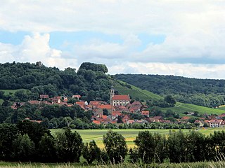
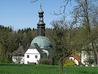
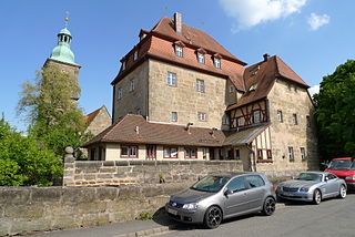
Castell is a municipality in the district of Kitzingen in Bavaria in Germany. It was the seat of the Counts of Castell. Today it is part of the municipal association Wiesentheid. It has around 800 inhabitants.

<span class="mw-page-title-main">Kreuth</span> Municipality in Bavaria, Germany

Kreuth is a municipality and a village in the district of Miesbach in Bavaria in Germany.

<span class="mw-page-title-main">Weichs</span> Municipality in Bavaria, Germany

Weichs is a municipality in the district of Dachau in Bavaria in Germany. There are 4 main villages in the municipality - Weichs, Aufhausen, Ebersbach, and Fränking. In addition, there are several smaller villages: Albertshof, Biechlhof, Breitenwiesen, Daxberg, Edenholzhausen, Edenpfaffenhofen, Erlbach, Erlhausen, Hölzböck, Jedenhofen, and Zillhofen.

References

  1. Liste der ersten Bürgermeister/Oberbürgermeister in kreisangehörigen Gemeinden, Bayerisches Landesamt für Statistik, 15 July 2021.
  2. "Tabelle 12411-003r Fortschreibung des Bevölkerungsstandes: Gemeinden, Stichtag" (in German). Bayerisches Landesamt für Statistik. June 2022.